
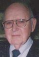
Howard Earl Karlson
| Birth | : | 10 Apr 1919 Unityville, McCook County, South Dakota, USA |
| Death | : | 14 Aug 2006 Madison, Lake County, South Dakota, USA |
| Burial | : | St. Anne's Churchyard, Chapeltown, Blackburn with Darwen Unitary Authority, England |
| Coordinate | : | 53.6371710, -2.4030440 |
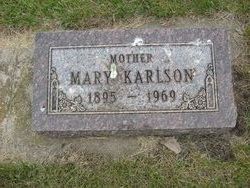
| Description | : | Funeral services will be Fri,. Aug. 18, for Howard Earl Karlson, 87, Madison, who died on Aug. 14, 2006, at Bethel Lutheran Home. The services will be held in Trinity Lutheran Church at Madison. Graveside services in Salem Lutheran Cemetery, rural Salem. Visitation will begin at 11 a.m. Thursday, with a prayer service at 7 p.m., at the Kinzley Funeral Home in Salem. Karlson was born on April 10, 1919, near Unityville to Karl Oscar and Mary (Peterson) Karlson. He attended grade school in Unityville and graduated from Salem High School. He then worked on the farm for his father and attended... Read More |
frequently asked questions (FAQ):
-
Where is Howard Earl Karlson's memorial?
Howard Earl Karlson's memorial is located at: St. Anne's Churchyard, Chapeltown, Blackburn with Darwen Unitary Authority, England.
-
When did Howard Earl Karlson death?
Howard Earl Karlson death on 14 Aug 2006 in Madison, Lake County, South Dakota, USA
-
Where are the coordinates of the Howard Earl Karlson's memorial?
Latitude: 53.6371710
Longitude: -2.4030440
Family Members:
Parent
Spouse
Siblings

Flowers:


Nearby Cemetories:
1. St. Anne's Churchyard
Chapeltown, Blackburn with Darwen Unitary Authority, England
Coordinate: 53.6371710, -2.4030440
2. Methodist Church Churchyard
Edgworth, Blackburn with Darwen Unitary Authority, England
Coordinate: 53.6424280, -2.3962830
3. Edgworth Congregational Chapelyard
Edgworth, Blackburn with Darwen Unitary Authority, England
Coordinate: 53.6476280, -2.3967210
4. Hawkshaw Methodist Church Cemetery
Hawkshaw, Metropolitan Borough of Bury, England
Coordinate: 53.6313490, -2.3674190
5. St Mary Churchyard
Hawkshaw, Metropolitan Borough of Bury, England
Coordinate: 53.6307270, -2.3636210
6. Christ Church Churchyard
Egerton, Metropolitan Borough of Bolton, England
Coordinate: 53.6237080, -2.4389210
7. Congregational Churchyard
Affetside, Metropolitan Borough of Bury, England
Coordinate: 53.6175200, -2.3705800
8. Tottington Road Methodist Church Churchyard
Harwood, Metropolitan Borough of Bolton, England
Coordinate: 53.6079190, -2.3904960
9. St. Maxentius Churchyard
Bradshaw, Metropolitan Borough of Bolton, England
Coordinate: 53.6056800, -2.4014800
10. Harwood Methodist Church Cemetery
Harwood, Metropolitan Borough of Bolton, England
Coordinate: 53.6028240, -2.3903990
11. Greenmount United Reformed Churchyard
Greenmount, Metropolitan Borough of Bury, England
Coordinate: 53.6254581, -2.3381465
12. St Paul Churchyard
Astley Bridge, Metropolitan Borough of Bolton, England
Coordinate: 53.5996230, -2.4314330
13. St Anne Churchyard
Tottington, Metropolitan Borough of Bury, England
Coordinate: 53.6161499, -2.3409030
14. Bolton Cemetery
Astley Bridge, Metropolitan Borough of Bolton, England
Coordinate: 53.5989150, -2.4370830
15. St. John's Churchyard
Tottington, Metropolitan Borough of Bury, England
Coordinate: 53.6141180, -2.3400670
16. Christ Church Churchyard
Harwood, Metropolitan Borough of Bolton, England
Coordinate: 53.5948860, -2.3821990
17. Emmanuel Churchyard
Holcombe, Metropolitan Borough of Bury, England
Coordinate: 53.6463000, -2.3293400
18. Ramsbottom Cemetery
Ramsbottom, Metropolitan Borough of Bury, England
Coordinate: 53.6372986, -2.3271000
19. St. Paul's Churchyard
Halliwell, Metropolitan Borough of Bolton, England
Coordinate: 53.5955450, -2.4475770
20. Darwen Eastern Cemetery
Darwen, Blackburn with Darwen Unitary Authority, England
Coordinate: 53.6769300, -2.4547700
21. Darwen Cemetery
Darwen, Blackburn with Darwen Unitary Authority, England
Coordinate: 53.6781400, -2.4598300
22. St Peter Churchyard
Belmont, Blackburn with Darwen Unitary Authority, England
Coordinate: 53.6379520, -2.4955480
23. Ainsworth Methodist Churchyard
Ainsworth, Metropolitan Borough of Bury, England
Coordinate: 53.5877390, -2.3623810
24. Belmont Congregational Churchyard
Belmont, Blackburn with Darwen Unitary Authority, England
Coordinate: 53.6419917, -2.4955512