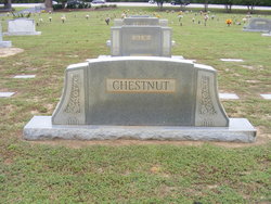
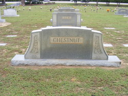
Hoyt Hudson Chestnut
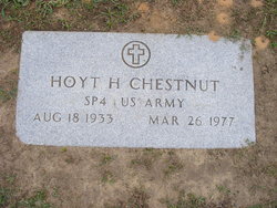
| Birth | : | 18 Aug 1933 Horry County, South Carolina, USA |
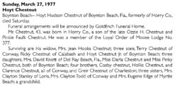
| Death | : | 26 Mar 1977 Boynton Beach, Palm Beach County, Florida, USA |
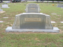
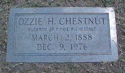
| Burial | : | Tecumseh Cemetery, Tecumseh, Pottawatomie County, USA |
| Coordinate | : | 35.2927800, -96.9263200 |
| Inscription | : | SP4 US Army |
frequently asked questions (FAQ):
-
Where is Hoyt Hudson Chestnut's memorial?
Hoyt Hudson Chestnut's memorial is located at: Tecumseh Cemetery, Tecumseh, Pottawatomie County, USA.
-
When did Hoyt Hudson Chestnut death?
Hoyt Hudson Chestnut death on 26 Mar 1977 in Boynton Beach, Palm Beach County, Florida, USA
-
Where are the coordinates of the Hoyt Hudson Chestnut's memorial?
Latitude: 35.2927800
Longitude: -96.9263200
Family Members:
Parent
Siblings
Flowers:
Nearby Cemetories:
1. Tecumseh Cemetery
Tecumseh, Pottawatomie County, USA
Coordinate: 35.2927800, -96.9263200
2. Citizen Potawatomi Nation Cemetery
Shawnee, Pottawatomie County, USA
Coordinate: 35.2979180, -96.9292110
3. Emmanuel Episcopal Church Columbarium
Shawnee, Pottawatomie County, USA
Coordinate: 35.3327000, -96.9235000
4. Fairview Cemetery
Shawnee, Pottawatomie County, USA
Coordinate: 35.3436300, -96.9078400
5. New Hope Cemetery
Tecumseh, Pottawatomie County, USA
Coordinate: 35.2759000, -96.9917000
6. Calvary Cemetery
Shawnee, Pottawatomie County, USA
Coordinate: 35.3509760, -96.9595490
7. Resthaven Memorial Park
Rock Creek Township, Pottawatomie County, USA
Coordinate: 35.3316994, -96.8636017
8. Forest Hill Cemetery
Tecumseh, Pottawatomie County, USA
Coordinate: 35.2282982, -96.8938980
9. Saint Gregory's Abbey Cemetery
Shawnee, Pottawatomie County, USA
Coordinate: 35.3669440, -96.9532800
10. Blackburn Chapel Cemetery
Bethel Acres, Pottawatomie County, USA
Coordinate: 35.3330000, -97.0121000
11. Harjo Underwood Family Cemetery
Harjo, Pottawatomie County, USA
Coordinate: 35.2311000, -96.8577000
12. Hopewell Cemetery
Bethel Acres, Pottawatomie County, USA
Coordinate: 35.3041100, -97.0275400
13. Bethel United Methodist Church Cemetery
Bethel Acres, Pottawatomie County, USA
Coordinate: 35.3050500, -97.0275300
14. Oak Grove Cemetery #2
Pottawatomie County, USA
Coordinate: 35.2317920, -96.9988380
15. Byers Family Cemetery
Shawnee, Pottawatomie County, USA
Coordinate: 35.2316000, -97.0127000
16. Earlsboro Cemetery
Earlsboro, Pottawatomie County, USA
Coordinate: 35.2832260, -96.8070000
17. Earlsboro Cemetery
Earlsboro, Pottawatomie County, USA
Coordinate: 35.2752000, -96.8056000
18. Kaskuske Family Cemetery
Shawnee, Pottawatomie County, USA
Coordinate: 35.3747400, -97.0049400
19. Ruggles Cemetery
Brooksville, Pottawatomie County, USA
Coordinate: 35.1880989, -96.9393997
20. Brooksville Cemetery
Brooksville, Pottawatomie County, USA
Coordinate: 35.1917000, -96.9749985
21. Lone Star Cemetery
Brooksville, Pottawatomie County, USA
Coordinate: 35.1917000, -96.9750000
22. Bently-Walker Family Cemetery
Shawnee, Pottawatomie County, USA
Coordinate: 35.3996000, -96.8814000
23. Brown Cemetery
Bethel Acres, Pottawatomie County, USA
Coordinate: 35.2613983, -97.0627975
24. Neal Cemetery
Earlsboro, Pottawatomie County, USA
Coordinate: 35.3260994, -96.7885971

