
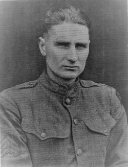

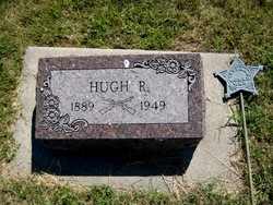
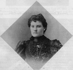
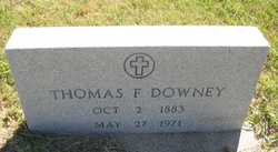
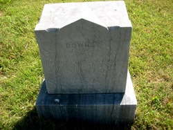
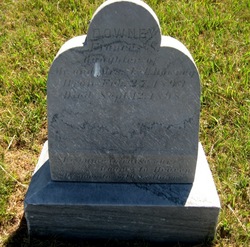
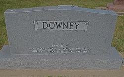
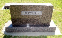
Hugh Raymond Downey
| Birth | : | 10 Aug 1889 Merna, Custer County, Nebraska, USA |
| Death | : | 16 Jan 1949 Broken Bow, Custer County, Nebraska, USA |
| Burial | : | Leesville Cemetery, Crawford County, USA |
| Coordinate | : | 40.7942940, -82.7914940 |
| Inscription | : | World War veteran marker |
frequently asked questions (FAQ):
-
Where is Hugh Raymond Downey's memorial?
Hugh Raymond Downey's memorial is located at: Leesville Cemetery, Crawford County, USA.
-
When did Hugh Raymond Downey death?
Hugh Raymond Downey death on 16 Jan 1949 in Broken Bow, Custer County, Nebraska, USA
-
Where are the coordinates of the Hugh Raymond Downey's memorial?
Latitude: 40.7942940
Longitude: -82.7914940
Family Members:
Parent
Spouse

Siblings
Children
Flowers:


Nearby Cemetories:
1. Leesville Cemetery
Crawford County, USA
Coordinate: 40.7942940, -82.7914940
2. Crawford County Memory Gardens
Crestline, Crawford County, USA
Coordinate: 40.8081128, -82.8037923
3. Gledhill Cemetery
Middletown, Crawford County, USA
Coordinate: 40.7751350, -82.7940420
4. Middletown Cemetery
Middletown, Crawford County, USA
Coordinate: 40.7701090, -82.7915850
5. Saint Paul Reformed Cemetery
Crawford County, USA
Coordinate: 40.8207880, -82.7859740
6. Windfall Cemetery
North Robinson, Crawford County, USA
Coordinate: 40.7696991, -82.8199997
7. Dapper Cemetery
Crawford County, USA
Coordinate: 40.8278008, -82.7891998
8. Barnes-Talbot Cemetery
Galion, Crawford County, USA
Coordinate: 40.7698000, -82.7592500
9. Biddle Cemetery
Crestline, Crawford County, USA
Coordinate: 40.8272018, -82.8088989
10. John Smith Family Farm Cemetery
Galion, Crawford County, USA
Coordinate: 40.7570100, -82.8186320
11. Fairview Cemetery
Galion, Crawford County, USA
Coordinate: 40.7508908, -82.7793469
12. Mount Calvary Catholic Cemetery
Galion, Crawford County, USA
Coordinate: 40.7498660, -82.7811778
13. Galion Mausoleum
Galion, Crawford County, USA
Coordinate: 40.7490980, -82.7810380
14. Greenlawn Cemetery
East Crestline, Richland County, USA
Coordinate: 40.7850571, -82.7226782
15. Saint Joseph Cemetery
Sandusky Township, Richland County, USA
Coordinate: 40.7871600, -82.7215628
16. Loss Creek Cemetery
Galion, Crawford County, USA
Coordinate: 40.8445280, -82.8164860
17. Union Green Cemetery
Galion, Crawford County, USA
Coordinate: 40.7359860, -82.7919280
18. Peace Lutheran Church Columbarium
Galion, Crawford County, USA
Coordinate: 40.7331469, -82.7897680
19. Line Cemetery
Galion, Crawford County, USA
Coordinate: 40.7477120, -82.7357200
20. Liberty Cemetery
North Robinson, Crawford County, USA
Coordinate: 40.8577995, -82.7821594
21. Luke Cemetery
Crawford County, USA
Coordinate: 40.8363991, -82.8553009
22. Pletcher Cemetery
Galion, Crawford County, USA
Coordinate: 40.7395348, -82.8392529
23. Sacred Heart Cemetery
Shelby, Richland County, USA
Coordinate: 40.8384552, -82.7230606
24. Park Cemetery
Galion, Crawford County, USA
Coordinate: 40.7266410, -82.8213790