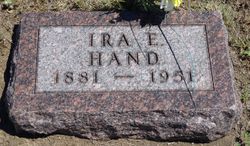
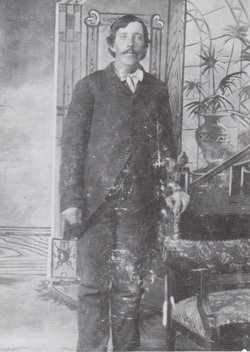
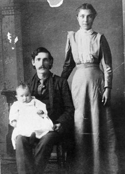
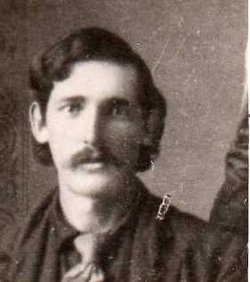
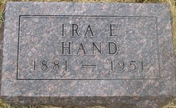
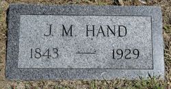
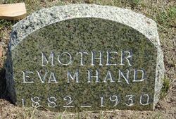
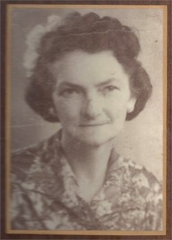
Ira Erwin Hand
| Birth | : | 27 Apr 1881 Murphysboro, Jackson County, Illinois, USA |
| Death | : | 18 Jan 1951 Yankton, Yankton County, South Dakota, USA |
| Burial | : | Te Kuiti Old Cemetery, Te Kuiti, Waitomo District, New Zealand |
| Coordinate | : | -38.3110400, 175.1845900 |
| Description | : | Ira Erwin Hand was born on April 27, 1881 at Murphysboro, Illinois and passed away at Yankton, SD, July 18, 1951 at the age of 70 years, 2 months and 21 days. At an early age, he with his family moved to Galena, Kansas. It was here in the year 1900, that he was married to Eva Hines. 12 children were born to this union, 2 of whom preceded him in death, one in infancy and his eldest daughter, Ruth, who passed away in March 1951. The family moved to Moenville, SD in 1924, where his wife passed away in... Read More |
frequently asked questions (FAQ):
-
Where is Ira Erwin Hand's memorial?
Ira Erwin Hand's memorial is located at: Te Kuiti Old Cemetery, Te Kuiti, Waitomo District, New Zealand.
-
When did Ira Erwin Hand death?
Ira Erwin Hand death on 18 Jan 1951 in Yankton, Yankton County, South Dakota, USA
-
Where are the coordinates of the Ira Erwin Hand's memorial?
Latitude: -38.3110400
Longitude: 175.1845900
Family Members:
Parent
Spouse
Siblings
Children
Flowers:
Nearby Cemetories:
1. Te Kuiti New Cemetery
Te Kuiti, Waitomo District, New Zealand
Coordinate: -38.3109520, 175.1869800
2. Te Kuiti Urupā
Te Kuiti, Waitomo District, New Zealand
Coordinate: -38.3389261, 175.1680442
3. Te Kotahitanga Marae Māori Cemetery
Otorohanga, Otorohanga District, New Zealand
Coordinate: -38.1968100, 175.2188100
4. Otorohanga Public Cemetery
Otorohanga, Otorohanga District, New Zealand
Coordinate: -38.1834100, 175.2215500
5. Piopio Cemetery
Piopio, Waitomo District, New Zealand
Coordinate: -38.4317400, 175.0368100
6. Mangapehi Māori Cemetery
Kopaki, Waitomo District, New Zealand
Coordinate: -38.5091100, 175.2980200
7. Tokanui Hospital Cemetery
Te Awamutu, Waipa District, New Zealand
Coordinate: -38.0719300, 175.3329900
8. Mapiu Cemetery
Mapiu, Waitomo District, New Zealand
Coordinate: -38.5861960, 175.2128920
9. Rewi Maniapoto Reserve
Kihikihi, Waipa District, New Zealand
Coordinate: -38.0389437, 175.3454567
10. Aria Cemetery
Te Kuiti, Waitomo District, New Zealand
Coordinate: -38.5690000, 174.9859000
11. Kihikihi Cemetery
Te Awamutu, Waipa District, New Zealand
Coordinate: -38.0415490, 175.3560930
12. St Johns Anglican Church Cemetery
Te Awamutu, Waipa District, New Zealand
Coordinate: -38.0091760, 175.3278440
13. Pirongia Cemetery
Te Awamutu, Waipa District, New Zealand
Coordinate: -37.9870310, 175.2115260
14. Te Waitere Cemetery
Te Waitere, Waitomo District, New Zealand
Coordinate: -38.1466690, 174.8230130
15. Saint Paul's Churchyard Cemetery
Te Awamutu, Waipa District, New Zealand
Coordinate: -38.0143750, 175.3767790
16. Te Awamutu Cemetery
Te Awamutu, Waipa District, New Zealand
Coordinate: -37.9991220, 175.3426520
17. Hairini Catholic Cemetery
Te Awamutu, Waipa District, New Zealand
Coordinate: -38.0108899, 175.3761181
18. Puahue Cemetery
Te Awamutu, Waipa District, New Zealand
Coordinate: -38.0392000, 175.4428300
19. Paterangi Cemetery
Te Awamutu, Waipa District, New Zealand
Coordinate: -37.9608970, 175.2707680
20. Kiritehere Cemetery
Marokopa, Waitomo District, New Zealand
Coordinate: -38.3227790, 174.7103940
21. Pukeatua Cemetery
Te Awamutu, Waipa District, New Zealand
Coordinate: -38.0732500, 175.5530120
22. Ohaupo Catholic Cemetery
Ōhaupō, Waipa District, New Zealand
Coordinate: -37.9383320, 175.3141890
23. Kawhia Cemetery
Kawhia, Otorohanga District, New Zealand
Coordinate: -38.0441760, 174.8274300
24. Ohaupo Cemetery
Ōhaupō, Waipa District, New Zealand
Coordinate: -37.9077640, 175.3159600

