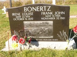
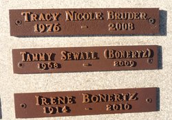
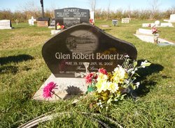
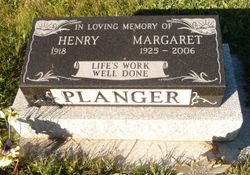
Irene Louise Planger Bonertz
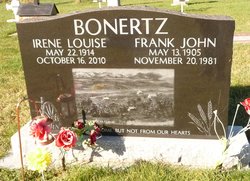
| Birth | : | 22 May 1914 Alberta, Canada |
| Death | : | 16 Oct 2010 Alberta, Canada |
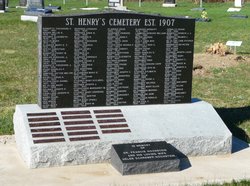
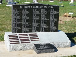
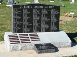
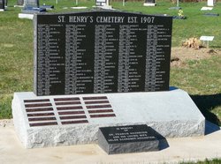
| Burial | : | Saint Henry's Roman Catholic Church Cemetery, Twin Butte, Claresholm Census Division, Canada |
| Coordinate | : | 49.3189900, -113.7728900 |
| Description | : | Pincher Creek Echo Irene Louise BONERTZ May 22, 1914 - October 16, 2010 BONERTZ, Irene Louise - (nee Planger) May 22,1914-October 16,2010 It is with deep sadness that the family of IRENE LOUISE BONERTZ (nee Planger) announce her passing on Saturday October 16,2010. She passed away peacefully surrounded by her family. Mom celebrated her 96th birthday on May 22,2010 at Vista Village in Pincher Creek with her family and many friends. Mom was blessed with 6 children, 16 grandchildren, 34 great grandchildren. Irene was born in the Porcupine Hills at a homestead to her parents Norbert... Read More |
frequently asked questions (FAQ):
-
Where is Irene Louise Planger Bonertz's memorial?
Irene Louise Planger Bonertz's memorial is located at: Saint Henry's Roman Catholic Church Cemetery, Twin Butte, Claresholm Census Division, Canada.
-
When did Irene Louise Planger Bonertz death?
Irene Louise Planger Bonertz death on 16 Oct 2010 in Alberta, Canada
-
Where are the coordinates of the Irene Louise Planger Bonertz's memorial?
Latitude: 49.3189900
Longitude: -113.7728900
Family Members:
Parent
Spouse
Siblings
Flowers:
Nearby Cemetories:
1. Saint Henry's Roman Catholic Church Cemetery
Twin Butte, Claresholm Census Division, Canada
Coordinate: 49.3189900, -113.7728900
2. Waterton Hutterite Cemetery
Hill Spring, Claresholm Census Division, Canada
Coordinate: 49.2661602, -113.6918691
3. Fishburn United Church Cemetery
Pincher Creek, Claresholm Census Division, Canada
Coordinate: 49.3783700, -113.7011300
4. Hill Spring Cemetery
Hill Spring, Claresholm Census Division, Canada
Coordinate: 49.3128700, -113.6436100
5. Hill Spring Pioneer Cemetery
Hill Spring, Claresholm Census Division, Canada
Coordinate: 49.3035000, -113.6249000
6. Hartley Cemetery
Hartleyville, Claresholm Census Division, Canada
Coordinate: 49.3777000, -113.6227000
7. Blue Ridge Hutterite Cemetery
Hill Spring, Claresholm Census Division, Canada
Coordinate: 49.2320117, -113.6305672
8. Trinity Lutheran Cemetery
Pincher Creek, Claresholm Census Division, Canada
Coordinate: 49.4070670, -113.9263560
9. Brocket Colony Cemetery
Pincher Creek, Claresholm Census Division, Canada
Coordinate: 49.4655200, -113.7694100
10. Springridge Mennonite Church Cemetery
Springridge, Claresholm Census Division, Canada
Coordinate: 49.4529305, -113.6340179
11. Pincher Creek Mennonite Brethren Cemetery
Pincher Creek, Claresholm Census Division, Canada
Coordinate: 49.4699090, -113.8627370
12. Thompson Hutterite Cemetery
Glenwood, Claresholm Census Division, Canada
Coordinate: 49.4269974, -113.5401975
13. Glenwood Cemetery
Glenwood, Claresholm Census Division, Canada
Coordinate: 49.3859800, -113.5003500
14. Fairview Cemetery
Pincher Creek, Claresholm Census Division, Canada
Coordinate: 49.4935700, -113.9231800
15. Pioneer Cemetery
Levern, Claresholm Census Division, Canada
Coordinate: 49.3489700, -113.4642000
16. Pioneer Cemetery
Pincher Creek, Claresholm Census Division, Canada
Coordinate: 49.4944000, -113.9404000
17. Mountain View Cemetery
Mountain View, Claresholm Census Division, Canada
Coordinate: 49.1293300, -113.5986300
18. Ewelme Hutterite Cemetery
Glenwood, Claresholm Census Division, Canada
Coordinate: 49.4510436, -113.4906843
19. Brocket Cemetery
Brocket, Claresholm Census Division, Canada
Coordinate: 49.5457100, -113.7667700
20. Pincher Creek Colony
Pincher Creek, Claresholm Census Division, Canada
Coordinate: 49.5047220, -113.9947220
21. Leavitt Cemetery
Leavitt, Claresholm Census Division, Canada
Coordinate: 49.1830500, -113.4768200
22. Riverside Hutterite Colony Cemetery
Glenwood, Claresholm Census Division, Canada
Coordinate: 49.4379404, -113.4492438
23. Waterton Park Cemetery
Waterton Park, Claresholm Census Division, Canada
Coordinate: 49.0718900, -113.8878500
24. Beazer Cemetery
Beazer, Claresholm Census Division, Canada
Coordinate: 49.1097500, -113.4975800

