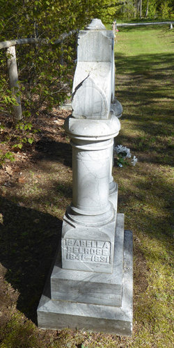
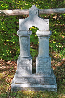
Isabella Rice Belrose
| Birth | : | 1 May 1844 Omemee, Kawartha Lakes Municipality, Ontario, Canada |
| Death | : | 11 May 1931 Southampton, Bruce County, Ontario, Canada |
| Burial | : | Dunk's Bay Cemetery, Tobermory, Bruce County, Canada |
| Coordinate | : | 45.2489000, -81.6459000 |
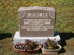
| Description | : | Daughter of William James Rice and Jane Murphy. She married Michael Belrose on Jan.28, 1859 in Ops township. They lived in Tobermory in Bruce County. Children: (1) John James (1860-1932) married Sarah Jane Davis (div.) (2) George Evan (1865-1948) married Sarah Jane Spears (3) Elizabeth Ann (1867-1937) wife of William Wade Leslie (4) Thomas Mahlon (1871-1956) (5) Frederick William (1873-1954) (6) Benson (1876-1960) (7) Helena May (1880-1964) wife of William John Smith (8) Alice May (1880-1881) (9) Margaret Jane (1883-1960) wife of Walter Albert Gibbons |
frequently asked questions (FAQ):
-
Where is Isabella Rice Belrose's memorial?
Isabella Rice Belrose's memorial is located at: Dunk's Bay Cemetery, Tobermory, Bruce County, Canada.
-
When did Isabella Rice Belrose death?
Isabella Rice Belrose death on 11 May 1931 in Southampton, Bruce County, Ontario, Canada
-
Where are the coordinates of the Isabella Rice Belrose's memorial?
Latitude: 45.2489000
Longitude: -81.6459000
Family Members:
Spouse
Children
Flowers:
Nearby Cemetories:
1. Dunk's Bay Cemetery
Tobermory, Bruce County, Canada
Coordinate: 45.2489000, -81.6459000
2. McVicar Cemetery
Saint-Edmunds Township, Bruce County, Canada
Coordinate: 45.1543480, -81.4642900
3. Stokes Bay Cemetery
Stokes Bay, Bruce County, Canada
Coordinate: 45.0052299, -81.3674927
4. Eastnor Township Cemetery
Eastnor Township, Bruce County, Canada
Coordinate: 44.9565200, -81.2648500
5. Hilly Grove Cemetery
Hilly Grove, Manitoulin District, Canada
Coordinate: 45.6789600, -81.8764700
6. Fairview Cemetery
Tehkummah, Manitoulin District, Canada
Coordinate: 45.6564280, -82.0034580
7. St. Paul's Anglican Cemetery
Manitowaning, Manitoulin District, Canada
Coordinate: 45.7447912, -81.8061589
8. Red Bay Cemetery
Red Bay, Bruce County, Canada
Coordinate: 44.8015000, -81.2827000
9. Buzwah Cemetery
Buzwah, Manitoulin District, Canada
Coordinate: 45.7660100, -81.7644500
10. Cape Croker St. Mary's First Nations Cemetery
Cape Croker, Bruce County, Canada
Coordinate: 44.9243200, -81.0198100
11. Little Port Elgin First Nations Cemetery
Little Port Elgin, Bruce County, Canada
Coordinate: 44.8880600, -81.0333400
12. Big Lake Cemetery
Manitoulin, Manitoulin District, Canada
Coordinate: 45.7457500, -82.0575900
13. Balsam Grove Cemetery
Oliphant, Bruce County, Canada
Coordinate: 44.7367000, -81.2755000
14. Lucius Albert Burial Site
Oliphant, Bruce County, Canada
Coordinate: 44.7313830, -81.2748130
15. Edgehill Cemetery
Wiarton, Bruce County, Canada
Coordinate: 44.7842700, -81.1237200
16. Providence Bay Cemetery
Providence Bay, Manitoulin District, Canada
Coordinate: 45.6728600, -82.2664600
17. Oxenden Cemetery
Oxenden, Grey County, Canada
Coordinate: 44.7620980, -81.0918510
18. Bayview Cemetery
Wiarton, Bruce County, Canada
Coordinate: 44.7354240, -81.1345901
19. Mindemoya Cemetery
Mindemoya, Manitoulin District, Canada
Coordinate: 45.7473100, -82.1928000
20. Sheguiandah Reserve Cemetery
Sheguiandah, Manitoulin District, Canada
Coordinate: 45.8809640, -81.9049780
21. Grimesthorpe Cemetery
Grimsthorpe, Manitoulin District, Canada
Coordinate: 45.7098120, -82.3246620
22. Green Bay United Church Cemetery
Manitoulin, Manitoulin District, Canada
Coordinate: 45.8603520, -82.0223110
23. M'Chigeeng Cemetery
West Bay, Manitoulin District, Canada
Coordinate: 45.8163400, -82.1601200
24. Jackson Cemetery
Amabel Township, Bruce County, Canada
Coordinate: 44.6500000, -81.1928000


