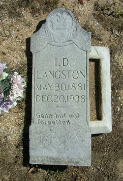
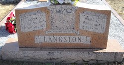
Isget Daniel Langston
| Birth | : | 30 May 1881 Williamsburg County, South Carolina, USA |
| Death | : | 20 Dec 1938 Florence County, South Carolina, USA |
| Burial | : | Grand Prairie Cemetery, Brush Ridge, Marion County, USA |
| Coordinate | : | 40.6906013, -83.1539001 |
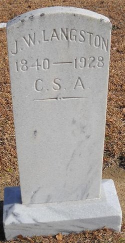
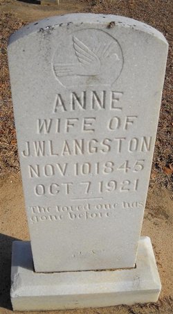
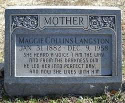
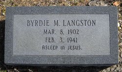
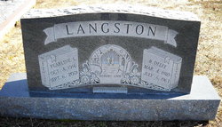
| Description | : | Son of John W. Langston (1845-1928) and Annie (1847- Husband of Martha (1873- Children: Byrdie M. Langston (1902-1941) Neicy Langston (1903- John Langston (1906- Husband of Mary Margaret 'Maggie' Collins (1882-1953) Children: Delee Langston (1910-1963) Virginia Langston Miles (1913-1937) Milber I. Langston (1916-1963) |
frequently asked questions (FAQ):
-
Where is Isget Daniel Langston's memorial?
Isget Daniel Langston's memorial is located at: Grand Prairie Cemetery, Brush Ridge, Marion County, USA.
-
When did Isget Daniel Langston death?
Isget Daniel Langston death on 20 Dec 1938 in Florence County, South Carolina, USA
-
Where are the coordinates of the Isget Daniel Langston's memorial?
Latitude: 40.6906013
Longitude: -83.1539001
Family Members:
Parent
Spouse
Siblings
Children
Flowers:
Nearby Cemetories:
1. Grand Prairie Cemetery
Brush Ridge, Marion County, USA
Coordinate: 40.6906013, -83.1539001
2. Bretz Cemetery
Brush Ridge, Marion County, USA
Coordinate: 40.6977997, -83.1455994
3. Macedonia Cemetery
Wyandot County, USA
Coordinate: 40.7176400, -83.1496220
4. Drake Cemetery
Wyandot, Wyandot County, USA
Coordinate: 40.7153230, -83.1272940
5. Burtsfield Cemetery
Brush Ridge, Marion County, USA
Coordinate: 40.6689500, -83.1146400
6. Page Cemetery
Marion County, USA
Coordinate: 40.6470000, -83.1710300
7. Chapel Heights Memory Gardens
Marion, Marion County, USA
Coordinate: 40.6407600, -83.1451400
8. Brewer Cemetery
Marion County, USA
Coordinate: 40.6398220, -83.1476480
9. Neff Cemetery
Morral, Marion County, USA
Coordinate: 40.6858900, -83.2218600
10. White Cemetery
Crawford County, USA
Coordinate: 40.7350006, -83.1018982
11. Little Sandusky Cemetery
Little Sandusky, Wyandot County, USA
Coordinate: 40.7367200, -83.2174200
12. John Green Cemetery
Harpster, Wyandot County, USA
Coordinate: 40.7095000, -83.2450000
13. Pipetown Indian Cemetery #1
Nevada, Wyandot County, USA
Coordinate: 40.7577980, -83.1881750
14. Pipetown Indian Cemetery #2
Nevada, Wyandot County, USA
Coordinate: 40.7577950, -83.1883690
15. Little John Green Cemetery
Harpster, Wyandot County, USA
Coordinate: 40.7095270, -83.2473940
16. Wyandot Indian Cemetery
Nevada, Wyandot County, USA
Coordinate: 40.7675216, -83.1617790
17. Likens Cemetery
Marion, Marion County, USA
Coordinate: 40.6288986, -83.0843964
18. Remer Cemetery
Crawford County, USA
Coordinate: 40.7163710, -83.0514935
19. Swartz Cemetery
Nevada, Wyandot County, USA
Coordinate: 40.7728336, -83.1688090
20. Kannel Cemetery
Big Island, Marion County, USA
Coordinate: 40.6300600, -83.2313100
21. Pleasant Hill Cemetery
Big Island, Marion County, USA
Coordinate: 40.6288986, -83.2300034
22. Hunt Cemetery
Harpster, Wyandot County, USA
Coordinate: 40.7347350, -83.2568610
23. Burke's Church Cemetery
Nevada, Wyandot County, USA
Coordinate: 40.7893982, -83.1500015
24. Union Cemetery
Big Island, Marion County, USA
Coordinate: 40.6436005, -83.2707977

