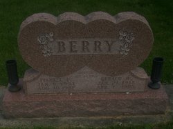
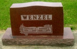
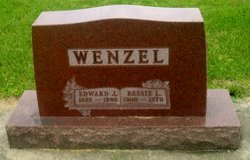
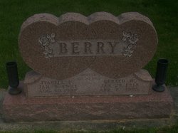
Ivanell Florence Wenzel Berry
| Birth | : | 9 Jan 1921 Strawberry Point, Clayton County, Iowa, USA |
| Death | : | Aug 1997 Dallas County, Texas, USA |
| Burial | : | St. John's Presbyterian Church Cemetery, Papatoetoe, Auckland Council, New Zealand |
| Coordinate | : | -36.9674185, 174.8598178 |
| Description | : | Ivanell WENZEL LVD:Carrollton,TX She married 1943.Elkport,IA Gerald Wm. BERRY(1918-1995.IA) ..Ivanell graduated in 1938 from Strawberry.Pt,IA High School and was a Clayton.Co,IA Rural School Teacher for Five years ..She and Gerald lived in Maynard,Fayette.Co,IA from 1954 to 1995 when she moved to Texas. They were members of Emmanuel.United.Methodist, Maynard,IA. |
frequently asked questions (FAQ):
-
Where is Ivanell Florence Wenzel Berry's memorial?
Ivanell Florence Wenzel Berry's memorial is located at: St. John's Presbyterian Church Cemetery, Papatoetoe, Auckland Council, New Zealand.
-
When did Ivanell Florence Wenzel Berry death?
Ivanell Florence Wenzel Berry death on Aug 1997 in Dallas County, Texas, USA
-
Where are the coordinates of the Ivanell Florence Wenzel Berry's memorial?
Latitude: -36.9674185
Longitude: 174.8598178
Family Members:
Parent
Spouse
Siblings
Flowers:
Nearby Cemetories:
1. St. John's Presbyterian Church Cemetery
Papatoetoe, Auckland Council, New Zealand
Coordinate: -36.9674185, 174.8598178
2. Nixon Memorial
Ōtāhūhū, Auckland Council, New Zealand
Coordinate: -36.9499366, 174.8449909
3. St. Joseph and St. Joachim Catholic Cemetery
Ōtāhūhū, Auckland Council, New Zealand
Coordinate: -36.9436100, 174.8490100
4. Papatoetoe Cemetery
Papatoetoe, Auckland Council, New Zealand
Coordinate: -36.9893110, 174.8373530
5. Manukau Memorial Gardens
Manukau, Auckland Council, New Zealand
Coordinate: -36.9944380, 174.8397300
6. Woodside Methodist Cemetery
Manukau, Auckland Council, New Zealand
Coordinate: -36.9929680, 174.8837860
7. Holy Trinity Memorial Park
Ōtāhūhū, Auckland Council, New Zealand
Coordinate: -36.9374510, 174.8448580
8. Otahuhu Public Cemetery
Ōtāhūhū, Auckland Council, New Zealand
Coordinate: -36.9377500, 174.8432390
9. St. John's Church Cemetery
East Tamaki, Auckland Council, New Zealand
Coordinate: -36.9522250, 174.8964540
10. St. Paul's Anglican Cemetery
East Tamaki, Auckland Council, New Zealand
Coordinate: -36.9615200, 174.9082000
11. Flat Bush Cemetery
East Tamaki, Auckland Council, New Zealand
Coordinate: -36.9563500, 174.9097100
12. St. David's Anglican Churchyard
Wiri, Auckland Council, New Zealand
Coordinate: -37.0025400, 174.8886150
13. Mangere Presbyterian Cemetery
Mangere, Auckland Council, New Zealand
Coordinate: -36.9750197, 174.7924783
14. Mangere Lawn Cemetery
Mangere, Auckland Council, New Zealand
Coordinate: -36.9626150, 174.7857000
15. St Matthias Churchyard
Panmure, Auckland Council, New Zealand
Coordinate: -36.9053300, 174.8577200
16. Waikaraka Cemetery
Ōnehunga, Auckland Council, New Zealand
Coordinate: -36.9297140, 174.7967170
17. St. Patrick's Roman Catholic Church Cemetery
Panmure, Auckland Council, New Zealand
Coordinate: -36.9029680, 174.8564960
18. Mangere Piriti Urupā St. James Churchyard
Mangere, Auckland Council, New Zealand
Coordinate: -36.9418970, 174.7835260
19. Pakuranga Methodist Cemetery
Pakuranga, Auckland Council, New Zealand
Coordinate: -36.9054000, 174.8914900
20. Howick Historical Village
Pakuranga, Auckland Council, New Zealand
Coordinate: -36.9067680, 174.9027080
21. Onehunga Catholic Cemetery
Ōnehunga, Auckland Council, New Zealand
Coordinate: -36.9224360, 174.7884560
22. Our Lady of the Assumption Catholic Church
Ōnehunga, Auckland Council, New Zealand
Coordinate: -36.9223690, 174.7884530
23. St. Peter's Anglican Cemetery
Ōnehunga, Auckland Council, New Zealand
Coordinate: -36.9227113, 174.7847550
24. Laurie-Gibbons Memorial Park
Weymouth, Auckland Council, New Zealand
Coordinate: -37.0440600, 174.8586790


