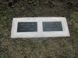
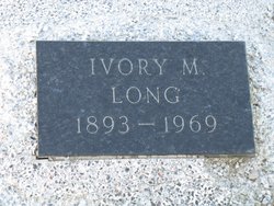
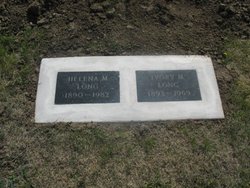
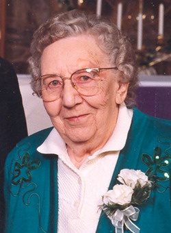
Ivory Mitchell Long
| Birth | : | 6 Sep 1893 Waubay, Day County, South Dakota, USA |
| Death | : | 23 Jul 1969 Kadoka, Jackson County, South Dakota, USA |
| Burial | : | Harrison Township Cemetery, South Bloomfield, Pickaway County, USA |
| Coordinate | : | 39.7100029, -82.9895859 |
| Description | : | He attended school at Bradley until 1906 when he moved with his parents to a farm near Kadoka. As a young man he worked for ranchers in the surrounding communities and Wyoming and North Dakota. He married Helena Hinz at Philip on September 6, 1917. They lived in Jackson and Haakon counties and in 1941 they purchased a ranch on Willow Creek north of Kadoka. They retired in 1956 and moved to Kadoka. |
frequently asked questions (FAQ):
-
Where is Ivory Mitchell Long's memorial?
Ivory Mitchell Long's memorial is located at: Harrison Township Cemetery, South Bloomfield, Pickaway County, USA.
-
When did Ivory Mitchell Long death?
Ivory Mitchell Long death on 23 Jul 1969 in Kadoka, Jackson County, South Dakota, USA
-
Where are the coordinates of the Ivory Mitchell Long's memorial?
Latitude: 39.7100029
Longitude: -82.9895859
Family Members:
Parent
Spouse
Siblings
Children
Flowers:
Nearby Cemetories:
1. Harrison Township Cemetery
South Bloomfield, Pickaway County, USA
Coordinate: 39.7100029, -82.9895859
2. Frye Farm Cemetery
South Bloomfield, Pickaway County, USA
Coordinate: 39.6971110, -83.0047600
3. Conner Family Farm Cemetery
Ashville, Pickaway County, USA
Coordinate: 39.7097700, -82.9625420
4. Floral Hills Memory Gardens
Circleville, Pickaway County, USA
Coordinate: 39.6775000, -82.9687000
5. Ashville Cemetery
Ashville, Pickaway County, USA
Coordinate: 39.7150440, -82.9425720
6. James Borror Farm Cemetery
Pickaway County, USA
Coordinate: 39.7519690, -83.0144500
7. Stage Cemetery (Defunct)
Walnut Township, Pickaway County, USA
Coordinate: 39.6810750, -82.9403970
8. Caldwell Farm Cemetery
Commercial Point, Pickaway County, USA
Coordinate: 39.7539518, -83.0168503
9. Hoover Hill Cemetery
Ashville, Pickaway County, USA
Coordinate: 39.7098530, -82.9213610
10. Mount Herman Cemetery
Ashville, Pickaway County, USA
Coordinate: 39.7010994, -82.9214020
11. Press Peters Farm Cemetery
Commercial Point, Pickaway County, USA
Coordinate: 39.7496470, -83.0378710
12. Ira Hoover Cemetery
Walnut Township, Pickaway County, USA
Coordinate: 39.7294565, -82.9190150
13. Hott Farm Cemetery
Matville, Pickaway County, USA
Coordinate: 39.7198200, -83.0653970
14. Jackson Township Cemetery
Pickaway County, USA
Coordinate: 39.6508942, -83.0090714
15. A R Duvall Cemetery
Ashville, Pickaway County, USA
Coordinate: 39.7447850, -82.9235130
16. Bowsher Cemetery
Circleville, Pickaway County, USA
Coordinate: 39.6458959, -82.9643476
17. Old Herrenstine Cemetery
Circleville, Pickaway County, USA
Coordinate: 39.6536734, -83.0376842
18. McLaine Cemetery
Circleville, Pickaway County, USA
Coordinate: 39.6450980, -83.0168030
19. Presbyterian Cemetery
Commercial Point, Pickaway County, USA
Coordinate: 39.7609000, -83.0504600
20. Clayton Weaver Cemetery (Defunct)
Walnut Township, Pickaway County, USA
Coordinate: 39.7090320, -82.8993170
21. W C Morrison Farm Cemetery (Defunct)
Walnut Township, Pickaway County, USA
Coordinate: 39.6683030, -82.9159340
22. Burnley Family Cemetery
Commercial Point, Pickaway County, USA
Coordinate: 39.7692650, -83.0558040
23. Dry Run Cemetery
Ashville, Pickaway County, USA
Coordinate: 39.6680984, -82.9036026
24. C F Brinker Farm Cemetery (Defunct)
Walnut Township, Pickaway County, USA
Coordinate: 39.6675060, -82.9038640

