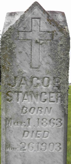
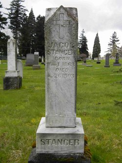
Jacob Stanger
| Birth | : | 1 Mar 1863 |
| Death | : | 26 Mar 1903 |
| Burial | : | Bay Center Pioneer Cemetery, Bay Center, Pacific County, USA |
| Coordinate | : | 46.6298850, -123.9538870 |
frequently asked questions (FAQ):
-
Where is Jacob Stanger's memorial?
Jacob Stanger's memorial is located at: Bay Center Pioneer Cemetery, Bay Center, Pacific County, USA.
-
When did Jacob Stanger death?
Jacob Stanger death on 26 Mar 1903 in
-
Where are the coordinates of the Jacob Stanger's memorial?
Latitude: 46.6298850
Longitude: -123.9538870
Family Members:
Parent
Siblings
Flowers:
Nearby Cemetories:
1. Bay Center Pioneer Cemetery
Bay Center, Pacific County, USA
Coordinate: 46.6298850, -123.9538870
2. Wilsonville Cemetery
Pacific County, USA
Coordinate: 46.6379710, -123.9387740
3. Bay Center Cemetery
Bay Center, Pacific County, USA
Coordinate: 46.5986490, -123.9355650
4. Oysterville Cemetery
Oysterville, Pacific County, USA
Coordinate: 46.5478670, -124.0337350
5. Shoalwater Bay Indian Tribal Cemetery
Pacific County, USA
Coordinate: 46.7217040, -124.0152920
6. North Cove Pioneer Cemetery
Pacific County, USA
Coordinate: 46.7316620, -124.0594300
7. Odd Fellows Cemetery
South Bend, Pacific County, USA
Coordinate: 46.6647130, -123.7541360
8. Ocean Park Cemetery
Ocean Park, Pacific County, USA
Coordinate: 46.4903970, -124.0427580
9. Riddell Street Cemetery
Raymond, Pacific County, USA
Coordinate: 46.6945200, -123.7358600
10. Washington Cemetery
Raymond, Pacific County, USA
Coordinate: 46.7005997, -123.7319031
11. F O E 1631 Cemetery
Raymond, Pacific County, USA
Coordinate: 46.7006000, -123.7319000
12. Giesy Family Cemetery
Menlo, Pacific County, USA
Coordinate: 46.6446780, -123.6625170
13. Fern Hill Cemetery
Menlo, Pacific County, USA
Coordinate: 46.6338997, -123.6585999
14. Saint Paul Catholic Church
Westport, Grays Harbor County, USA
Coordinate: 46.8583670, -124.0963540
15. Briscoe Family Cemetery
Pacific County, USA
Coordinate: 46.3867690, -124.0541310
16. Ocosta Cemetery
Ocosta, Grays Harbor County, USA
Coordinate: 46.8885890, -124.0291860
17. Johns River Cemetery
Markham, Grays Harbor County, USA
Coordinate: 46.8933830, -123.9788500
18. Lone Fir Cemetery
Long Beach, Pacific County, USA
Coordinate: 46.3622017, -124.0175018
19. Maple Hill Cemetery
Lebam, Pacific County, USA
Coordinate: 46.5653150, -123.5671480
20. Fir Grove Cemetery
Lebam, Pacific County, USA
Coordinate: 46.5604910, -123.5548970
21. Peaceful Hill Cemetery
Naselle, Pacific County, USA
Coordinate: 46.3678017, -123.7994003
22. Salmon Creek Cemetery
Deep River, Wahkiakum County, USA
Coordinate: 46.3634000, -123.7164000
23. Ilwaco Cemetery
Ilwaco, Pacific County, USA
Coordinate: 46.3180008, -124.0227966
24. Salmon Creek Cemetery Old
Wahkiakum County, USA
Coordinate: 46.3578630, -123.7178340

