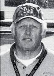
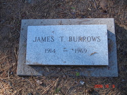
James Buford Burrows
| Birth | : | 25 Jul 1938 Westwood, Lassen County, California, USA |
| Death | : | 24 Jul 2017 Stevensville, Ravalli County, Montana, USA |
| Burial | : | Cromberg Cemetery, Cromberg, Plumas County, USA |
| Coordinate | : | 39.8535995, -120.6947021 |
| Description | : | Sometime in the early morning hours of July 24, 2017, Jim passed away in his sleep at his home in Stevensville, Montana. Jim was born to James Tyler and Elnora A. Burrows in Westwood, California on July 25, 1938. He lived a carefree childhood in Keddie, California, where his parents were employed by Western Pacific Railroad. During these years, he gained many childhood friends, some of which he was still in contact with until his death. Jim went to school in Quincy, California and Stockton, California where he graduated high school at what was then known as Stockton... Read More |
frequently asked questions (FAQ):
-
Where is James Buford Burrows's memorial?
James Buford Burrows's memorial is located at: Cromberg Cemetery, Cromberg, Plumas County, USA.
-
When did James Buford Burrows death?
James Buford Burrows death on 24 Jul 2017 in Stevensville, Ravalli County, Montana, USA
-
Where are the coordinates of the James Buford Burrows's memorial?
Latitude: 39.8535995
Longitude: -120.6947021
Family Members:
Flowers:
Nearby Cemetories:
1. Cromberg Cemetery
Cromberg, Plumas County, USA
Coordinate: 39.8535995, -120.6947021
2. Mohawk Cemetery
Mohawk, Plumas County, USA
Coordinate: 39.7791060, -120.6384200
3. Johnsville Cemetery
Johnsville, Plumas County, USA
Coordinate: 39.7627983, -120.6913986
4. Andrew J Brineger Gravesite
Quincy, Plumas County, USA
Coordinate: 39.8380230, -120.8486450
5. Whiskey Diggings Cemetery
Sierra County, USA
Coordinate: 39.7504200, -120.8868700
6. East Lawn Cemetery
Quincy, Plumas County, USA
Coordinate: 39.9336014, -120.9088974
7. Shady Grove Cemetery
Portola, Plumas County, USA
Coordinate: 39.8072014, -120.4593964
8. Quincy Chinese Cemetery
Quincy, Plumas County, USA
Coordinate: 39.9357770, -120.9247350
9. Gibsonville Cemetery
Gibsonville, Sierra County, USA
Coordinate: 39.7448700, -120.9097100
10. Quincy Cemetery
Quincy, Plumas County, USA
Coordinate: 39.9361000, -120.9297028
11. Howland Flat Cemetery
Howland Flat, Sierra County, USA
Coordinate: 39.7152500, -120.8821900
12. Shims Flat Indian Burial Ground
Taylorsville, Plumas County, USA
Coordinate: 40.0499992, -120.7780991
13. Pine Grove Cemetery
Sierra County, USA
Coordinate: 39.7174988, -120.8983002
14. Davis Family Cemetery
Genesee, Plumas County, USA
Coordinate: 40.0648010, -120.6877290
15. Plumas County Cemetery
Quincy, Plumas County, USA
Coordinate: 39.9486008, -120.9417038
16. Whispering Pines Cemetery
Beckworth, Plumas County, USA
Coordinate: 39.8252983, -120.4180984
17. Stiver Cemetery
Quincy, Plumas County, USA
Coordinate: 39.9747009, -120.9300003
18. Saint Louis Cemetery
Sierra County, USA
Coordinate: 39.6967010, -120.9302979
19. Taylorsville District Cemetery
Taylorsville, Plumas County, USA
Coordinate: 40.0740820, -120.8367200
20. Taylorsville Indian Burial Grounds
Taylorsville, Plumas County, USA
Coordinate: 40.0748050, -120.8359420
21. George Schmidt Burial Ground
Keddie, Plumas County, USA
Coordinate: 39.9873046, -120.9768519
22. Morristown Cemetery
Sierra County, USA
Coordinate: 39.6545730, -120.9034680
23. L H Merritt Gravesite
Queen City, Sierra County, USA
Coordinate: 39.6624900, -120.9194500
24. Summers Family Cemetery
Calpine, Sierra County, USA
Coordinate: 39.6861940, -120.4355350


