

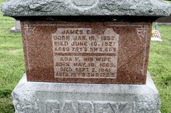
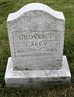
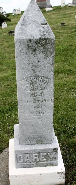
James Carey
| Birth | : | 18 Jan 1852 |
| Death | : | 10 Jun 1927 |
| Burial | : | Providence Bay Cemetery, Providence Bay, Manitoulin District, Canada |
| Coordinate | : | 45.6728600, -82.2664600 |
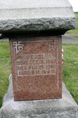
| Description | : | ---- Evening Times, Cumberland, Maryland, June 11, 1927: "James Carey, prominent farmer of Garrett county, died yesterday at his home on the National Pike, about six miles from Frostburg. Death was due to pneumonia. Born on the old Carey estate, known as District No. 9, in Garrett county, on January 16, 1852, he was the son of the late Mr.and Mrs. Daniel Carey, his parents being among the earliest pioneer land owners of Garrett county. He was descended from Revolutionary ancestors, his parents, grandparent and great grandparents being extensive land owner farmers within a radius of a few miles of Mr.... Read More |
frequently asked questions (FAQ):
-
Where is James Carey's memorial?
James Carey's memorial is located at: Providence Bay Cemetery, Providence Bay, Manitoulin District, Canada.
-
When did James Carey death?
James Carey death on 10 Jun 1927 in
-
Where are the coordinates of the James Carey's memorial?
Latitude: 45.6728600
Longitude: -82.2664600
Family Members:
Parent
Spouse
Siblings
Children
Flowers:


Nearby Cemetories:
1. Providence Bay Cemetery
Providence Bay, Manitoulin District, Canada
Coordinate: 45.6728600, -82.2664600
2. Grimesthorpe Cemetery
Grimsthorpe, Manitoulin District, Canada
Coordinate: 45.7098120, -82.3246620
3. Mindemoya Cemetery
Mindemoya, Manitoulin District, Canada
Coordinate: 45.7473100, -82.1928000
4. Long Bay Cemetery
Long Bay, Manitoulin District, Canada
Coordinate: 45.8056680, -82.3795380
5. M'Chigeeng Cemetery
West Bay, Manitoulin District, Canada
Coordinate: 45.8163400, -82.1601200
6. Big Lake Cemetery
Manitoulin, Manitoulin District, Canada
Coordinate: 45.7457500, -82.0575900
7. Fairview Cemetery
Tehkummah, Manitoulin District, Canada
Coordinate: 45.6564280, -82.0034580
8. Burpee Mills Cemetery
Burpee and Mills, Manitoulin District, Canada
Coordinate: 45.7685100, -82.5328800
9. Cold Springs Cemetery
Cold Springs, Manitoulin District, Canada
Coordinate: 45.8595060, -82.1087820
10. Kagawong Cedars Cemetery
Kagawong, Manitoulin District, Canada
Coordinate: 45.9089600, -82.2568300
11. Gordon Cemetery
Gordon, Manitoulin District, Canada
Coordinate: 45.8757300, -82.4724300
12. Green Bay United Church Cemetery
Manitoulin, Manitoulin District, Canada
Coordinate: 45.8603520, -82.0223110
13. Hilly Grove Cemetery
Hilly Grove, Manitoulin District, Canada
Coordinate: 45.6789600, -81.8764700
14. Sheguiandah Reserve Cemetery
Sheguiandah, Manitoulin District, Canada
Coordinate: 45.8809640, -81.9049780
15. St. Paul's Anglican Cemetery
Manitowaning, Manitoulin District, Canada
Coordinate: 45.7447912, -81.8061589
16. Elm View Cemetery
Howland, Manitoulin District, Canada
Coordinate: 45.9045270, -81.9204550
17. Sucker Creek Cemetery
Sucker Creek, Manitoulin District, Canada
Coordinate: 45.9604060, -81.9764140
18. Mountain View Cemetery
Little Current, Manitoulin District, Canada
Coordinate: 45.9604400, -81.9523100
19. Buzwah Cemetery
Buzwah, Manitoulin District, Canada
Coordinate: 45.7660100, -81.7644500
20. Holy Trinity Anglican Cemetery
Little Current, Manitoulin District, Canada
Coordinate: 45.9677590, -81.9439240
21. St. Bernard's Catholic Cemetery
Little Current, Manitoulin District, Canada
Coordinate: 45.9789170, -81.9596700
22. Silver Lake Cemetery
Silver Water, Manitoulin District, Canada
Coordinate: 45.8578000, -82.8552000
23. Sheshegwaning Catholic Cemetery
Sheshegwaning, Manitoulin District, Canada
Coordinate: 45.9369839, -82.8383913
24. Sheshegwaning Anglican Cemetery
Sheshegwaning, Manitoulin District, Canada
Coordinate: 45.9368920, -82.8522804