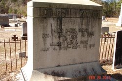
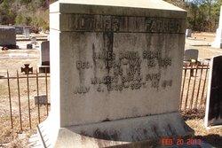
James Daniel Rhoad
| Birth | : | 11 Dec 1824 Orangeburg County, South Carolina, USA |
| Death | : | 12 May 1886 |
| Burial | : | Gate of Heaven Cemetery, Springfield, Hampden County, USA |
| Coordinate | : | 42.1048370, -72.4778450 |
| Description | : | Father: John RHOAD b: 1768 Mother: Catherine LINDER b: 4 AUG 1783 in Branchville, Orangeburg Co., SC Marriage 1 Meldred Sarah BYRD b: 4 JUL 1838 |
frequently asked questions (FAQ):
-
Where is James Daniel Rhoad's memorial?
James Daniel Rhoad's memorial is located at: Gate of Heaven Cemetery, Springfield, Hampden County, USA.
-
When did James Daniel Rhoad death?
James Daniel Rhoad death on 12 May 1886 in
-
Where are the coordinates of the James Daniel Rhoad's memorial?
Latitude: 42.1048370
Longitude: -72.4778450
Family Members:
Parent
Spouse
Siblings
Children
Flowers:
Nearby Cemetories:
1. Gate of Heaven Cemetery
Springfield, Hampden County, USA
Coordinate: 42.1048370, -72.4778450
2. Brookside Cemetery
East Longmeadow, Hampden County, USA
Coordinate: 42.0842819, -72.4809036
3. Hillcrest Park Cemetery
Springfield, Hampden County, USA
Coordinate: 42.1274986, -72.4933014
4. Wachogue Cemetery
Springfield, Hampden County, USA
Coordinate: 42.0950860, -72.5109030
5. Adams Cemetery
Wilbraham, Hampden County, USA
Coordinate: 42.1082993, -72.4389038
6. Maplewood Cemetery
Springfield, Hampden County, USA
Coordinate: 42.1307983, -72.4957962
7. Saint Marks Memorial Garden
East Longmeadow, Hampden County, USA
Coordinate: 42.0725600, -72.5007430
8. Kesser Israel Cemetery
Springfield, Hampden County, USA
Coordinate: 42.1145610, -72.5304670
9. Sons of Israel Cemetery
Springfield, Hampden County, USA
Coordinate: 42.1143000, -72.5316000
10. City of Homes Cemetery
Springfield, Hampden County, USA
Coordinate: 42.1142980, -72.5316060
11. Woodland Dell Cemetery
Wilbraham, Hampden County, USA
Coordinate: 42.1211014, -72.4263992
12. Green Lawn Cemetery
East Longmeadow, Hampden County, USA
Coordinate: 42.0645561, -72.5079727
13. Baptist Village Cemetery
East Longmeadow, Hampden County, USA
Coordinate: 42.0559920, -72.4711310
14. Saint Michael's Cemetery
Springfield, Hampden County, USA
Coordinate: 42.1240997, -72.5392914
15. Saint Aloysius Cemetery
Springfield, Hampden County, USA
Coordinate: 42.1514015, -72.5139008
16. Sinai Memorial Park
Springfield, Hampden County, USA
Coordinate: 42.1427994, -72.5291977
17. Bay Path Cemetery
Springfield, Hampden County, USA
Coordinate: 42.1231003, -72.5519028
18. Glendale Cemetery
Wilbraham, Hampden County, USA
Coordinate: 42.1133000, -72.3964000
19. Polish National Cemetery
Springfield, Hampden County, USA
Coordinate: 42.1441870, -72.5417380
20. Billings Hill Cemetery
East Longmeadow, Hampden County, USA
Coordinate: 42.0433860, -72.5000000
21. Old Hampden Cemetery
Hampden, Hampden County, USA
Coordinate: 42.0611000, -72.4111023
22. Oak Grove Cemetery
Springfield, Hampden County, USA
Coordinate: 42.1264000, -72.5625000
23. Cherry Lane Cemetery
Springfield, Hampden County, USA
Coordinate: 42.0971985, -72.5689011
24. Prospect Hill Cemetery
Hampden, Hampden County, USA
Coordinate: 42.0639000, -72.4028015

