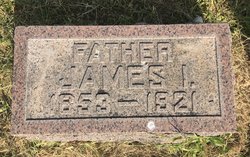
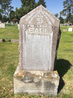
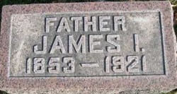
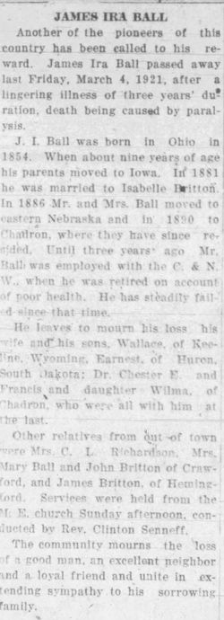
James Ira Ball
| Birth | : | Oct 1854 Morgan County, Ohio, USA |
| Death | : | 4 Mar 1921 Chadron, Dawes County, Nebraska, USA |
| Burial | : | Greenwood Cemetery, Chadron, Dawes County, USA |
| Coordinate | : | 42.8272018, -103.0239029 |
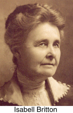
| Description | : | On April 6, 1882, James Ira Ball was united in marriage to Isabelle Britton and moved to Blair, Neb., where Mr. Ball was engaged in farming. He later gave up farming and operated a general store in California Junction and from there went to Lyons, Neb. In 1887 Mr. and Mrs. Ball came to the Chadron area and took up a homestead on Ash Creek near Mrs. Ball's parents. They had preceded them about two years, having come to this country on the first train that ran west of Valentine. After proving their claim, Mr. and Mrs. Ball moved to Chadron... Read More |
frequently asked questions (FAQ):
-
Where is James Ira Ball's memorial?
James Ira Ball's memorial is located at: Greenwood Cemetery, Chadron, Dawes County, USA.
-
When did James Ira Ball death?
James Ira Ball death on 4 Mar 1921 in Chadron, Dawes County, Nebraska, USA
-
Where are the coordinates of the James Ira Ball's memorial?
Latitude: 42.8272018
Longitude: -103.0239029
Family Members:
Spouse
Children
Flowers:
Nearby Cemetories:
1. Greenwood Cemetery
Chadron, Dawes County, USA
Coordinate: 42.8272018, -103.0239029
2. Calvary Cemetery
Chadron, Dawes County, USA
Coordinate: 42.8224983, -103.0085983
3. Grace Episcopal Cemetery
Chadron, Dawes County, USA
Coordinate: 42.8267000, -102.9996000
4. Shisler Cemetery
Dawes County, USA
Coordinate: 42.7930984, -103.0875015
5. Highland Cemetery
Dawes County, USA
Coordinate: 42.8163986, -102.9302979
6. Evergreen Cemetery
Chadron, Dawes County, USA
Coordinate: 42.6646710, -103.0608510
7. Whitney Cemetery
Whitney, Dawes County, USA
Coordinate: 42.7705994, -103.2564011
8. Bethel Cemetery
Dawes County, USA
Coordinate: 42.6850014, -103.1841965
9. Beaver Valley Cemetery
Sheridan County, USA
Coordinate: 42.8880997, -102.7517014
10. Highland Cemetery
Hay Springs, Sheridan County, USA
Coordinate: 42.7145500, -102.7727500
11. Antelope Cemetery
Hay Springs, Sheridan County, USA
Coordinate: 42.7144970, -102.7727290
12. Highland Center Cemetery
Dawes County, USA
Coordinate: 42.6100006, -103.1258011
13. Antelope Springs Cemetery
Chadron, Dawes County, USA
Coordinate: 42.6185000, -102.8706100
14. Wanda Highway Gravesite
Chadron, Dawes County, USA
Coordinate: 42.6535800, -103.2655800
15. Bomar Cemetery
Hay Springs, Sheridan County, USA
Coordinate: 42.8062000, -102.6459600
16. Our Lady of Lourdes Catholic Cemetery
Slim Butte, Oglala Lakota County, USA
Coordinate: 43.0619800, -102.8166200
17. Slim Buttes Cemetery
Pine Ridge, Oglala Lakota County, USA
Coordinate: 43.0621700, -102.8168100
18. St. Mary's Cemetery
Hay Springs, Sheridan County, USA
Coordinate: 42.6721992, -102.7035980
19. Hay Springs Cemetery
Hay Springs, Sheridan County, USA
Coordinate: 42.6702995, -102.7033005
20. Crawford Cemetery
Crawford, Dawes County, USA
Coordinate: 42.7181015, -103.4052963
21. Pleasant Hill Cemetery
Chadron, Dawes County, USA
Coordinate: 42.5547300, -102.8429000
22. Saint Matthews Episcopal Cemetery
Slim Butte, Oglala Lakota County, USA
Coordinate: 43.0780530, -102.7873140
23. Abold Family Cemetery
Rushville, Sheridan County, USA
Coordinate: 42.8863500, -102.6158000
24. Harvey Cemetery
Crawford, Dawes County, USA
Coordinate: 42.6455994, -103.3625031

