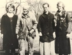
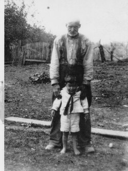
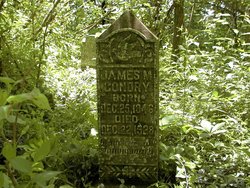
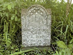
James Madison Condry
| Birth | : | 25 Dec 1846 Grainger County, Tennessee, USA |
| Death | : | 22 Dec 1928 Grainger County, Tennessee, USA |
| Burial | : | Harmony Baptist Church Cemetery, Edgemoor, Chester County, USA |
| Coordinate | : | 34.8046250, -80.9690760 |
| Description | : | James Madison Condry was the son of William H. and Louisa (Barnard) Condry. He married 1st, 5 May 1875, to Adaline Brooks. He married 2nd, 30 Aug 1877, to Mary Louisa Parris, 30 Aug 1877, Grainger County, Tennessee. He lived his entire lifetime on the banks of the Clinch River. He was a farmer in the Condry Bend area of Grainger County as was his father before him. Dr E.T. Idol was the attending physician at the time of his death. He was treating him for "Organic Heart Trouble." He was the father of one child by the 1st marriage; 1. Mollie... Read More |
frequently asked questions (FAQ):
-
Where is James Madison Condry's memorial?
James Madison Condry's memorial is located at: Harmony Baptist Church Cemetery, Edgemoor, Chester County, USA.
-
When did James Madison Condry death?
James Madison Condry death on 22 Dec 1928 in Grainger County, Tennessee, USA
-
Where are the coordinates of the James Madison Condry's memorial?
Latitude: 34.8046250
Longitude: -80.9690760
Family Members:
Parent
Spouse
Siblings
Children
Flowers:
Nearby Cemetories:
1. Harmony Baptist Church Cemetery
Edgemoor, Chester County, USA
Coordinate: 34.8046250, -80.9690760
2. Rives Family Burying Grounds
Edgemoor, Chester County, USA
Coordinate: 34.7990600, -80.9970000
3. Bethel United Methodist Church Cemetery
Edgemoor, Chester County, USA
Coordinate: 34.7921600, -80.9321100
4. Big Calvary Baptist Church Cemetery
Edgemoor, Chester County, USA
Coordinate: 34.7882180, -81.0050820
5. Edgemoor ARP Church Cemetery
Edgemoor, Chester County, USA
Coordinate: 34.8055800, -81.0104000
6. Liberty Hill Baptist Church Cemetery
Catawba, York County, USA
Coordinate: 34.8286660, -80.9384350
7. Red Oak AME Zion Church Cemetery
Edgemoor, Chester County, USA
Coordinate: 34.8019210, -81.0123740
8. Mount Calvary AME Zion Church Cemetery
Rock Hill, York County, USA
Coordinate: 34.8445778, -80.9860687
9. New Covenant Church
Chester County, USA
Coordinate: 34.7818130, -80.9198320
10. Lando Cemetery
Lando, Chester County, USA
Coordinate: 34.7717300, -81.0102260
11. Nichols Family Cemetery
Edgemoor, Chester County, USA
Coordinate: 34.7734860, -80.9251110
12. Mount Zion AME Zion Church Cemetery
Landsford, Chester County, USA
Coordinate: 34.7743200, -80.9175800
13. Old Stone Cemetery
Fort Lawn, Chester County, USA
Coordinate: 34.7905870, -80.9053250
14. New Vision Freewill Baptist Church Cemetery
Rock Hill, York County, USA
Coordinate: 34.8520660, -81.0023010
15. Burnt Meeting House Church Cemetery
Chester County, USA
Coordinate: 34.7440000, -80.9765300
16. Catawba Chapel A.M.E. Zion Church Cemetery
Catawba, York County, USA
Coordinate: 34.8555500, -80.9262500
17. Neely's Creek ARP Church Cemetery
Rock Hill, York County, USA
Coordinate: 34.8673260, -80.9651080
18. Mount Vernon AME Zion Church Cemetery
Chester County, USA
Coordinate: 34.7422210, -80.9603680
19. Catawba Methodist Church Cemetery
Catawba, York County, USA
Coordinate: 34.8506851, -80.9131012
20. El Bethel United Methodist Church Cemetery
Chester County, USA
Coordinate: 34.7513590, -80.9194850
21. Mount Holly United Methodist Church Cemetery
Rock Hill, York County, USA
Coordinate: 34.8674278, -81.0165024
22. Pleasant Ridge Baptist Church Cemetery
Rock Hill, York County, USA
Coordinate: 34.8530235, -81.0420914
23. Tabernacle AME Zion Church Cemetery
Rock Hill, York County, USA
Coordinate: 34.8749847, -80.9308090
24. Hopewell Presbyterian Church Cemetery
Lesslie, York County, USA
Coordinate: 34.8835320, -80.9648800

