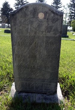
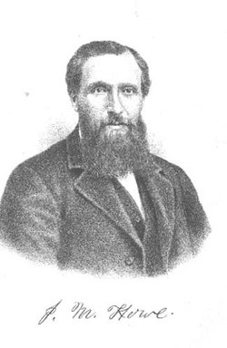
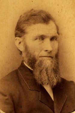
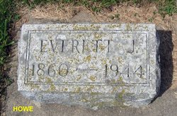
James Marion Howe
| Birth | : | 3 Jan 1833 Livingston County, New York, USA |
| Death | : | 19 Jan 1906 Townsend, Broadwater County, Montana, USA |
| Burial | : | Deep Creek Cemetery, Townsend, Broadwater County, USA |
| Coordinate | : | 46.2832000, -111.4667000 |
| Description | : | James M. Howe Biography From HISTORY OF MITCHELL AND WORTH COUNTIES, Iowa, 1883; page 302 James M. Howe bought land on section 4, Cedar township, Mitchell county in 1856, which he has improved by the erection of good buildings and setting out trees. It is deemed he has the finest grove in the county with every variety of timber. He has also a fine apple orchard with all small fruits grown in that section of country. He is a son of Stephen and Nancy (Tyler) Howe, born in Livingston Co., N. Y., June 3, 1833. His grandfather, Tyler, was a soldier... Read More |
frequently asked questions (FAQ):
-
Where is James Marion Howe's memorial?
James Marion Howe's memorial is located at: Deep Creek Cemetery, Townsend, Broadwater County, USA.
-
When did James Marion Howe death?
James Marion Howe death on 19 Jan 1906 in Townsend, Broadwater County, Montana, USA
-
Where are the coordinates of the James Marion Howe's memorial?
Latitude: 46.2832000
Longitude: -111.4667000
Family Members:
Parent
Spouse
Siblings
Children
Nearby Cemetories:
1. Deep Creek Cemetery
Townsend, Broadwater County, USA
Coordinate: 46.2832000, -111.4667000
2. Holy Cross Cemetery
Townsend, Broadwater County, USA
Coordinate: 46.3182983, -111.4831009
3. Centerville Cemetery
Townsend, Broadwater County, USA
Coordinate: 46.3375140, -111.5142990
4. Charity Jane Dillon Gravesite
Townsend, Broadwater County, USA
Coordinate: 46.2947200, -111.5875770
5. Shull Cemetery
Broadwater County, USA
Coordinate: 46.1678760, -111.4242520
6. St. Joseph's Cemetery
Canton, Broadwater County, USA
Coordinate: 46.4073200, -111.4446150
7. Macomber Field Cemetery
Radersburg, Broadwater County, USA
Coordinate: 46.1744100, -111.5986100
8. Radersburg Cemetery
Radersburg, Broadwater County, USA
Coordinate: 46.1765990, -111.6126290
9. Parker Cemetery
Broadwater County, USA
Coordinate: 46.1760000, -111.6130000
10. Lavina Chapel Cemetery
Broadwater County, USA
Coordinate: 46.4555000, -111.5043000
11. Fairview Cemetery
Broadwater County, USA
Coordinate: 46.4570110, -111.5035380
12. Beaver Creek Cemetery (Defunct)
Winston, Broadwater County, USA
Coordinate: 46.5152780, -111.5952780
13. Winston Cemetery
Winston, Broadwater County, USA
Coordinate: 46.5017014, -111.6714020
14. Diamond City Cemetery
Broadwater County, USA
Coordinate: 46.5883300, -111.4346900
15. Elkhorn Cemetery
Elkhorn, Jefferson County, USA
Coordinate: 46.2683450, -111.9480010
16. Missouri Headwaters State Park Cemetery
Trident, Gallatin County, USA
Coordinate: 45.9346470, -111.4937960
17. Turner Cemetery
Jefferson County, USA
Coordinate: 46.5306015, -111.8486023
18. Morgan Cemetery
Springhill, Gallatin County, USA
Coordinate: 46.0092010, -111.1102982
19. Saint John the Evangelist Catholic Church Cemetery
Boulder, Jefferson County, USA
Coordinate: 46.1234000, -111.9505000
20. Canyon Ferry Cemetery
Lewis and Clark County, USA
Coordinate: 46.6344330, -111.7059790
21. Logan Cemetery
Logan, Gallatin County, USA
Coordinate: 45.8880997, -111.4710999
22. Jefferson City Cemetery
Jefferson City, Jefferson County, USA
Coordinate: 46.3913000, -112.0308000
23. Fairview Cemetery
Three Forks, Gallatin County, USA
Coordinate: 45.8717003, -111.5325012
24. Fly Cemetery
Gallatin County, USA
Coordinate: 45.8939018, -111.2485962

