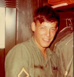
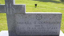
James Marvin “Jim” Cornelison
| Birth | : | 10 Sep 1951 Osceola, Clarke County, Iowa, USA |
| Death | : | 30 Sep 2011 Des Moines, Polk County, Iowa, USA |
| Burial | : | Lorimor Cemetery, Lorimor, Union County, USA |
| Coordinate | : | 41.1128006, -94.0516968 |
| Description | : | Son of Merrill & Patricia Repplinger Cornelison Veteran of Vietnam War James ‘Jim' Marvin Cornelison, 60, of Lorimor, Iowa died September 30, 2011 at the Iowa Methodist Medical Center in Des Moines. Jim was born September 10, 1951 in Osceola, Iowa, the son of Merrill and Patricia (Repplinger) Cornelison. He attended grade school at East Union and finished his education at Ft. Sill Army School, Ft. Sills, Oklahoma. His marriage to Norma ‘Gidget' Nelson took place on February 20, 1977 and to this union were blessed with two children, Shannon and Matt. Jim enlisted in the United States Army and... Read More |
frequently asked questions (FAQ):
-
Where is James Marvin “Jim” Cornelison's memorial?
James Marvin “Jim” Cornelison's memorial is located at: Lorimor Cemetery, Lorimor, Union County, USA.
-
When did James Marvin “Jim” Cornelison death?
James Marvin “Jim” Cornelison death on 30 Sep 2011 in Des Moines, Polk County, Iowa, USA
-
Where are the coordinates of the James Marvin “Jim” Cornelison's memorial?
Latitude: 41.1128006
Longitude: -94.0516968
Family Members:
Parent
Siblings
Flowers:
Nearby Cemetories:
1. Lorimor Cemetery
Lorimor, Union County, USA
Coordinate: 41.1128006, -94.0516968
2. Monette Cemetery
Lorimor, Union County, USA
Coordinate: 41.0800743, -94.0715866
3. Groesbeck Cemetery
Lorimor, Union County, USA
Coordinate: 41.1100006, -94.1230011
4. Bethel Cemetery
Thayer, Union County, USA
Coordinate: 41.0600014, -94.0693970
5. Barney Cemetery
Monroe Township, Madison County, USA
Coordinate: 41.1641998, -94.0239029
6. Beulah Cemetery
Thayer, Union County, USA
Coordinate: 41.0589981, -94.0759964
7. Bragg Cemetery
Lorimor, Union County, USA
Coordinate: 41.1282997, -94.1433029
8. Mount Pisgah Cemetery
Thayer, Union County, USA
Coordinate: 41.0511017, -94.1007996
9. Browns Mountain Cemetery
Thayer, Union County, USA
Coordinate: 41.0499992, -94.0999985
10. Thayer Catholic Cemetery
Thayer, Union County, USA
Coordinate: 41.0374985, -94.0357971
11. Bullock Cemetery
Monroe Township, Madison County, USA
Coordinate: 41.1960983, -94.0650024
12. West Union Cemetery
Thayer, Union County, USA
Coordinate: 41.0191994, -94.0721970
13. Dodge Center Cemetery
Afton, Union County, USA
Coordinate: 41.1279984, -94.1829987
14. Claypool Cemetery
Thayer, Union County, USA
Coordinate: 41.0126114, -94.0303497
15. Union Cemetery
Murray, Clarke County, USA
Coordinate: 41.1265000, -93.9115000
16. Bell Family Cemetery
Murray, Clarke County, USA
Coordinate: 41.0625267, -93.9240036
17. Hamblin Cemetery
Monroe Township, Madison County, USA
Coordinate: 41.2214012, -94.0958023
18. Murray Cemetery
Murray, Clarke County, USA
Coordinate: 41.0278015, -93.9456024
19. Otterbein Cemetery
Thayer, Union County, USA
Coordinate: 40.9990005, -94.0879974
20. Clark Cemetery
Monroe Township, Madison County, USA
Coordinate: 41.2364006, -94.0733032
21. Moon Cemetery
Grand River Township, Madison County, USA
Coordinate: 41.1935997, -94.1810989
22. Cedar Grove Cemetery
Lorimor, Union County, USA
Coordinate: 41.1209984, -94.2200012
23. Greenlawn Cemetery
Afton, Union County, USA
Coordinate: 41.0335999, -94.1856003
24. Civil War Era Cemetery
Afton, Union County, USA
Coordinate: 41.0460854, -94.2025299


