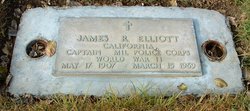
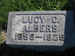
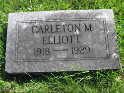
James R. Elliott
| Birth | : | 17 May 1907 Iowa, USA |
| Death | : | 15 Mar 1969 Stockton, San Joaquin County, California, USA |
| Burial | : | Union Cemetery, Brentwood, Contra Costa County, USA |
| Coordinate | : | 37.9103012, -121.6477966 |
| Description | : | Obituary of James Elliott Brentwood News March 20, 1969 Death came suddenly to Captain James R. Elliott , 61, of 144 Lynn Drive, Brentwood, as he was on an outing last Friday with his wife in Stockton. He was stricken by an apparent heart attack as he was opening the trunk of his car. Taken to the nearby Naval Dispensary immediately, he was pronounced dead. Funeral services were held yesterday in the Brentwood Church of Jesus Christ, Latter Day Saints with Bishop Floyd Pedersen officiating. Arrangements were made through the Higgins Chapel in Antioch. Graveside rites were... Read More |
frequently asked questions (FAQ):
-
Where is James R. Elliott's memorial?
James R. Elliott's memorial is located at: Union Cemetery, Brentwood, Contra Costa County, USA.
-
When did James R. Elliott death?
James R. Elliott death on 15 Mar 1969 in Stockton, San Joaquin County, California, USA
-
Where are the coordinates of the James R. Elliott's memorial?
Latitude: 37.9103012
Longitude: -121.6477966
Family Members:
Parent
Siblings
Flowers:
Nearby Cemetories:
1. Union Cemetery
Brentwood, Contra Costa County, USA
Coordinate: 37.9103012, -121.6477966
2. Haney Family Estate Cemetery
Antioch, Contra Costa County, USA
Coordinate: 38.0027700, -121.7704400
3. Oak View Memorial Park
Antioch, Contra Costa County, USA
Coordinate: 38.0036011, -121.7696991
4. Holy Cross Cemetery
Antioch, Contra Costa County, USA
Coordinate: 38.0057983, -121.7733002
5. Rose Hill Cemetery
Antioch, Contra Costa County, USA
Coordinate: 37.9576700, -121.8713100
6. Five Pillars Farm Cemetery
Livermore, Alameda County, USA
Coordinate: 37.7262764, -121.7105789
7. Collinsville Cemetery
Collinsville, Solano County, USA
Coordinate: 38.0768635, -121.8499580
8. Roselawn Cemetery
Livermore, Alameda County, USA
Coordinate: 37.6947000, -121.7734800
9. Saint Michaels Cemetery
Livermore, Alameda County, USA
Coordinate: 37.6797790, -121.7519150
10. IOOF Memory Gardens Cemetery
Livermore, Alameda County, USA
Coordinate: 37.6797850, -121.7526100
11. Valpico Memorial Park
Tracy, San Joaquin County, USA
Coordinate: 37.7113260, -121.4656510
12. Rio Vista Memorial Park
Rio Vista, Solano County, USA
Coordinate: 38.1603127, -121.6971054
13. Rio Vista Catholic Cemetery
Rio Vista, Solano County, USA
Coordinate: 38.1611176, -121.6976471
14. Rio Vista Odd Fellows and Masonic Cemetery
Rio Vista, Solano County, USA
Coordinate: 38.1632919, -121.6999283
15. Oak Knoll Pioneer Memorial Park (Defunct)
Livermore, Alameda County, USA
Coordinate: 37.6770660, -121.7896590
16. Tracy Public Cemetery
Tracy, San Joaquin County, USA
Coordinate: 37.7251358, -121.4189453
17. Live Oak Cemetery
Concord, Contra Costa County, USA
Coordinate: 37.9491997, -121.9725037
18. Tracy Mausoleum
Tracy, San Joaquin County, USA
Coordinate: 37.7250214, -121.4150696
19. Saint Timothys Episcopal Church Columbarium
Danville, Contra Costa County, USA
Coordinate: 37.8364800, -121.9708800
20. Central United Methodist Church Columbarium
Stockton, San Joaquin County, USA
Coordinate: 37.9825710, -121.3078170
21. Thomas Lindsay Gravesite
San Joaquin County, USA
Coordinate: 37.9573110, -121.2918430
22. David Kelsey Gravesite
Stockton, San Joaquin County, USA
Coordinate: 37.9573110, -121.2918430
23. Chinese Cemetery
French Camp, San Joaquin County, USA
Coordinate: 37.8819962, -121.2805862
24. Casa Bonita Mausoleum
Stockton, San Joaquin County, USA
Coordinate: 37.9752340, -121.2877800

