
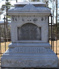
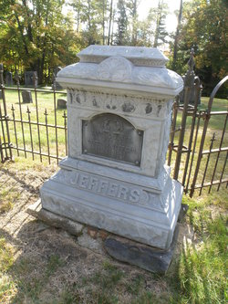
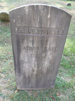
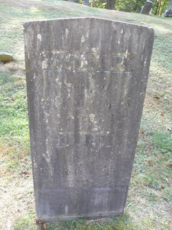
Jane M. Blake Jeffers
| Birth | : | 26 Jan 1843 |
| Death | : | 28 Apr 1885 |
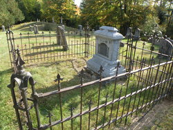
| Burial | : | Number 6 Cemetery, East Haverhill, Grafton County, USA |
| Coordinate | : | 44.0326400, -71.9518600 |
frequently asked questions (FAQ):
-
Where is Jane M. Blake Jeffers's memorial?
Jane M. Blake Jeffers's memorial is located at: Number 6 Cemetery, East Haverhill, Grafton County, USA.
-
When did Jane M. Blake Jeffers death?
Jane M. Blake Jeffers death on 28 Apr 1885 in
-
Where are the coordinates of the Jane M. Blake Jeffers's memorial?
Latitude: 44.0326400
Longitude: -71.9518600
Family Members:
Parent
Spouse
Siblings
Flowers:


Nearby Cemetories:
1. Number 6 Cemetery
East Haverhill, Grafton County, USA
Coordinate: 44.0326400, -71.9518600
2. East Haverhill Cemetery
East Haverhill, Grafton County, USA
Coordinate: 44.0289688, -71.9889297
3. Oliverian Road Cemetery
Benton, Grafton County, USA
Coordinate: 43.9978145, -71.9209265
4. Lund Cemetery
Warren, Grafton County, USA
Coordinate: 43.9882800, -71.9589200
5. Center Haverhill Cemetery
Center Haverhill, Grafton County, USA
Coordinate: 44.0770650, -71.9868740
6. Rodimon-Cross Cemetery
Piermont, Grafton County, USA
Coordinate: 43.9901100, -71.9924500
7. High Street Cemetery
Glencliff, Grafton County, USA
Coordinate: 43.9851100, -71.8913900
8. Abbott Cemetery
North Haverhill, Grafton County, USA
Coordinate: 44.0821730, -72.0186420
9. Ladd Street Cemetery
Haverhill, Grafton County, USA
Coordinate: 44.0439600, -72.0532800
10. West Cemetery
Benton, Grafton County, USA
Coordinate: 44.1033700, -71.9014000
11. East Cemetery
Benton, Grafton County, USA
Coordinate: 44.0985985, -71.8846970
12. Oxbow Cemetery
Newbury, Orange County, USA
Coordinate: 44.0881830, -72.0486670
13. East Piermont Cemetery
Piermont, Grafton County, USA
Coordinate: 43.9438890, -71.9689890
14. Brown Farmstead Cemetery
Benton, Grafton County, USA
Coordinate: 44.0778000, -71.8420830
15. Clay Hollow Cemetery
Piermont, Grafton County, USA
Coordinate: 43.9597220, -72.0333330
16. Horse Meadow Annex Cemetery
North Haverhill, Grafton County, USA
Coordinate: 44.1056820, -72.0408260
17. Swiftwater Cemetery
Bath, Grafton County, USA
Coordinate: 44.1303400, -71.9574300
18. Horse Meadow Cemetery
North Haverhill, Grafton County, USA
Coordinate: 44.1068880, -72.0405500
19. Pine Hill Cemetery
Warren, Grafton County, USA
Coordinate: 43.9370003, -71.8929977
20. Warren Village Cemetery
Warren, Grafton County, USA
Coordinate: 43.9326200, -71.8917600
21. Cedar Grove Cemetery
Piermont, Grafton County, USA
Coordinate: 43.9720300, -72.0813400
22. River Road Cemetery
Piermont, Grafton County, USA
Coordinate: 44.0019500, -72.1013600
23. South Lawn Cemetery
Piermont, Grafton County, USA
Coordinate: 43.9667600, -72.0812500
24. Pine Grove Cemetery
Woodsville, Grafton County, USA
Coordinate: 44.1380997, -72.0188980