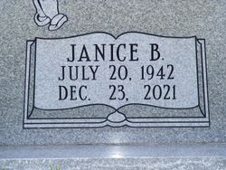
Janice Ruth Bair Jones
| Birth | : | 20 Jul 1942 Orangeburg, Orangeburg County, South Carolina, USA |
| Death | : | 23 Dec 2021 Elloree, Orangeburg County, South Carolina, USA |
| Burial | : | Santee First Baptist Cemetery, Elloree, Orangeburg County, USA |
| Coordinate | : | 33.5553700, -80.6018080 |
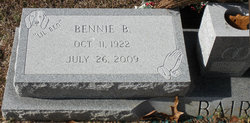
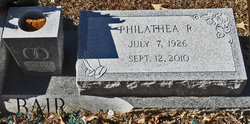
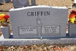
| Description | : | Mrs Jones was born July 20, 1942, in Orangeburg. She was the daughter of the late Bennie Byron Bair and the late Ruth Philathea Rourk Bair. Before retirement, she worked in the garment industry as a seamstress and later for Hughes Aircraft as an inspector. She was a member of the First Baptist Church of Elloree. Mrs Jones was survived by her husband, Robert Milton Jones, of the home; one son, Ronnie McGee (Peggy) of Elloree; one daughter, Veronica "Ronnie" Jones of Beaufort. She was predeceased by a daughter, Susan Griffin (Mark). She is also survived by... Read More |
frequently asked questions (FAQ):
-
Where is Janice Ruth Bair Jones's memorial?
Janice Ruth Bair Jones's memorial is located at: Santee First Baptist Cemetery, Elloree, Orangeburg County, USA.
-
When did Janice Ruth Bair Jones death?
Janice Ruth Bair Jones death on 23 Dec 2021 in Elloree, Orangeburg County, South Carolina, USA
-
Where are the coordinates of the Janice Ruth Bair Jones's memorial?
Latitude: 33.5553700
Longitude: -80.6018080
Family Members:
Parent
Spouse
Children
Flowers:
Nearby Cemetories:
1. Santee First Baptist Cemetery
Elloree, Orangeburg County, USA
Coordinate: 33.5553700, -80.6018080
2. Elloree Hillcrest Cemetery
Elloree, Orangeburg County, USA
Coordinate: 33.5608720, -80.6099720
3. Bookhart Cemetery
Elloree, Orangeburg County, USA
Coordinate: 33.5485992, -80.5924988
4. Mount Zion AME Church Cemetery
Creston, Calhoun County, USA
Coordinate: 33.5689940, -80.6151050
5. Trinity Lutheran Church Cemetery
Elloree, Orangeburg County, USA
Coordinate: 33.5603720, -80.5659850
6. Browning Branch Cemetery
Elloree, Orangeburg County, USA
Coordinate: 33.5231820, -80.5632140
7. Union AME Church Cemetery
Calhoun County, USA
Coordinate: 33.5840910, -80.5575110
8. Hungerpiller Family Cemetery
Elloree, Orangeburg County, USA
Coordinate: 33.5049010, -80.6123380
9. Brown Chapel AME Church Cemetery
Calhoun County, USA
Coordinate: 33.5255490, -80.6531950
10. Brown Chapel AME Church Cemetery
Elloree, Orangeburg County, USA
Coordinate: 33.5253550, -80.6530780
11. Jericho Methodist Church Cemetery
Cameron, Calhoun County, USA
Coordinate: 33.5330010, -80.6625040
12. New Faith Community Church Cemetery
Elloree, Orangeburg County, USA
Coordinate: 33.5229150, -80.5477570
13. Magrill Family Cemetery
Calhoun County, USA
Coordinate: 33.5601790, -80.5354270
14. Smith Family Cemetery
Midway, Calhoun County, USA
Coordinate: 33.5129060, -80.6501570
15. Smith-Dantzler Cemetery
Elloree, Orangeburg County, USA
Coordinate: 33.4941130, -80.6052520
16. Haynes Chapel AME Church Cemetery
Cameron, Calhoun County, USA
Coordinate: 33.6130110, -80.5751970
17. Granger Baptist Church Cemetery
Elloree, Orangeburg County, USA
Coordinate: 33.4909840, -80.6030410
18. Gresham Cemetery
Orangeburg County, USA
Coordinate: 33.4906006, -80.6031036
19. Jerusalem Cemetery
Elloree, Orangeburg County, USA
Coordinate: 33.5102340, -80.5447570
20. McGrew Cemetery
Elloree, Orangeburg County, USA
Coordinate: 33.4859880, -80.6027150
21. Bodrick Cemetery
Lone Star, Calhoun County, USA
Coordinate: 33.6245880, -80.5891440
22. Cedar Grove Baptist Church Cemetery
Lone Star, Calhoun County, USA
Coordinate: 33.6259320, -80.5947950
23. Shady Grove Methodist Church Cemetery
Cameron, Calhoun County, USA
Coordinate: 33.5896560, -80.6767060
24. Irick Cemetery
Lone Star, Calhoun County, USA
Coordinate: 33.6283580, -80.5924100


