
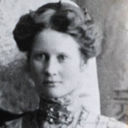
| Birth | : | 26 Feb 1886 Unionville, Putnam County, Missouri, USA |
| Death | : | 14 Oct 1961 Plattsmouth Township, Cass County, Nebraska, USA |
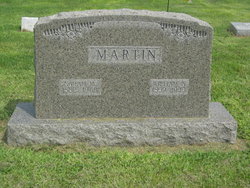
| Burial | : | Rose Hill Cemetery, Callaway, Custer County, USA |
| Coordinate | : | 41.2783012, -99.9203033 |
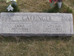
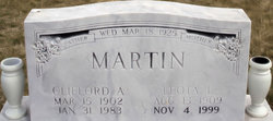
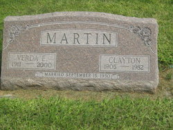
| Description | : | Jennie Ellen Martin was a daughter of William Alfred Martin and Margaret Ellen Brown Martin. She was united in marriage with John Ellsworth Garringer on May 27, 1903 in Quincy, Hickory County, Missouri. -------------------- |
frequently asked questions (FAQ):
-
Where is Jennie Ellen Martin Garringer's memorial?
Jennie Ellen Martin Garringer's memorial is located at: Rose Hill Cemetery, Callaway, Custer County, USA.
-
When did Jennie Ellen Martin Garringer death?
Jennie Ellen Martin Garringer death on 14 Oct 1961 in Plattsmouth Township, Cass County, Nebraska, USA
-
Where are the coordinates of the Jennie Ellen Martin Garringer's memorial?
Latitude: 41.2783012
Longitude: -99.9203033
Family Members:
Parent
Spouse
Siblings

Children
Flowers:


Nearby Cemetories:
1. Rose Hill Cemetery
Callaway, Custer County, USA
Coordinate: 41.2783012, -99.9203033
2. Kingsbury Cemetery
Callaway, Custer County, USA
Coordinate: 41.3097000, -99.9681015
3. Michaels Cemetery
Callaway, Custer County, USA
Coordinate: 41.2956480, -99.8536800
4. Fairview Cemetery
Callaway, Custer County, USA
Coordinate: 41.3353004, -99.9216995
5. Schreyer Homestead Family Cemetery
Custer County, USA
Coordinate: 41.3330100, -99.9769800
6. Sand Valley Cemetery
Callaway, Custer County, USA
Coordinate: 41.2775002, -100.0242004
7. Lodi Cemetery
Custer County, USA
Coordinate: 41.2196999, -99.8497009
8. Stop Table Cemetery
Custer County, USA
Coordinate: 41.2350006, -100.0642014
9. Riverside Cemetery
Custer County, USA
Coordinate: 41.2447014, -99.7581024
10. Table Lawn Cemetery
Broken Bow, Custer County, USA
Coordinate: 41.3873500, -99.8255500
11. Woldheim Cemetery
Custer County, USA
Coordinate: 41.3852997, -100.0246964
12. Oconto Cemetery
Oconto, Custer County, USA
Coordinate: 41.1477000, -99.7802000
13. Sells Valley Cemetery
Custer County, USA
Coordinate: 41.1624985, -100.0927963
14. Saint Mary Cemetery
Oconto, Custer County, USA
Coordinate: 41.1478004, -99.7639008
15. Tallin Cemetery
Custer County, USA
Coordinate: 41.2625504, -100.1762543
16. Cliff Table Cemetery
Merna, Custer County, USA
Coordinate: 41.4694100, -99.9626800
17. Pleasant Valley Cemetery
Oconto, Custer County, USA
Coordinate: 41.0895000, -99.9890000
18. Christ Lutheran Cemetery
Oconto, Custer County, USA
Coordinate: 41.0759000, -99.8560000
19. Custer Center Cemetery
Broken Bow, Custer County, USA
Coordinate: 41.4377000, -99.7040000
20. Saint Joseph Cemetery
Broken Bow, Custer County, USA
Coordinate: 41.4049988, -99.6647034
21. Kilfoil Cemetery
Merna, Custer County, USA
Coordinate: 41.4883003, -99.7878036
22. Ortello Cemetery
Merna, Custer County, USA
Coordinate: 41.5113983, -99.9024963
23. Powell Canyon Cemetery
Custer County, USA
Coordinate: 41.4543991, -100.1280975
24. Kilmer Valley Cemetery
Lincoln County, USA
Coordinate: 41.3025017, -100.2347031