
| Birth | : | 12 Oct 1814 Bourneath, Bromsgrove District, Worcestershire, England |
| Death | : | 2 Mar 1893 Amaranth, Dufferin County, Ontario, Canada |
| Burial | : | Greenwood Cemetery, Orangeville, Dufferin County, Canada |
| Coordinate | : | 43.9121500, -80.1323500 |
| Plot | : | Block 6, Section 19, Lot 4 |
| Inscription | : | Jerah PHILLIPS died Mar. 2, 1892 aged 78 yrs. |
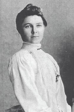
| Description | : | Jeremiah Phillips was born to James Phillips (1786 - 1875) and Letitia nee Read (1788 - 1817) in Bourneath, Bromsgrove District in England. He had two older brothers, Abraham (1809) and James (1812). Jeremiah's mother passed away when he was 3 years old. His father remarried in 1819 to Hannah nee Smith. On August 5, 1837, Jeremiah, a Fish Monger, married Hannah nee Lea and they had 4 children, James, John, Amelia and Hector. Their first child, James, for reasons unknown was being raised by Hannah’s parents in 1841 and the young couple were raising their 2nd child, John... Read More |
frequently asked questions (FAQ):
-
Where is Jeremiah “Jerry” Phillips's memorial?
Jeremiah “Jerry” Phillips's memorial is located at: Greenwood Cemetery, Orangeville, Dufferin County, Canada.
-
When did Jeremiah “Jerry” Phillips death?
Jeremiah “Jerry” Phillips death on 2 Mar 1893 in Amaranth, Dufferin County, Ontario, Canada
-
Where are the coordinates of the Jeremiah “Jerry” Phillips's memorial?
Latitude: 43.9121500
Longitude: -80.1323500
Family Members:
Parent
Spouse

Siblings
Children
Flowers:


Nearby Cemetories:
1. Greenwood Cemetery
Orangeville, Dufferin County, Canada
Coordinate: 43.9121500, -80.1323500
2. Hughson Family Cemetery
Laurel, Dufferin County, Canada
Coordinate: 43.9281000, -80.1348000
3. Providence Methodist Cemetery
East Garafraxa, Dufferin County, Canada
Coordinate: 43.8900590, -80.1656360
4. Forest Lawn Cemetery
Orangeville, Dufferin County, Canada
Coordinate: 43.9349430, -80.0981640
5. Mono College Presbyterian Cemetery
Orangeville, Dufferin County, Canada
Coordinate: 43.9494200, -80.1049200
6. Zion Wesleyan Methodist Cemetery
Mono, Dufferin County, Canada
Coordinate: 43.9548170, -80.1244380
7. Alton Cemetery
Alton, Peel Regional Municipality, Canada
Coordinate: 43.8581581, -80.0661240
8. Laurel Cemetery
Laurel, Dufferin County, Canada
Coordinate: 43.9579300, -80.2106700
9. Saint George's Cemetery
Peel Regional Municipality, Canada
Coordinate: 43.8698226, -80.0325520
10. Caledon United Church Cemetery
Caledon, Peel Regional Municipality, Canada
Coordinate: 43.8648360, -80.0013450
11. Waldemar Cemetery
Dufferin County, Canada
Coordinate: 43.8861500, -80.2820000
12. Huxley Cemetery
Hillsburgh, Wellington County, Canada
Coordinate: 43.7999660, -80.1600710
13. Bethel Presbyterian
East Garafraxa, Dufferin County, Canada
Coordinate: 43.8192000, -80.2348000
14. Price's Corners Cemetery
Prices Corner, Dufferin County, Canada
Coordinate: 43.8186570, -80.2351690
15. Saint Francis Roman Catholic Cemetery
Mono, Dufferin County, Canada
Coordinate: 43.9504493, -79.9726131
16. Hillsburgh Pioneer Cemetery
Hillsburgh, Wellington County, Canada
Coordinate: 43.7870610, -80.1400340
17. The Grove Cemetery
East Garafraxa, Dufferin County, Canada
Coordinate: 43.7988100, -80.2092750
18. Burns Cemetery
Mono, Dufferin County, Canada
Coordinate: 44.0313290, -80.0733000
19. Mono East Cemetery
Mono, Dufferin County, Canada
Coordinate: 43.9743990, -79.9778650
20. Union Cemetery
Grand Valley, Dufferin County, Canada
Coordinate: 43.8922070, -80.3121550
21. Saint Johns Cemetery
Mono, Dufferin County, Canada
Coordinate: 43.9875630, -79.9789050
22. McDougall Cemetery
Grand Valley, Dufferin County, Canada
Coordinate: 43.9452210, -80.3261600
23. Saint Peter's Roman Catholic Cemetery
Oustic, Wellington County, Canada
Coordinate: 43.7620750, -80.1530310
24. Church of the Assumption Catholic Cemetery
Erin Township, Wellington County, Canada
Coordinate: 43.7684288, -80.0688324