
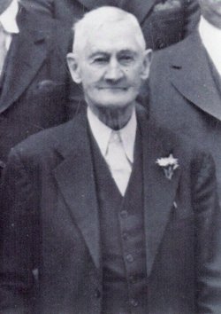
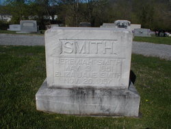
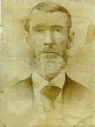
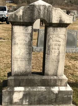
Jeremiah Smith
| Birth | : | 3 May 1851 Whitley County, Kentucky, USA |
| Death | : | 13 Feb 1943 Campbell County, Tennessee, USA |
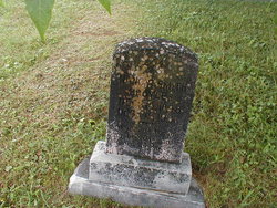
| Burial | : | Calvary Cemetery, Canton, Hartford County, USA |
| Coordinate | : | 41.8153000, -72.9242020 |
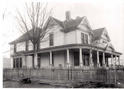
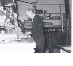
| Description | : | Jeremiah Smith was the son of Josiah and Mary "Polly" Harmon Smith. He was married to Eliza Jane Lay on Mar 27, 1873. Jeremiah and Eliza lived in a large home on S. Main St. in Jellico which is now Lewellyn Funeral Home. |
frequently asked questions (FAQ):
-
Where is Jeremiah Smith's memorial?
Jeremiah Smith's memorial is located at: Calvary Cemetery, Canton, Hartford County, USA.
-
When did Jeremiah Smith death?
Jeremiah Smith death on 13 Feb 1943 in Campbell County, Tennessee, USA
-
Where are the coordinates of the Jeremiah Smith's memorial?
Latitude: 41.8153000
Longitude: -72.9242020
Family Members:
Parent
Spouse
Siblings
Children
Flowers:


Nearby Cemetories:
1. Calvary Cemetery
Canton, Hartford County, USA
Coordinate: 41.8153000, -72.9242020
2. Canton Veterans Memorial
Collinsville, Hartford County, USA
Coordinate: 41.8122750, -72.9217530
3. Trinity Episcopal Church Memorial Cemetery
Canton, Hartford County, USA
Coordinate: 41.8216060, -72.9234460
4. Canton Memorial Monument
Collinsville, Hartford County, USA
Coordinate: 41.8096100, -72.9194000
5. Southwest Cemetery
Collinsville, Hartford County, USA
Coordinate: 41.8227997, -72.9227982
6. Saint Patricks Cemetery
Canton, Hartford County, USA
Coordinate: 41.8092003, -72.9175034
7. Collinsville Cemetery
Collinsville, Hartford County, USA
Coordinate: 41.8089409, -72.9170609
8. Dyer Cemetery
Canton, Hartford County, USA
Coordinate: 41.8338699, -72.9222260
9. Canton Street Cemetery
Canton, Hartford County, USA
Coordinate: 41.8231888, -72.8954239
10. West Avon Pet Cemetery
West Avon, Hartford County, USA
Coordinate: 41.7917800, -72.8932900
11. Canton Center Cemetery
Canton, Hartford County, USA
Coordinate: 41.8550960, -72.9159270
12. Seventh Day Baptist Cemetery
Burlington, Hartford County, USA
Coordinate: 41.7835290, -72.9739330
13. Greenwood Cemetery
Avon, Hartford County, USA
Coordinate: 41.7719002, -72.8899994
14. Saint Mary's Cemetery
Avon, Hartford County, USA
Coordinate: 41.7668991, -72.8968964
15. Burlington Center Cemetery
Burlington, Hartford County, USA
Coordinate: 41.7700882, -72.9642868
16. West Avon Cemetery
Avon, Hartford County, USA
Coordinate: 41.7906990, -72.8590622
17. Saint Patricks Cemetery
Burlington, Hartford County, USA
Coordinate: 41.7710700, -72.9672500
18. Old Nepaug Cemetery
Nepaug, Litchfield County, USA
Coordinate: 41.8300600, -72.9960200
19. New Nepaug Cemetery
New Hartford, Litchfield County, USA
Coordinate: 41.8290800, -72.9968300
20. Case Cemetery
Burlington, Hartford County, USA
Coordinate: 41.7583008, -72.9344025
21. Bushy Hill Cemetery
Simsbury, Hartford County, USA
Coordinate: 41.8408012, -72.8544006
22. Milford Street Cemetery
Burlington, Hartford County, USA
Coordinate: 41.7682991, -72.9700012
23. Beth El Temple Cemetery
Avon, Hartford County, USA
Coordinate: 41.7997500, -72.8437500
24. Beth Israel Cemetery
Avon, Hartford County, USA
Coordinate: 41.7997500, -72.8437500