
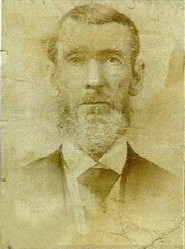
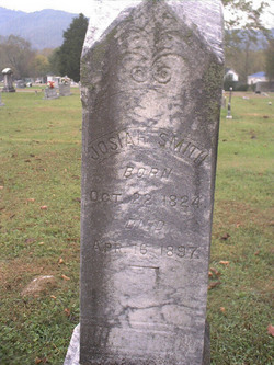
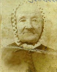
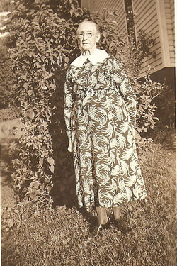
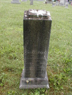
Josiah Smith
| Birth | : | 22 Oct 1824 Whitley County, Kentucky, USA |
| Death | : | 16 Apr 1897 Jellico, Campbell County, Tennessee, USA |
| Burial | : | Pleasington Cemetery and Crematorium, Blackburn, Blackburn with Darwen Unitary Authority, England |
| Coordinate | : | 53.7388880, -2.5368710 |
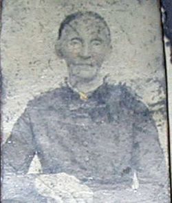
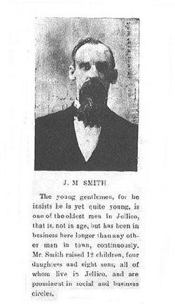
| Description | : | *Confirmed DNA GRP R M269-42 R-L21 The first born of twelve to James and Nancy Meadows Smith, early pioneers of the area; husband of Mary Polly Harmon, married October 5, 1843; the father of at least 10 children. Josiah and Polly were among the charter members of the First Baptist Church of Jellico, founded by his brother Reverend Thomas Mobile Smith. The Church "constituted" August 24, 1884 in the city of Jellico, formerly Smithburg, Tennessee. § By CL Hileman lineal descendant |
frequently asked questions (FAQ):
-
Where is Josiah Smith's memorial?
Josiah Smith's memorial is located at: Pleasington Cemetery and Crematorium, Blackburn, Blackburn with Darwen Unitary Authority, England.
-
When did Josiah Smith death?
Josiah Smith death on 16 Apr 1897 in Jellico, Campbell County, Tennessee, USA
-
Where are the coordinates of the Josiah Smith's memorial?
Latitude: 53.7388880
Longitude: -2.5368710
Family Members:
Parent
Spouse
Siblings
Children
Flowers:


Nearby Cemetories:
1. Pleasington Cemetery and Crematorium
Blackburn, Blackburn with Darwen Unitary Authority, England
Coordinate: 53.7388880, -2.5368710
2. Pleasington Priory
Pleasington, Blackburn with Darwen Unitary Authority, England
Coordinate: 53.7348590, -2.5433060
3. New Row Methodist Church
Blackburn with Darwen Unitary Authority, England
Coordinate: 53.7208950, -2.5023720
4. St Paul's
Blackburn, Blackburn with Darwen Unitary Authority, England
Coordinate: 53.7491222, -2.4891266
5. St. Peter's Churchyard
Blackburn, Blackburn with Darwen Unitary Authority, England
Coordinate: 53.7448110, -2.4865070
6. Holy Trinity Churchyard
Hoghton, Chorley Borough, England
Coordinate: 53.7279300, -2.5848550
7. St. Josephs Roman Catholic Churchyard
Brindle, Chorley Borough, England
Coordinate: 53.7350780, -2.5880640
8. Independent Chapel Churchyard
Blackburn, Blackburn with Darwen Unitary Authority, England
Coordinate: 53.7454960, -2.4864460
9. Wesleyan Methodist Chapel Chapelyard
Blackburn, Blackburn with Darwen Unitary Authority, England
Coordinate: 53.7464910, -2.4848380
10. Blackburn Cathedral
Blackburn, Blackburn with Darwen Unitary Authority, England
Coordinate: 53.7472960, -2.4820020
11. St. Mary's Churchyard
Mellor, Ribble Valley Borough, England
Coordinate: 53.7728600, -2.5312400
12. St Stephen Churchyard
Tockholes, Blackburn with Darwen Unitary Authority, England
Coordinate: 53.7058350, -2.5169320
13. Mellor Methodist Churchyard
Blackburn, Blackburn with Darwen Unitary Authority, England
Coordinate: 53.7742950, -2.5255060
14. Mount St Presbyterian Chapelyard
Blackburn, Blackburn with Darwen Unitary Authority, England
Coordinate: 53.7478000, -2.4775000
15. Holy Trinity Church
Blackburn with Darwen Unitary Authority, England
Coordinate: 53.7511727, -2.4747178
16. St Alban's Churchyard
Blackburn, Blackburn with Darwen Unitary Authority, England
Coordinate: 53.7530090, -2.4748540
17. St Mary's R.C. Church Cemetery
Osbaldeston, Ribble Valley Borough, England
Coordinate: 53.7816970, -2.5350240
18. St Paul's Churchyard
Withnell, Chorley Borough, England
Coordinate: 53.6970740, -2.5592150
19. St James Churchyard
Lower Darwen, Blackburn with Darwen Unitary Authority, England
Coordinate: 53.7245510, -2.4634700
20. Blackburn Cemetery
Blackburn, Blackburn with Darwen Unitary Authority, England
Coordinate: 53.7662430, -2.4726050
21. St Leonard Churchyard
Balderstone, Ribble Valley Borough, England
Coordinate: 53.7860070, -2.5609380
22. St James's Churchyard
Brindle, Chorley Borough, England
Coordinate: 53.7133333, -2.6086111
23. St. Mary's and St. John RC Churchyard, Southworth
Samlesbury, South Ribble Borough, England
Coordinate: 53.7676690, -2.6183400
24. St. Leonard the Less Churchyard
Samlesbury, South Ribble Borough, England
Coordinate: 53.7680000, -2.6237000