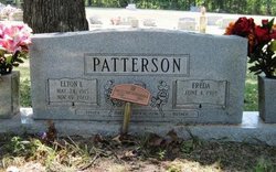
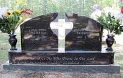
Jerry Wayne Patterson
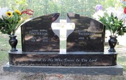
| Birth | : | 18 Sep 1937 El Dorado, Union County, Arkansas, USA |
| Death | : | 27 Feb 2010 Brownwood, Brown County, Texas, USA |
| Burial | : | Old Parkers Chapel Cemetery, Parkers Chapel, Union County, USA |
| Coordinate | : | 33.1470000, -92.7258300 |
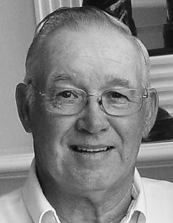
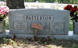
| Description | : | Jerry Wayne Patterson, 72, of Brownwood Texas, formerly of Lake Jackson, Texas, and El Dorado, Arkansas, joined his beloved Lord and Savior on Saturday, February 27th. After suffering a major stroke, he received his wings while surrounded by his loving family. Jerry was born September 18, 1937, in El Dorado, Arkansas, to Elton and Freda Patterson. He was a devoted Husband, Father and Papa, truly living life for his family. His grandchildren and great grandchildren were the true joys of his life, and if you don't believe it, just ask anyone who knew him, he was not afraid to use... Read More |
frequently asked questions (FAQ):
-
Where is Jerry Wayne Patterson's memorial?
Jerry Wayne Patterson's memorial is located at: Old Parkers Chapel Cemetery, Parkers Chapel, Union County, USA.
-
When did Jerry Wayne Patterson death?
Jerry Wayne Patterson death on 27 Feb 2010 in Brownwood, Brown County, Texas, USA
-
Where are the coordinates of the Jerry Wayne Patterson's memorial?
Latitude: 33.1470000
Longitude: -92.7258300
Family Members:
Parent
Spouse
Siblings
Children
Flowers:
Nearby Cemetories:
1. Old Parkers Chapel Cemetery
Parkers Chapel, Union County, USA
Coordinate: 33.1470000, -92.7258300
2. Shady Grove Cemetery
Parkers Chapel, Union County, USA
Coordinate: 33.1350000, -92.7093000
3. Meek-Traylor Cemetery
Parkers Chapel, Union County, USA
Coordinate: 33.1333677, -92.7002846
4. Parkers Chapel Church Cemetery
Parkers Chapel, Union County, USA
Coordinate: 33.1724500, -92.7217700
5. Galilee Cemetery
El Dorado, Union County, USA
Coordinate: 33.1716995, -92.6841965
6. Beulah Grove Cemetery
El Dorado, Union County, USA
Coordinate: 33.1954000, -92.7133000
7. Wesson Cemetery
Wesson, Union County, USA
Coordinate: 33.1074300, -92.7642700
8. Wyatt-Parnell Cemetery
El Dorado, Union County, USA
Coordinate: 33.1958008, -92.7442017
9. Cummings Cemetery
Junction City, Union County, USA
Coordinate: 33.0989000, -92.7037800
10. Rogers Family Cemetery
El Dorado, Union County, USA
Coordinate: 33.2010440, -92.7245660
11. Hammond Cemetery
El Dorado, Union County, USA
Coordinate: 33.1988983, -92.7071991
12. Beulah Grove Wesson Cemetery
Wesson, Union County, USA
Coordinate: 33.1063995, -92.7696991
13. Friendship Cemetery
El Dorado, Union County, USA
Coordinate: 33.1936000, -92.6818000
14. Stamps Cemetery
El Dorado, Union County, USA
Coordinate: 33.1490000, -92.6539000
15. Mount Calvary Cemetery
El Dorado, Union County, USA
Coordinate: 33.1900000, -92.6645000
16. Lott-Burgy Cemetery
El Dorado, Union County, USA
Coordinate: 33.1917000, -92.6649000
17. Saint Marks Cemetery
Union County, USA
Coordinate: 33.1006000, -92.6639000
18. Carroll Cemetery
Wesson, Union County, USA
Coordinate: 33.1724000, -92.8037000
19. Pleasant Hill Cemetery
Wesson, Union County, USA
Coordinate: 33.1025000, -92.7946000
20. Centre Point Cemetery
El Dorado, Union County, USA
Coordinate: 33.2198982, -92.7304993
21. Presbyterian Cemetery
El Dorado, Union County, USA
Coordinate: 33.2085991, -92.6631012
22. Harris Cemetery
El Dorado, Union County, USA
Coordinate: 33.1966600, -92.8031000
23. Smyrna Cemetery
El Dorado, Union County, USA
Coordinate: 33.1143990, -92.6342010
24. Warner Brown Cemetery
El Dorado, Union County, USA
Coordinate: 33.2108002, -92.6614990

