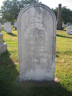
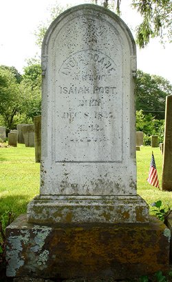
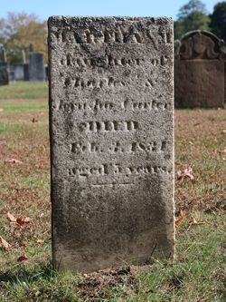
Jerusha L'Hommedieu “Rusha” Doane Carter
| Birth | : | 9 May 1806 Old Saybrook, Middlesex County, Connecticut, USA |
| Death | : | 6 Jun 1899 Clinton, Middlesex County, Connecticut, USA |
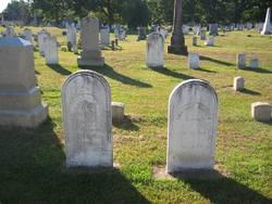
| Burial | : | Egg Harbor City Cemetery, Egg Harbor City, Atlantic County, USA |
| Coordinate | : | 39.5504799, -74.6369095 |
| Plot | : | Section IX |
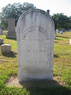
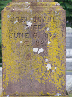
| Description | : | Married 3 Nov 1825 at Saybrook, CT, to Charles Carter. Daughter of Joel Doane and Jemima L'Hommedieu. DAR Real Daughter. |
frequently asked questions (FAQ):
-
Where is Jerusha L'Hommedieu “Rusha” Doane Carter's memorial?
Jerusha L'Hommedieu “Rusha” Doane Carter's memorial is located at: Egg Harbor City Cemetery, Egg Harbor City, Atlantic County, USA.
-
When did Jerusha L'Hommedieu “Rusha” Doane Carter death?
Jerusha L'Hommedieu “Rusha” Doane Carter death on 6 Jun 1899 in Clinton, Middlesex County, Connecticut, USA
-
Where are the coordinates of the Jerusha L'Hommedieu “Rusha” Doane Carter's memorial?
Latitude: 39.5504799
Longitude: -74.6369095
Family Members:
Parent
Spouse
Siblings
Children
Flowers:
Nearby Cemetories:
1. Egg Harbor City Cemetery
Egg Harbor City, Atlantic County, USA
Coordinate: 39.5504799, -74.6369095
2. Saint Nicholas Roman Catholic Church Cemetery
Egg Harbor City, Atlantic County, USA
Coordinate: 39.5318222, -74.6367950
3. Shaler Burial Ground
Egg Harbor City, Atlantic County, USA
Coordinate: 39.5593452, -74.6049881
4. Germania Cemetery
Germania, Atlantic County, USA
Coordinate: 39.5310707, -74.5867081
5. Laurel Hill Cemetery
Elwood, Atlantic County, USA
Coordinate: 39.5916519, -74.6949463
6. Elwood Rural Cemetery
Elwood, Atlantic County, USA
Coordinate: 39.5817184, -74.7122574
7. Green Bank Methodist Cemetery
Green Bank, Burlington County, USA
Coordinate: 39.6095276, -74.5847397
8. Charles Williams Burial Site
Elwood, Atlantic County, USA
Coordinate: 39.5864530, -74.7179570
9. Clark Burial Site
Clarks Landing, Atlantic County, USA
Coordinate: 39.5760080, -74.5442020
10. Adams Burying Ground
Lower Bank, Burlington County, USA
Coordinate: 39.5903400, -74.5460800
11. Johnson Cemetery
Lower Bank, Burlington County, USA
Coordinate: 39.5902405, -74.5458755
12. Cavileer-Sooy Memorial Site
Lower Bank, Burlington County, USA
Coordinate: 39.5942268, -74.5479355
13. Lower Bank Cemetery
Lower Bank, Burlington County, USA
Coordinate: 39.6081085, -74.5572052
14. Saint Marys of the Assumption Cemetery
Pleasant Mills, Atlantic County, USA
Coordinate: 39.6346092, -74.6601715
15. Joseph Mulliner Gravesite
Pleasant Mills, Atlantic County, USA
Coordinate: 39.6377830, -74.6564670
16. Batsto-Pleasant Mills Cemetery
Pleasant Mills, Atlantic County, USA
Coordinate: 39.6406898, -74.6605606
17. Laurel Memorial Park and Crematory
Egg Harbor Township, Atlantic County, USA
Coordinate: 39.4565887, -74.5941925
18. Carmantown Cemetery
Carmantown, Atlantic County, USA
Coordinate: 39.4483250, -74.6446000
19. Clarks Mill Burying Ground
Port Republic, Atlantic County, USA
Coordinate: 39.5180817, -74.5098877
20. Boling Cemetery
Port Republic, Atlantic County, USA
Coordinate: 39.5084000, -74.5123978
21. Holy Cross Cemetery and Chapel Mausoleum
Mays Landing, Atlantic County, USA
Coordinate: 39.4490395, -74.6839523
22. Lincoln Memorial Park
Mays Landing, Atlantic County, USA
Coordinate: 39.4478493, -74.6872635
23. Saint Paul's Methodist Episcopal Church Cemetery
Port Republic, Atlantic County, USA
Coordinate: 39.5194400, -74.4951000
24. Methodist Union Chapel Cemetery
Port Republic, Atlantic County, USA
Coordinate: 39.5185089, -74.4952316

