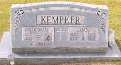
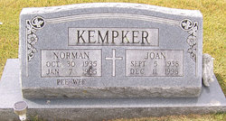
Joan Wilhelmina Kemna Kempker
| Birth | : | 5 Sep 1938 Jefferson City, Cole County, Missouri, USA |
| Death | : | 11 Dec 1998 Olean, Miller County, Missouri, USA |
| Burial | : | Saint John Lutheran Cemetery, Hanover, Buena Vista County, USA |
| Coordinate | : | 42.6053467, -95.3725739 |
| Description | : | The Eldon Advertiser, Thursday, December 17, 1998 Joan Kempker, 60, of Olean died Friday, Dec. 11, 1998, at her home. She was born Sept. 5, 1938, in Jefferson City to Lawrence and Aldolphine Voss Kemna. Her mother survives at St. Martins. On May 9, 1959, she was married in St. Elizabeth to Norman “Pee Wee” Kempker, who died Jan. 7, 1985. Mrs. Kempker attended the St. Elizabeth schools, where she was active in sports. She was a member of Sacred Heart Catholic Church in Eldon and was employed with Sola Optical in... Read More |
frequently asked questions (FAQ):
-
Where is Joan Wilhelmina Kemna Kempker's memorial?
Joan Wilhelmina Kemna Kempker's memorial is located at: Saint John Lutheran Cemetery, Hanover, Buena Vista County, USA.
-
When did Joan Wilhelmina Kemna Kempker death?
Joan Wilhelmina Kemna Kempker death on 11 Dec 1998 in Olean, Miller County, Missouri, USA
-
Where are the coordinates of the Joan Wilhelmina Kemna Kempker's memorial?
Latitude: 42.6053467
Longitude: -95.3725739
Family Members:
Parent
Spouse
Siblings
Flowers:
Nearby Cemetories:
1. Saint John Lutheran Cemetery
Hanover, Buena Vista County, USA
Coordinate: 42.6053467, -95.3725739
2. Maple Valley Township Cemetery
Alta, Buena Vista County, USA
Coordinate: 42.5752600, -95.3199980
3. Diamond Cemetery
Cherokee County, USA
Coordinate: 42.6156006, -95.4480972
4. Scandinavian Cemetery
Alta, Buena Vista County, USA
Coordinate: 42.6833000, -95.3107986
5. Woodlawn Cemetery
Alta, Buena Vista County, USA
Coordinate: 42.6730600, -95.2908300
6. Saint Johns Lutheran Cemetery
Galva, Ida County, USA
Coordinate: 42.5187700, -95.4183300
7. Galva Township Cemetery East
Galva, Ida County, USA
Coordinate: 42.5031110, -95.4083200
8. Schaller Cemetery
Schaller, Sac County, USA
Coordinate: 42.5046000, -95.3117600
9. Pleasant Hill Cemetery
Aurelia, Cherokee County, USA
Coordinate: 42.7024994, -95.4460983
10. Saint Josephs Catholic Church Cemetery
Schaller, Sac County, USA
Coordinate: 42.5035000, -95.3095000
11. Buena Vista Memorial Park Cemetery
Storm Lake, Buena Vista County, USA
Coordinate: 42.6539001, -95.2339020
12. Galva Township Cemetery
Galva, Ida County, USA
Coordinate: 42.5031013, -95.4664001
13. Immanuel Reformed Cemetery
Schaller, Sac County, USA
Coordinate: 42.5396996, -95.2294006
14. Good Hope Cemetery
Cherokee, Cherokee County, USA
Coordinate: 42.6618996, -95.5258026
15. German Methodist Cemetery
Schaller, Sac County, USA
Coordinate: 42.5045000, -95.2481000
16. Chase Cemetery
Sac County, USA
Coordinate: 42.5036011, -95.2288971
17. Storm Lake Cemetery
Storm Lake, Buena Vista County, USA
Coordinate: 42.6352800, -95.1744400
18. Holstein Cemetery
Holstein, Ida County, USA
Coordinate: 42.5119019, -95.5436020
19. Saint Mary's Catholic Cemetery
Storm Lake, Buena Vista County, USA
Coordinate: 42.6470000, -95.1660000
20. Silver Cemetery
Quimby, Cherokee County, USA
Coordinate: 42.6058006, -95.5950012
21. Elk Cemetery
Elk Township, Buena Vista County, USA
Coordinate: 42.7641983, -95.3094025
22. West Pilot Cemetery
Cherokee County, USA
Coordinate: 42.6674995, -95.5841980
23. Haight Family Farm Cemetery
Aurelia, Cherokee County, USA
Coordinate: 42.7778400, -95.3781060
24. Cook Center Cemetery
Schaller, Sac County, USA
Coordinate: 42.4432983, -95.2649994


