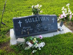
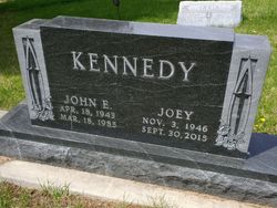
JoAnn “Joey” Flanagan Sullivan
| Birth | : | 3 Nov 1946 |
| Death | : | 30 Sep 2015 Albion, Boone County, Nebraska, USA |
| Burial | : | Saint Michael's Cemetery, Albion, Boone County, USA |
| Coordinate | : | 41.6991997, -97.9764023 |
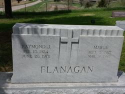
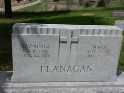
| Description | : | JoAnn Sullivan, daughter of Raymond and Marge (LeSuer) Flanagan, was born November 3, 1946 at St. Edward, NE. She was baptized and confirmed at St. Michael’s Catholic Church in Albion and attended rural country school, St. Michael’s Elementary, graduating from Albion High School in 1964. She worked at the Boone County Bank before attending the University of Nebraska at Lincoln. On November 7, 1964 Joey was married to John Edward Kennedy, Sr. They made their home on a farm west of Loretto and moved to Primrose in 1975. Together they had three children. John passed away in March of 1985. On August... Read More |
frequently asked questions (FAQ):
-
Where is JoAnn “Joey” Flanagan Sullivan's memorial?
JoAnn “Joey” Flanagan Sullivan's memorial is located at: Saint Michael's Cemetery, Albion, Boone County, USA.
-
When did JoAnn “Joey” Flanagan Sullivan death?
JoAnn “Joey” Flanagan Sullivan death on 30 Sep 2015 in Albion, Boone County, Nebraska, USA
-
Where are the coordinates of the JoAnn “Joey” Flanagan Sullivan's memorial?
Latitude: 41.6991997
Longitude: -97.9764023
Family Members:
Parent
Spouse
Flowers:
Nearby Cemetories:
1. Saint Michael's Cemetery
Albion, Boone County, USA
Coordinate: 41.6991997, -97.9764023
2. Rose Hill Cemetery
Albion, Boone County, USA
Coordinate: 41.6762000, -98.0003900
3. Boone Cemetery
Boone County, USA
Coordinate: 41.6272011, -97.9332962
4. Orford Pioneer Cemetery
Loretto, Boone County, USA
Coordinate: 41.7953000, -98.0864300
5. Immanuel Zion South Branch Cemetery
Albion, Boone County, USA
Coordinate: 41.8135000, -97.8906000
6. Salem Lutheran Cemetery
Woodville Township, Platte County, USA
Coordinate: 41.6525800, -97.8084000
7. Trinity Cemetery
Newman Grove, Madison County, USA
Coordinate: 41.7574997, -97.8035965
8. Dennison Cemetery
Albion, Boone County, USA
Coordinate: 41.7182999, -98.1753006
9. Hope Cemetery
Platte County, USA
Coordinate: 41.7383003, -97.7742004
10. Dahlsborg Cemetery
Closter, Boone County, USA
Coordinate: 41.8212300, -97.8360000
11. Saint Edward Catholic Cemetery
Saint Edward, Boone County, USA
Coordinate: 41.5684800, -97.8424800
12. Looking Glass Cemetery
Rosenborg, Platte County, USA
Coordinate: 41.6571000, -97.7617000
13. Evergreen Cemetery
Saint Edward, Boone County, USA
Coordinate: 41.5677986, -97.8411026
14. Sunrise Cemetery
Cedar Rapids, Boone County, USA
Coordinate: 41.5760994, -98.1278000
15. Shell Creek Lutheran Cemetery
Newman Grove, Madison County, USA
Coordinate: 41.7717018, -97.7652969
16. Naomi Cemetery
Saint Edward, Boone County, USA
Coordinate: 41.5245200, -97.9907000
17. Saint Ansgar Cemetery
Rosenborg, Platte County, USA
Coordinate: 41.6334000, -97.7539000
18. Mount Pleasant Cemetery
Petersburg, Boone County, USA
Coordinate: 41.8568993, -98.0924988
19. Saint Johns Cemetery
Petersburg, Boone County, USA
Coordinate: 41.8581009, -98.0939026
20. Zion Lutheran West Cemetery
Petersburg, Boone County, USA
Coordinate: 41.8843994, -97.9291992
21. Immanuel Zion East Branch Cemetery
Petersburg, Boone County, USA
Coordinate: 41.8874000, -97.9207000
22. Sunset Cemetery
Cedar Rapids, Boone County, USA
Coordinate: 41.5611000, -98.1605988
23. Rosehill Cemetery
Newman Grove, Madison County, USA
Coordinate: 41.8584000, -97.8238000
24. Saint Anthony Cemetery
Cedar Rapids, Boone County, USA
Coordinate: 41.5607986, -98.1616974


