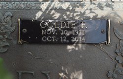
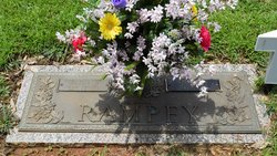
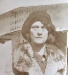
Jodie “Goldie” Forrester Rampey
| Birth | : | 30 Nov 1931 Anderson County, South Carolina, USA |
| Death | : | 12 Oct 2014 Lawrenceville, Gwinnett County, Georgia, USA |
| Burial | : | Camp Creek Baptist Church Cemetery, Six Mile, Pickens County, USA |
| Coordinate | : | 34.7880360, -82.7879620 |
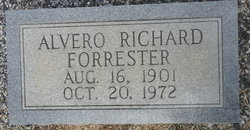
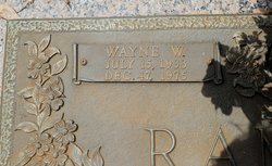
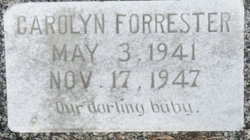
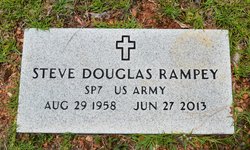
| Description | : | Jodie Forrester Rampey, 82, of 145 Kelly Mill Road, wife of the late Wayne W. Rampey, passed away Sunday, October 12, 2014 at Life Care Center of Lawrenceville, GA. Born in Anderson County, the daughter of the late Alvero Richard and Mabel Duncan Forrester, Mrs. Rampey retired from ECP and was a member of Camp Creek Baptist Church. In addition to her husband and parents, Mrs. Cooper was predeceased by two sons, Steve Rampey and Roger Rampey, a brother, Ronald Forrester, a sister, Caroline, and two grandchildren. Funeral services will be at 11:00 AM Thursday at Faith Baptist Church in Norris. Burial will... Read More |
frequently asked questions (FAQ):
-
Where is Jodie “Goldie” Forrester Rampey's memorial?
Jodie “Goldie” Forrester Rampey's memorial is located at: Camp Creek Baptist Church Cemetery, Six Mile, Pickens County, USA.
-
When did Jodie “Goldie” Forrester Rampey death?
Jodie “Goldie” Forrester Rampey death on 12 Oct 2014 in Lawrenceville, Gwinnett County, Georgia, USA
-
Where are the coordinates of the Jodie “Goldie” Forrester Rampey's memorial?
Latitude: 34.7880360
Longitude: -82.7879620
Family Members:
Parent
Spouse
Siblings
Children
Flowers:
Nearby Cemetories:
1. Camp Creek Baptist Church Cemetery
Six Mile, Pickens County, USA
Coordinate: 34.7880360, -82.7879620
2. Clayton-Robinson Cemetery
Cateechee, Pickens County, USA
Coordinate: 34.7848670, -82.7628330
3. Fairview Baptist Church Cemetery
Liberty, Pickens County, USA
Coordinate: 34.8031006, -82.7620010
4. Church of God of Prophecy Cemetery
Six Mile, Pickens County, USA
Coordinate: 34.7962860, -82.8183080
5. Norris Cemetery
Central, Pickens County, USA
Coordinate: 34.7658000, -82.7650000
6. Faith Baptist Church Cemetery
Central, Pickens County, USA
Coordinate: 34.7656940, -82.7643770
7. Pleasant Hill Baptist (Old)
Central, Pickens County, USA
Coordinate: 34.7606670, -82.8082870
8. Welcome Baptist Church Cemetery
Central, Pickens County, USA
Coordinate: 34.7580500, -82.8037330
9. Kirksey-Kuksey Family Cemetery
Central, Pickens County, USA
Coordinate: 34.7719841, -82.7528000
10. Golden Creek Baptist Church Cemetery
Liberty, Pickens County, USA
Coordinate: 34.7910995, -82.7472000
11. Six Mile Baptist Church Cemetery
Six Mile, Pickens County, USA
Coordinate: 34.8074989, -82.8214035
12. Mount Olivet Wesleyan Church Cemetery
Six Mile, Pickens County, USA
Coordinate: 34.8121430, -82.8242680
13. Phillip Clayton Family Cemetery
Liberty, Pickens County, USA
Coordinate: 34.8223500, -82.7646000
14. Praters Creek Baptist Church Cemetery
Pickens, Pickens County, USA
Coordinate: 34.8286018, -82.7733002
15. Smith Chapel Wesleyan Church Cemetery
Liberty, Pickens County, USA
Coordinate: 34.8006330, -82.7383670
16. Pleasant Hill Baptist Church Cemetery
Central, Pickens County, USA
Coordinate: 34.7633018, -82.8324966
17. Ballentine Cemetery
Pickens County, USA
Coordinate: 34.7415009, -82.7768021
18. Cedar Hill Holiness Church Cemetery
Six Mile, Pickens County, USA
Coordinate: 34.8324530, -82.8202970
19. Stewart Family Cemetery
Liberty, Pickens County, USA
Coordinate: 34.8099830, -82.7308670
20. Bolding-Garrett Cemetery
Six Mile, Pickens County, USA
Coordinate: 34.8400330, -82.7845830
21. Robert Morgan-Cannon Family
Central, Pickens County, USA
Coordinate: 34.7820850, -82.8521350
22. Hendricks-Prater Cemetery
Liberty, Pickens County, USA
Coordinate: 34.7725500, -82.7239500
23. Kings Grove Baptist Church Cemetery
Central, Pickens County, USA
Coordinate: 34.7829000, -82.8574000
24. Parsons Family Cemetery
Liberty, Pickens County, USA
Coordinate: 34.7973330, -82.7189670

