
| Birth | : | 11 Jan 1839 Germany |
| Death | : | 23 Sep 1896 Castlewood, Hamlin County, South Dakota, USA |
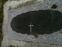
| Burial | : | Batson Cemetery, Johnson County, USA |
| Coordinate | : | 35.6266420, -93.6304180 |
| Plot | : | Lot 36, Block 1 |
| Description | : | Married Wilhelmine "Minnie" Geise in 1869. Migrated to America with his wife and their seven children in 1884. They had four more children after settling in South Dakota. |
frequently asked questions (FAQ):
-
Where is Johann “John” Benthin's memorial?
Johann “John” Benthin's memorial is located at: Batson Cemetery, Johnson County, USA.
-
When did Johann “John” Benthin death?
Johann “John” Benthin death on 23 Sep 1896 in Castlewood, Hamlin County, South Dakota, USA
-
Where are the coordinates of the Johann “John” Benthin's memorial?
Latitude: 35.6266420
Longitude: -93.6304180
Family Members:
Spouse

Children
Flowers:


Nearby Cemetories:
1. Batson Cemetery
Johnson County, USA
Coordinate: 35.6266420, -93.6304180
2. Dowd Cemetery
Johnson County, USA
Coordinate: 35.6225014, -93.6511002
3. Good Hope Cemetery
Johnson County, USA
Coordinate: 35.6411018, -93.6464005
4. Hailey Cemetery
Johnson County, USA
Coordinate: 35.6203003, -93.6567001
5. Oak Grove Cemetery
Johnson County, USA
Coordinate: 35.6147003, -93.6836014
6. Yale Cemetery
Oark, Johnson County, USA
Coordinate: 35.6708360, -93.6506330
7. Brendle Cemetery
Johnson County, USA
Coordinate: 35.6116982, -93.6911011
8. Williams Cemetery
Johnson County, USA
Coordinate: 35.5799100, -93.6757800
9. Porter Cemetery
Hunt, Johnson County, USA
Coordinate: 35.5631000, -93.6198000
10. Sherman Cemetery
Low Gap, Johnson County, USA
Coordinate: 35.6171989, -93.5513992
11. Edwards Cemetery
Johnson County, USA
Coordinate: 35.5685997, -93.5768967
12. Hogan Cemetery
Clarksville, Johnson County, USA
Coordinate: 35.5544014, -93.6132965
13. Watson Cemetery
Johnson County, USA
Coordinate: 35.5625000, -93.5792007
14. Naylor Cemetery
Johnson County, USA
Coordinate: 35.5527992, -93.5922012
15. Oark Cemetery
Oark, Johnson County, USA
Coordinate: 35.6917560, -93.5709520
16. Younger Cemetery
Franklin County, USA
Coordinate: 35.5708008, -93.7050018
17. Miller Cemetery
Johnson County, USA
Coordinate: 35.7078018, -93.6125031
18. Gimlin Cemetery
Low Gap, Johnson County, USA
Coordinate: 35.6258500, -93.5244400
19. Pryor Cemetery
Johnson County, USA
Coordinate: 35.5656013, -93.5552979
20. Hickory Grove Cemetery
Ozark, Franklin County, USA
Coordinate: 35.5923990, -93.7337060
21. Ogilvie Cemetery II
Johnson County, USA
Coordinate: 35.5401400, -93.5911800
22. Ogilbie Cemetery III
Johnson County, USA
Coordinate: 35.5400009, -93.5911026
23. McDaniel Cemetery
Johnson County, USA
Coordinate: 35.5321999, -93.6110992
24. Lone Pine Cemetery
Franklin County, USA
Coordinate: 35.6543999, -93.7433014