
| Birth | : | 25 Dec 1855 |
| Death | : | 18 Nov 1889 Pierce, Pierce County, Nebraska, USA |
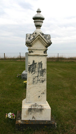
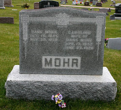
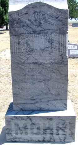
| Burial | : | Wall Lake Cemetery, Wall Lake, Sac County, USA |
| Coordinate | : | 42.2757988, -95.0805969 |
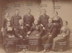
| Description | : | Pierce County Call; Pierce, Nebraska Friday, 22 November 1889 Mr. H. Mohr died suddenly Monday of apoplexy. He had been quite sick for several weeks and had just got able to get about on the streets, but was suddenly stricken Monday, from which attack he never recovered. Mr. Mohr came to Pierce about two months ago and was a comparative stranger. He was intending to go into the hardware business at Osmond in the spring. His body was taken to Iowa Tuesday morning by Chris Reimers and a representative of the Masonic lodge of Pierce of which society he... Read More |
frequently asked questions (FAQ):
-
Where is Johannes "Honnes" “John” Mohr's memorial?
Johannes "Honnes" “John” Mohr's memorial is located at: Wall Lake Cemetery, Wall Lake, Sac County, USA.
-
When did Johannes "Honnes" “John” Mohr death?
Johannes "Honnes" “John” Mohr death on 18 Nov 1889 in Pierce, Pierce County, Nebraska, USA
-
Where are the coordinates of the Johannes "Honnes" “John” Mohr's memorial?
Latitude: 42.2757988
Longitude: -95.0805969
Family Members:
Parent
Spouse

Siblings
Children
Flowers:


Nearby Cemetories:
1. Wall Lake Cemetery
Wall Lake, Sac County, USA
Coordinate: 42.2757988, -95.0805969
2. South Wall Lake Cemetery
Wall Lake, Sac County, USA
Coordinate: 42.2318993, -95.0911026
3. Immanuel Presbyterian Cemetery
Carnarvon, Sac County, USA
Coordinate: 42.2392006, -95.0224991
4. Ferguson Cemetery
Lake View, Sac County, USA
Coordinate: 42.3142014, -95.0132980
5. Tom Marks Cemetery
Wall Lake, Sac County, USA
Coordinate: 42.2537000, -95.1605000
6. Clinton Township Cemetery
Sac County, USA
Coordinate: 42.3330600, -95.1475000
7. Linton Cemetery
Sac County, USA
Coordinate: 42.3330994, -95.1474991
8. Wheatland Cemetery
Carroll County, USA
Coordinate: 42.1814003, -95.0582962
9. Salem Reform Cemetery
Sac County, USA
Coordinate: 42.3555984, -95.1866989
10. Odebolt Cemetery
Odebolt, Sac County, USA
Coordinate: 42.2985992, -95.2469025
11. Saint Bernards Cemetery
Breda, Carroll County, USA
Coordinate: 42.1786003, -94.9732971
12. Saint Martins Catholic Cemetery
Odebolt, Sac County, USA
Coordinate: 42.2985573, -95.2481842
13. Luckow Cemetery
Auburn, Sac County, USA
Coordinate: 42.2168999, -94.9266968
14. Richland Cemetery
Sac County, USA
Coordinate: 42.3544006, -95.2238998
15. Cory Grove Cemetery
Sac City, Sac County, USA
Coordinate: 42.3932991, -94.9788971
16. Grant City Cemetery
Grant City, Sac County, USA
Coordinate: 42.2681007, -94.8908005
17. Oak Lawn Cemetery
Auburn, Sac County, USA
Coordinate: 42.2611008, -94.8852997
18. Saint Marys Cemetery
Sac County, USA
Coordinate: 42.2611008, -94.8839035
19. Emmanuel Cemetery
Cook Township, Sac County, USA
Coordinate: 42.3993988, -95.2063980
20. Sac County Farm Cemetery
Early, Sac County, USA
Coordinate: 42.4295560, -95.1175190
21. Protestant Union Cemetery
Early, Sac County, USA
Coordinate: 42.4294014, -95.1483002
22. Saint Peters Lutheran Cemetery
Sac County, USA
Coordinate: 42.3543000, -94.8868000
23. Oakland Cemetery
Sac City, Sac County, USA
Coordinate: 42.4272100, -94.9910760
24. Saint John Lutheran Church Cemetery
Crawford County, USA
Coordinate: 42.1780000, -95.2650000