
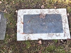


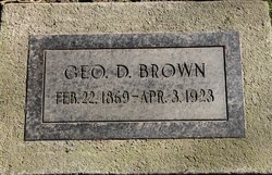
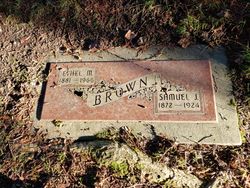
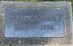
John A. Brown
| Birth | : | 18 May 1862 Ontario, Canada |
| Death | : | 27 Oct 1941 Toole County, Montana, USA |
| Burial | : | Evergreen-Washelli Memorial Park, Seattle, King County, USA |
| Coordinate | : | 47.7104000, -122.3396400 |
| Plot | : | Section O |
| Description | : | Liberty County Times, Chester, MT, 30 Oct 1841 John A. Brown, Whitlash Pioneer, Called By Death John A. Brown, pioneer stockman and prominent citizen of the Sweet Grass Hills, died at the home of his son, Elmer Brown, near Whitlash Monday morning of a heart attack at the age of seventy-nine years. Deceased had been in his usual health recently and Monday morning helped with the chores and seemed quite happy and cheerful. He was stricken with a heart attack shortly after breakfast, and passed away without suffering any apparent pain. Among the survivors are the son, Elmer of Whitlash; a daughter, Mrs. Harry... Read More |
frequently asked questions (FAQ):
-
Where is John A. Brown's memorial?
John A. Brown's memorial is located at: Evergreen-Washelli Memorial Park, Seattle, King County, USA.
-
When did John A. Brown death?
John A. Brown death on 27 Oct 1941 in Toole County, Montana, USA
-
Where are the coordinates of the John A. Brown's memorial?
Latitude: 47.7104000
Longitude: -122.3396400
Family Members:
Parent

Spouse
Siblings
Children
Flowers:


Nearby Cemetories:
1. Evergreen-Washelli Memorial Park
Seattle, King County, USA
Coordinate: 47.7104000, -122.3396400
2. Seattle Historic Sephardic Cemetery
Seattle, King County, USA
Coordinate: 47.7118900, -122.3399900
3. Orthodox Brotherly Cemetery of Saint Nicholas
Seattle, King County, USA
Coordinate: 47.7122002, -122.3377991
4. New Bikur Cholim Cemetery
Seattle, King County, USA
Coordinate: 47.7128800, -122.3402700
5. Pacific Lutheran Cemetery
Seattle, King County, USA
Coordinate: 47.7120520, -122.3360360
6. Saint Dunstan's Episcopal Church Columbarium
Shoreline, King County, USA
Coordinate: 47.7344250, -122.3487390
7. Crown Hill Cemetery
Seattle, King County, USA
Coordinate: 47.6935997, -122.3685989
8. Phinney Ridge Lutheran Church Columbarium
Seattle, King County, USA
Coordinate: 47.6837900, -122.3549100
9. Machzikay Hadath Cemetery
Seattle, King County, USA
Coordinate: 47.7517014, -122.3424988
10. Seattle Sephardic Brotherhood Cemetery
Shoreline, King County, USA
Coordinate: 47.7518000, -122.3437000
11. Herzl Memorial Park
Shoreline, King County, USA
Coordinate: 47.7507210, -122.3550034
12. Acacia Memorial Park and Funeral Home
Lake Forest Park, King County, USA
Coordinate: 47.7392006, -122.2928009
13. Calvary Cemetery
Seattle, King County, USA
Coordinate: 47.6666985, -122.2917023
14. Holyrood Cemetery
Shoreline, King County, USA
Coordinate: 47.7745200, -122.3274600
15. Fort Lawton Cemetery
Seattle, King County, USA
Coordinate: 47.6601181, -122.4055252
16. Hills of Eternity Reform Cemetery
Seattle, King County, USA
Coordinate: 47.6441994, -122.3643036
17. Queen Anne Columbarium
Seattle, King County, USA
Coordinate: 47.6432000, -122.3644000
18. Mount Pleasant Cemetery
Seattle, King County, USA
Coordinate: 47.6432800, -122.3662643
19. Grand Army of the Republic Cemetery
Seattle, King County, USA
Coordinate: 47.6363602, -122.3162994
20. Restlawn Memorial Gardens
Edmonds, Snohomish County, USA
Coordinate: 47.7832900, -122.3722400
21. Congregation Beth Shalom Cemetery
Brier, Snohomish County, USA
Coordinate: 47.7782000, -122.2851000
22. Lake View Cemetery
Seattle, King County, USA
Coordinate: 47.6342010, -122.3143997
23. Saint Mark's Episcopal Cathedral Columbarium
Seattle, King County, USA
Coordinate: 47.6319000, -122.3208000
24. Abbey View Memorial Park
Brier, Snohomish County, USA
Coordinate: 47.7797012, -122.2806015