
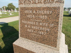
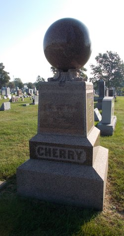
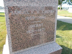
John A. Cherry
| Birth | : | Jun 1854 Ohio, USA |
| Death | : | 8 Oct 1923 Oklahoma City, Oklahoma County, Oklahoma, USA |
| Burial | : | Oxford West Cemetery, Oxford, Benton County, USA |
| Coordinate | : | 40.5188850, -87.2591260 |
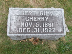
| Description | : | Son of Robert Greenwood Cherry and Mary Ann (Layman) Cherry. THE OKLAHOMAN (Oklahoma City, OK) 10/9/1923 In Memoriam (Tuesday) John A. Cherry, 69 years old, 213 Harvey avenue, died in a city hospital Monday morning. Funeral services will be held at Street & Draper's chapel Tuesday afternoon at 4 o'clock, conducted by Rev. W.H.B. Urch, pastor of the First Presbyterian church. The body will be sent to Washington, Ia. Obituary provided by Findagrave member #47063153. |
frequently asked questions (FAQ):
-
Where is John A. Cherry's memorial?
John A. Cherry's memorial is located at: Oxford West Cemetery, Oxford, Benton County, USA.
-
When did John A. Cherry death?
John A. Cherry death on 8 Oct 1923 in Oklahoma City, Oklahoma County, Oklahoma, USA
-
Where are the coordinates of the John A. Cherry's memorial?
Latitude: 40.5188850
Longitude: -87.2591260
Family Members:
Parent

Siblings


Flowers:


Nearby Cemetories:
1. Oxford West Cemetery
Oxford, Benton County, USA
Coordinate: 40.5188850, -87.2591260
2. Justus Cemetery
Oxford, Benton County, USA
Coordinate: 40.5133018, -87.2489014
3. Oxford Catholic Cemetery
Oxford, Benton County, USA
Coordinate: 40.5160751, -87.2466888
4. McConnell Cemetery
Oxford, Benton County, USA
Coordinate: 40.5157310, -87.2459150
5. Dan Patch Gravesite
Oxford, Benton County, USA
Coordinate: 40.5194016, -87.2452011
6. Griffin Cemetery
Templeton, Benton County, USA
Coordinate: 40.4991989, -87.2014008
7. Benton County Poor Farm Cemetery
Center Township, Benton County, USA
Coordinate: 40.5841904, -87.2491302
8. Perigo Cemetery
Chase, Benton County, USA
Coordinate: 40.5094330, -87.3456730
9. Pine Village Cemetery
Pine Village, Warren County, USA
Coordinate: 40.4486771, -87.2578812
10. West Pine Chapel Cemetery
Pine Village, Warren County, USA
Coordinate: 40.4732500, -87.3297500
11. Jones Cemetery
Hooker Corner, Warren County, USA
Coordinate: 40.4596620, -87.3210470
12. Gray Cemetery
Pine Village, Warren County, USA
Coordinate: 40.4413986, -87.2878036
13. Hooker Cemetery
Rainsville, Warren County, USA
Coordinate: 40.4491997, -87.3161011
14. Boswell Cemetery
Boswell, Benton County, USA
Coordinate: 40.5200005, -87.3700027
15. Smith Cemetery
Boswell, Benton County, USA
Coordinate: 40.4818993, -87.3589020
16. Timmons Cemetery
Oxford, Benton County, USA
Coordinate: 40.5630722, -87.1431503
17. Davis Family Cemetery
Fowler, Benton County, USA
Coordinate: 40.5970060, -87.1691060
18. Sacred Heart Cemetery
Fowler, Benton County, USA
Coordinate: 40.6075516, -87.3341980
19. Fowler Cemetery
Fowler, Benton County, USA
Coordinate: 40.6086731, -87.3342514
20. Mound Cemetery
Pine Village, Warren County, USA
Coordinate: 40.4178009, -87.2063980
21. Foster Cemetery
Green Hill, Warren County, USA
Coordinate: 40.4659400, -87.1259300
22. Rainsville Cemetery
Rainsville, Warren County, USA
Coordinate: 40.4113998, -87.3150024
23. Harman Cemetery
Pine Village, Warren County, USA
Coordinate: 40.4102000, -87.1966460
24. Union Cemetery
Pine Village, Warren County, USA
Coordinate: 40.4102690, -87.1961800