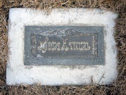
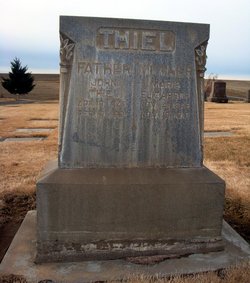
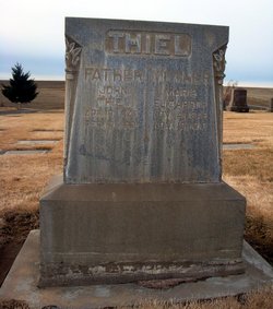
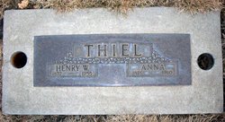
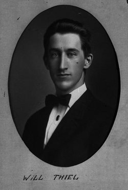
John A. Thiel
| Birth | : | 20 Jun 1870 Russia |
| Death | : | 9 May 1932 Missoula, Missoula County, Montana, USA |
| Burial | : | Weston State Hospital Cemetery, Weston, Lewis County, USA |
| Coordinate | : | 39.0395050, -80.4727760 |
| Description | : | John A Thiel, 62, died at the hospital in Missoula, MT, May 9, following an illess of two years, and the body was brought to Ritzville Wednesday evening. The funeral was held today from the Zion Congregational church, Rev. Geo. Zocher officiating. Interment was in the Ritzville Cemetery. Mr. Thiel was born in northern Russia June 20, 1870 and came to America with his parents, Mr. and Mrs. John Thiel in 1878. The family settled at Clbertson, Nebraska and in the spring 1882, they joined the covered wagon train for the long trek across the plains to Washington, arriving at Walla... Read More |
frequently asked questions (FAQ):
-
Where is John A. Thiel's memorial?
John A. Thiel's memorial is located at: Weston State Hospital Cemetery, Weston, Lewis County, USA.
-
When did John A. Thiel death?
John A. Thiel death on 9 May 1932 in Missoula, Missoula County, Montana, USA
-
Where are the coordinates of the John A. Thiel's memorial?
Latitude: 39.0395050
Longitude: -80.4727760
Family Members:
Parent
Spouse
Siblings
Flowers:
Nearby Cemetories:
1. Weston State Hospital Cemetery
Weston, Lewis County, USA
Coordinate: 39.0395050, -80.4727760
2. Old Arnold Cemetery
Weston, Lewis County, USA
Coordinate: 39.0350120, -80.4693550
3. Machpelah Cemetery
Weston, Lewis County, USA
Coordinate: 39.0475400, -80.4640760
4. Brownsville Cemetery
Lewis County, USA
Coordinate: 39.0163994, -80.4756012
5. Waldeck Cemetery
Waldeck, Lewis County, USA
Coordinate: 39.0486860, -80.5095950
6. Smith Family Cemetery
Lewis County, USA
Coordinate: 39.0457993, -80.4297028
7. Butcher Cemetery
Turnertown, Lewis County, USA
Coordinate: 39.0727997, -80.4614029
8. Dutch Hollow Road Cemetery
Lewis County, USA
Coordinate: 39.0730330, -80.4860520
9. Middle Run Cemetery
Weston, Lewis County, USA
Coordinate: 39.0149994, -80.5081024
10. Gee Lick Cemetery
Weston, Lewis County, USA
Coordinate: 39.0787170, -80.4761610
11. Forest Lawn Memorial Gardens
Jane Lew, Lewis County, USA
Coordinate: 39.0649986, -80.4328003
12. Fisher Cemetery
Weston, Lewis County, USA
Coordinate: 39.0331001, -80.5239029
13. Peterson Cemetery
Weston, Lewis County, USA
Coordinate: 39.0224991, -80.4244003
14. Smiths Run Cemetery
Weston, Lewis County, USA
Coordinate: 39.0463070, -80.4173810
15. Lewis County Memorial Gardens
Weston, Lewis County, USA
Coordinate: 39.0224390, -80.4202340
16. Ward Cemetery
Lewis County, USA
Coordinate: 38.9975860, -80.5051990
17. Jackson Cemetery
Jackson Mill, Lewis County, USA
Coordinate: 39.0974998, -80.4705963
18. Thomas Law Cemetery
Jane Lew, Lewis County, USA
Coordinate: 39.0893270, -80.4326240
19. Hicks Cemetery
Lewis County, USA
Coordinate: 39.0717010, -80.4077988
20. Bush Cemetery
Horner, Lewis County, USA
Coordinate: 39.0147018, -80.4021988
21. Rockford-Pletcher Cemetery (Defunct)
Lewis County, USA
Coordinate: 38.9817009, -80.4963989
22. Glady Cemetery
Horner, Lewis County, USA
Coordinate: 38.9846992, -80.4389038
23. Freemansburg Baptist Cemetery
Freemansburg, Lewis County, USA
Coordinate: 39.0903750, -80.5290080
24. Freemansburg United Methodist Church Cemetery
Freemansburg, Lewis County, USA
Coordinate: 39.0913030, -80.5290410

