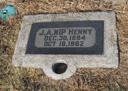
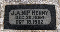
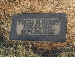
John Albert “Nip” Henny
| Birth | : | 30 Dec 1894 Ophir, Placer County, California, USA |
| Death | : | 18 Oct 1962 Sacramento, Sacramento County, California, USA |
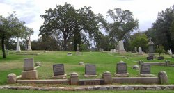
| Burial | : | Saint Pauls Cemetery, Warren, Worcester County, USA |
| Coordinate | : | 42.2069016, -72.1999969 |
| Plot | : | W-1/2-363-1 |
| Description | : | John Henny 5 - grandson Social Security Death Index about John Henny Name: John Henny Last Residence: Born: 30 Dec 1894 Ophir, Placer Co., Ca Died: Aug 1962 State (Year) SSN issued: California (1952) U.S., World War I Draft Registration Cards, 1917-1918 about John Alfred Henny Name: John Alfred Henny County: Placer State: California Birthplace: California,United States of America Birth Date: 30 Dec 1894 Household Members: Name Age John A Henny 45 Freda Henny 38 |
frequently asked questions (FAQ):
-
Where is John Albert “Nip” Henny's memorial?
John Albert “Nip” Henny's memorial is located at: Saint Pauls Cemetery, Warren, Worcester County, USA.
-
When did John Albert “Nip” Henny death?
John Albert “Nip” Henny death on 18 Oct 1962 in Sacramento, Sacramento County, California, USA
-
Where are the coordinates of the John Albert “Nip” Henny's memorial?
Latitude: 42.2069016
Longitude: -72.1999969
Family Members:
Parent
Spouse
Children
Flowers:
Nearby Cemetories:
1. Saint Pauls Cemetery
Warren, Worcester County, USA
Coordinate: 42.2069016, -72.1999969
2. Pine Grove Cemetery
Warren, Worcester County, USA
Coordinate: 42.2097015, -72.1971970
3. Sacred Heart Cemetery
West Brookfield, Worcester County, USA
Coordinate: 42.2334900, -72.1517300
4. Old Indian Cemetery
West Brookfield, Worcester County, USA
Coordinate: 42.2372600, -72.1456500
5. Saint Marys Cemetery
Ware, Hampshire County, USA
Coordinate: 42.2472000, -72.2438965
6. Millbrook Road Cemetery
West Brimfield, Hampden County, USA
Coordinate: 42.1746470, -72.2581020
7. Pine Grove Cemetery
West Brookfield, Worcester County, USA
Coordinate: 42.2382960, -72.1406610
8. South Warren Cemetery
Warren, Worcester County, USA
Coordinate: 42.1609300, -72.1461700
9. Walnut Grove Cemetery
Ware, Hampshire County, USA
Coordinate: 42.2623430, -72.2367810
10. West Street Burial Ground
Ware, Hampshire County, USA
Coordinate: 42.2533800, -72.2554700
11. Old Saint William Cemetery
Ware, Hampshire County, USA
Coordinate: 42.2582380, -72.2472420
12. Brookfield Cemetery
Brookfield, Worcester County, USA
Coordinate: 42.2181015, -72.1156006
13. Taylor Cemetery
West Brookfield, Worcester County, USA
Coordinate: 42.2695300, -72.1839700
14. Holy Cross Polish National Catholic Cemetery
Ware, Hampshire County, USA
Coordinate: 42.2595300, -72.2508200
15. New Saint William Cemetery
Ware, Hampshire County, USA
Coordinate: 42.2597400, -72.2526400
16. Aspen Grove Cemetery
Ware, Hampshire County, USA
Coordinate: 42.2653008, -72.2450027
17. Mount Carmel Cemetery
Ware, Hampshire County, USA
Coordinate: 42.2694016, -72.2491989
18. West Brimfield Cemetery
Brimfield, Hampden County, USA
Coordinate: 42.1320526, -72.1984542
19. Methodist Cemetery
West Brookfield, Worcester County, USA
Coordinate: 42.2833700, -72.2061400
20. Little Alum Pond Cemetery
Brimfield, Hampden County, USA
Coordinate: 42.1362750, -72.1537020
21. Ware Center Cemetery
Ware, Hampshire County, USA
Coordinate: 42.2641180, -72.2744130
22. Old West Brookfield Road Cemetery
North Brookfield, Worcester County, USA
Coordinate: 42.2545500, -72.1137600
23. West Cemetery
Ware, Hampshire County, USA
Coordinate: 42.2651860, -72.2757270
24. Palmer Center Cemetery
Palmer, Hampden County, USA
Coordinate: 42.1819000, -72.3125000

