John Alexander James
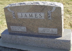
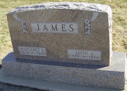
| Birth | : | 1878 Blue Hill, Webster County, Nebraska, USA |
| Death | : | Nov 1966 Hastings, Adams County, Nebraska, USA |
| Burial | : | Rock Cave Cemetery, Rock Cave, Upshur County, USA |
| Coordinate | : | 38.8367004, -80.3494034 |
| Plot | : | NW section Lot 137 |
| Description | : | John A. James Dies at 88 Years John A. James of 1510 west Sixth, former Hastings chief of police and Adams county supervisor for a number of years, died Wednesday at the Mary Lanning Memorial Hospital at 88 years. He was born in Blue Hill and farmed in that community until 1921 when he moved to Hastings. In recent years he had engaged in the realty business, retiring four years ago. James served as chairman of the Adams County Board of Supervisors two terms and was elected president of the Nebraska Central County Officers Association in 1946. He is survived by his son... Read More |
frequently asked questions (FAQ):
-
Where is John Alexander James's memorial?
John Alexander James's memorial is located at: Rock Cave Cemetery, Rock Cave, Upshur County, USA.
-
When did John Alexander James death?
John Alexander James death on Nov 1966 in Hastings, Adams County, Nebraska, USA
-
Where are the coordinates of the John Alexander James's memorial?
Latitude: 38.8367004
Longitude: -80.3494034
Family Members:
Parent
Spouse
Siblings
Children
Flowers:
Nearby Cemetories:
1. Rock Cave Cemetery
Rock Cave, Upshur County, USA
Coordinate: 38.8367004, -80.3494034
2. Chestnut Flat Cemetery
Rock Cave, Upshur County, USA
Coordinate: 38.8391991, -80.3811035
3. McDowell Cemetery
Frenchton, Upshur County, USA
Coordinate: 38.8632450, -80.3444930
4. Ash Family Cemetery
Frenchton, Upshur County, USA
Coordinate: 38.8648224, -80.3427582
5. Kanawha Run Church Cemetery
French Creek, Upshur County, USA
Coordinate: 38.8347751, -80.3109749
6. Kanawha Run Cemetery
Arlington, Upshur County, USA
Coordinate: 38.8348770, -80.3108990
7. Cow Run Cemetery
Rock Cave, Upshur County, USA
Coordinate: 38.8065910, -80.3588530
8. Wimer Cemetery
Rock Cave, Upshur County, USA
Coordinate: 38.8407593, -80.3906555
9. Arlington Cemetery
Arlington, Upshur County, USA
Coordinate: 38.8020400, -80.3416910
10. Cow Run School Cemetery
Rock Cave, Upshur County, USA
Coordinate: 38.8094090, -80.3816080
11. Phillips Family Cemetery
Upshur County, USA
Coordinate: 38.8628100, -80.3150700
12. Brown Cemetery
Rock Cave, Upshur County, USA
Coordinate: 38.8065600, -80.3857820
13. Heaston Cemetery
Kanawha Head, Upshur County, USA
Coordinate: 38.7969100, -80.3776400
14. Beechtown Cemetery
Frenchton, Upshur County, USA
Coordinate: 38.8838997, -80.3494034
15. Union Hill Cemetery
Lewis County, USA
Coordinate: 38.8734350, -80.3971630
16. Taylor Chapel Cemetery
Crawford, Lewis County, USA
Coordinate: 38.8497370, -80.4145380
17. Saul Smith Farm Cemetery
Crawford, Lewis County, USA
Coordinate: 38.8491950, -80.4149770
18. Center Chapel Cemetery
French Creek, Upshur County, USA
Coordinate: 38.8454790, -80.2822450
19. French Creek Memorial Gardens
Upshur County, USA
Coordinate: 38.8827910, -80.3054480
20. Lee Cemetery
Kanawha Head, Upshur County, USA
Coordinate: 38.7787000, -80.3431390
21. Waterloo Cemetery
Carter, Upshur County, USA
Coordinate: 38.8571940, -80.2783510
22. French Creek Presbyterian Church Cemetery
French Creek, Upshur County, USA
Coordinate: 38.8856020, -80.3022650
23. Salem Ridge Cemetery
Gaines, Upshur County, USA
Coordinate: 38.7821200, -80.3130500
24. Bennett Cemetery
Upshur County, USA
Coordinate: 38.7749063, -80.3555116

