
| Birth | : | 7 Oct 1947 Huntington, Cabell County, West Virginia, USA |
| Death | : | 2 Aug 2002 Huntington, Cabell County, West Virginia, USA |
| Burial | : | Mount Hope Cemetery, Mount Hope, Spokane County, USA |
| Coordinate | : | 47.4477997, -117.2382965 |
| Plot | : | Mausoleum, Inside, Space 324 |
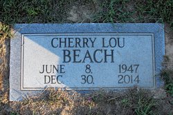
| Inscription | : | D Y E R JOHNNY A. 1947 - 2002 |
| Description | : | JOHNNY ALLEN DYER, 54, of Ona, passed away Friday, August 2, 2002, in St. Mary's Hospital. He was born October 7, 1947, in Huntington, the son of John M. Dyer and Mildred Petrie Dyer. He was founder and owner of Johnny's Pizza. He was retired from American Car and Foundry (ACF). He was a member of St. Joseph Catholic Church and a graduate of Barboursville High School Class of 65. He is survived by his loving and caring wife, Emma Lou Donahue Dyer of Ona; a daughter, Tara K. Dyer and her special friend, Denny Henderson, both of Ona; a... Read More |
frequently asked questions (FAQ):
-
Where is John Allen “Johnny” Dyer's memorial?
John Allen “Johnny” Dyer's memorial is located at: Mount Hope Cemetery, Mount Hope, Spokane County, USA.
-
When did John Allen “Johnny” Dyer death?
John Allen “Johnny” Dyer death on 2 Aug 2002 in Huntington, Cabell County, West Virginia, USA
-
Where are the coordinates of the John Allen “Johnny” Dyer's memorial?
Latitude: 47.4477997
Longitude: -117.2382965
Family Members:
Parent

Spouse

Flowers:


Nearby Cemetories:
1. Mount Hope Cemetery
Mount Hope, Spokane County, USA
Coordinate: 47.4477997, -117.2382965
2. Wood Memorial Cemetery
Valleyford, Spokane County, USA
Coordinate: 47.5071983, -117.2692032
3. Spring Valley Cemetery
Spring Valley, Spokane County, USA
Coordinate: 47.5150140, -117.2713870
4. Fairview Cemetery
Rockford, Spokane County, USA
Coordinate: 47.4421997, -117.1296997
5. Evergreen Cemetery
Freeman, Spokane County, USA
Coordinate: 47.5181790, -117.1886620
6. Broadacres Cemetery
Spangle, Spokane County, USA
Coordinate: 47.4144440, -117.3647220
7. Mica Cemetery
Mica, Spokane County, USA
Coordinate: 47.5433006, -117.2146988
8. Spangle Cemetery
Spangle, Spokane County, USA
Coordinate: 47.4202766, -117.3775024
9. Fairfield Cemetery
Fairfield, Spokane County, USA
Coordinate: 47.3699989, -117.1402969
10. Waverly Cemetery
Waverly, Spokane County, USA
Coordinate: 47.3432999, -117.2366028
11. Rosewood Cemetery
Fairfield, Spokane County, USA
Coordinate: 47.3474998, -117.1722031
12. Mica Creek Cemetery
Rockford, Spokane County, USA
Coordinate: 47.5217018, -117.1093979
13. Mica Peak Cemetery
Saxby, Spokane County, USA
Coordinate: 47.5078011, -117.0764008
14. Butte Cemetery
Spokane County, USA
Coordinate: 47.3850000, -117.0577780
15. Queen of Peace Cemetery
Spokane, Spokane County, USA
Coordinate: 47.5893200, -117.3409370
16. Latah Evergreen Cemetery
Latah, Spokane County, USA
Coordinate: 47.2961006, -117.1619034
17. Chester Community Cemetery
Chester, Spokane County, USA
Coordinate: 47.6138802, -117.2486343
18. Moran Cemetery
Spokane, Spokane County, USA
Coordinate: 47.5957985, -117.3685989
19. South Pines Cemetery
Spokane, Spokane County, USA
Coordinate: 47.6277000, -117.2261500
20. Latah Cemetery
Latah, Spokane County, USA
Coordinate: 47.2821999, -117.1264038
21. Saint Stephens Episcopal Church Columbarium
Spokane, Spokane County, USA
Coordinate: 47.6017230, -117.3911700
22. Saltese Cemetery
Greenacres, Spokane County, USA
Coordinate: 47.6278000, -117.1660995
23. Spokane Valley Church of the Nazarene Columbarium
Spokane, Spokane County, USA
Coordinate: 47.6393000, -117.1948000
24. Pines Cemetery
Spokane Valley, Spokane County, USA
Coordinate: 47.6425018, -117.2416992