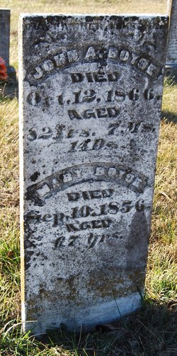
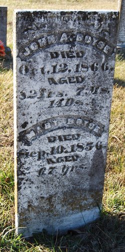
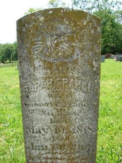
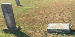
John Arthur Boyse
| Birth | : | 28 Feb 1784 South Carolina, USA |
| Death | : | 12 Oct 1866 Osage County, Missouri, USA |
| Burial | : | Westlawn Memorial Cemetery, Grand Island, Hall County, USA |
| Coordinate | : | 40.9039000, -98.3889010 |
| Description | : | John was born in SC, town unknown, married Mary Scrimpture in Blount Co, TN, lived in Marion County, TN, then moved to Jefferson Township, Osage,MO. They raised 11 children. If anyone wishes to correct or contact submitter, Robert T & Phyllis Boyse, [email protected] or [email protected] 18905 IH 35N, #128 Schertz TX 78154 830-606-3961 |
frequently asked questions (FAQ):
-
Where is John Arthur Boyse's memorial?
John Arthur Boyse's memorial is located at: Westlawn Memorial Cemetery, Grand Island, Hall County, USA.
-
When did John Arthur Boyse death?
John Arthur Boyse death on 12 Oct 1866 in Osage County, Missouri, USA
-
Where are the coordinates of the John Arthur Boyse's memorial?
Latitude: 40.9039000
Longitude: -98.3889010
Family Members:
Spouse
Children
Flowers:
Nearby Cemetories:
1. Westlawn Memorial Cemetery
Grand Island, Hall County, USA
Coordinate: 40.9039000, -98.3889010
2. Grand Island Cemetery
Grand Island, Hall County, USA
Coordinate: 40.9048830, -98.3721500
3. First Presbyterian Columbarium
Grand Island, Hall County, USA
Coordinate: 40.9097000, -98.3568000
4. Trinity United Methodist Church Columbarium
Grand Island, Hall County, USA
Coordinate: 40.9275000, -98.3472000
5. Saint Stephens Church Columbarium
Grand Island, Hall County, USA
Coordinate: 40.9234000, -98.3435000
6. Soldiers And Sailors Cemetery
Grand Island, Hall County, USA
Coordinate: 40.9467010, -98.3775024
7. East Grand Island Cemetery
Grand Island, Hall County, USA
Coordinate: 40.9446983, -98.3103027
8. Poor Farm Cemetery
Grand Island, Hall County, USA
Coordinate: 40.9745000, -98.3597000
9. Alda Cemetery
Alda, Hall County, USA
Coordinate: 40.8594017, -98.4749985
10. Jacob W Harper Burial Site
Adams County, USA
Coordinate: 40.8108130, -98.3516480
11. Phillips Cemetery
Phillips, Hamilton County, USA
Coordinate: 40.8736000, -98.2350006
12. Cedar View Cemetery
Doniphan, Hall County, USA
Coordinate: 40.7846146, -98.3594055
13. Campbell Cemetery
Doniphan, Hall County, USA
Coordinate: 40.7780991, -98.4083023
14. Goettsche-Tramm Burial Site
Merrick County, USA
Coordinate: 40.9583800, -98.2364400
15. Berwick Cemetery
Cairo, Hall County, USA
Coordinate: 40.9636002, -98.5588989
16. Wiegert Cemetery
Hall County, USA
Coordinate: 41.0243988, -98.2822037
17. Wood River Cemetery
Wood River, Hall County, USA
Coordinate: 40.8218994, -98.5693970
18. Haggart Cemetery
Saint Libory, Howard County, USA
Coordinate: 41.0698500, -98.3547500
19. Laurel Cemetery
Chapman, Merrick County, USA
Coordinate: 40.9915600, -98.1950710
20. Wood River Mennonite Church Cemetery
Wood River, Hall County, USA
Coordinate: 40.8887460, -98.6262510
21. Saint Libory Catholic Cemetery
Saint Libory, Howard County, USA
Coordinate: 41.0828700, -98.3569700
22. Rosedale Cemetery
Doniphan, Hall County, USA
Coordinate: 40.7125015, -98.4353027
23. Cameron Cemetery
Cameron, Hall County, USA
Coordinate: 40.9024680, -98.6514320
24. Mount Pleasant Cemetery
Cairo, Hall County, USA
Coordinate: 40.9888992, -98.6303024

