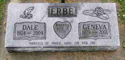
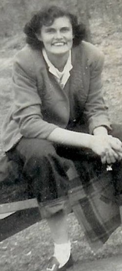
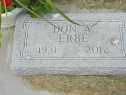
John Dale “Dale” Erbe
| Birth | : | 4 Sep 1924 Mitchell County, Iowa, USA |
| Death | : | 7 Mar 2004 Allamakee County, Iowa, USA |
| Burial | : | St Mary Magdalene Churchyard, Gillingham, Medway Unitary Authority, England |
| Coordinate | : | 51.3903530, 0.5622230 |
| Description | : | OBITUARY: Funeral services for John Dale Erbe, 79, of Lime Springs, Iowa, and formerly of New Albin, Iowa, were held on Friday, March 12, 2004 at the New Albin Townhouse and Chapel in New Albin. The Reverend William Reese officiated. Burial was in St. Joseph's Catholic Cemetery. John died Sunday, March 7, 2004 at his home. John Erbe was born on September 4, 1924 in Osage, Iowa, to John and Mable (Wherry) Erbe. Dale is a 1938 graduate of Osage High School. On June 2, 1956 he married Geneva Marie Adams at Sacred Heart Catholic Church in Willow Springs, Missouri.... Read More |
frequently asked questions (FAQ):
-
Where is John Dale “Dale” Erbe's memorial?
John Dale “Dale” Erbe's memorial is located at: St Mary Magdalene Churchyard, Gillingham, Medway Unitary Authority, England.
-
When did John Dale “Dale” Erbe death?
John Dale “Dale” Erbe death on 7 Mar 2004 in Allamakee County, Iowa, USA
-
Where are the coordinates of the John Dale “Dale” Erbe's memorial?
Latitude: 51.3903530
Longitude: 0.5622230
Family Members:
Parent
Spouse
Siblings
Flowers:
Nearby Cemetories:
1. St Mary Magdalene Churchyard
Gillingham, Medway Unitary Authority, England
Coordinate: 51.3903530, 0.5622230
2. Grange Road Cemetery
Gillingham, Medway Unitary Authority, England
Coordinate: 51.3902512, 0.5639850
3. Woodlands Cemetery
Gillingham, Medway Unitary Authority, England
Coordinate: 51.3839989, 0.5680000
4. St. Barnabas Church
Gillingham, Medway Unitary Authority, England
Coordinate: 51.3801400, 0.5505370
5. St. Augustine's Church
Gillingham, Medway Unitary Authority, England
Coordinate: 51.3745050, 0.5474930
6. St George Churchyard
Chatham, Medway Unitary Authority, England
Coordinate: 51.3974070, 0.5346770
7. Chatham Naval Memorial
Chatham, Medway Unitary Authority, England
Coordinate: 51.3836479, 0.5321670
8. Brompton War Memorial
Chatham, Medway Unitary Authority, England
Coordinate: 51.3932140, 0.5293660
9. Christ Church Cemetery
Chatham, Medway Unitary Authority, England
Coordinate: 51.3716730, 0.5462690
10. Chatham Burial Ground
Chatham, Medway Unitary Authority, England
Coordinate: 51.3849900, 0.5272600
11. St Mary Churchyard
Chatham, Medway Unitary Authority, England
Coordinate: 51.3874550, 0.5244280
12. St. Werburgh Churchyard
Hoo St Werburgh, Medway Unitary Authority, England
Coordinate: 51.4176500, 0.5634340
13. Chatham Unitarian Church
Chatham, Medway Unitary Authority, England
Coordinate: 51.3826090, 0.5195850
14. St Philip and St James Churchyard
Upnor, Medway Unitary Authority, England
Coordinate: 51.4106250, 0.5250480
15. Chatham Palmerston Road Cemetery
Chatham, Medway Unitary Authority, England
Coordinate: 51.3678600, 0.5267300
16. Chatham Maidstone Road Cemetery
Chatham, Medway Unitary Authority, England
Coordinate: 51.3703300, 0.5227600
17. Fort Pitt Military Cemetery
Rochester, Medway Unitary Authority, England
Coordinate: 51.3769790, 0.5114570
18. Rochester Baptist Church
Rochester, Medway Unitary Authority, England
Coordinate: 51.3871570, 0.5052370
19. All Saints Churchyard
Frindsbury, Medway Unitary Authority, England
Coordinate: 51.4004440, 0.5058970
20. St Nicholas Churchyard
Rochester, Medway Unitary Authority, England
Coordinate: 51.3894170, 0.5035320
21. Rochester Cathedral
Rochester, Medway Unitary Authority, England
Coordinate: 51.3889750, 0.5031160
22. Rochester Castle Moat Burial Ground
Rochester, Medway Unitary Authority, England
Coordinate: 51.3894140, 0.5024580
23. St. Nicholas's Cemetery
Rochester, Medway Unitary Authority, England
Coordinate: 51.3780081, 0.5021076
24. St Margaret Churchyard
Rochester, Medway Unitary Authority, England
Coordinate: 51.3849380, 0.4993630

