
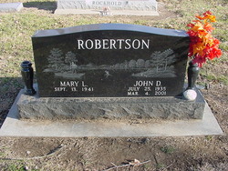

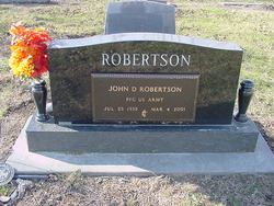
John Deal Robertson
| Birth | : | 25 Jul 1935 Vinland, Douglas County, Kansas, USA |
| Death | : | 4 Mar 2001 Lawrence, Douglas County, Kansas, USA |
| Burial | : | Vinland Cemetery, Vinland, Douglas County, USA |
| Coordinate | : | 38.8485985, -95.1763992 |
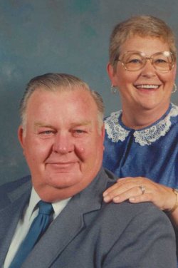
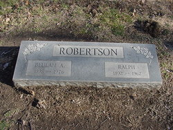
| Description | : | John Deal Robertson, 65, Lawrence, will be at 1 p.m. Wednesday at Ives Chapel United Methodist Church, Baldwin. Burial will be in Vinland Cemetery. Mr. Robertson died Sunday, March 4, 2001, at Lawrence Memorial Hospital. He was born July 25, 1935, in Vinland, the son of Beulah A. (Carpenter) and Ralph Robertson. He grew up in the Vinland community, attended grade schools in Vinland and Coal Creek and graduated from Baldwin High School in 1953. He then attended Emporia State University. Mr. Robertson was a Baldwin Police officer for three years, and also had worked for All-Star Dairy for eight years. He worked... Read More |
frequently asked questions (FAQ):
-
Where is John Deal Robertson's memorial?
John Deal Robertson's memorial is located at: Vinland Cemetery, Vinland, Douglas County, USA.
-
When did John Deal Robertson death?
John Deal Robertson death on 4 Mar 2001 in Lawrence, Douglas County, Kansas, USA
-
Where are the coordinates of the John Deal Robertson's memorial?
Latitude: 38.8485985
Longitude: -95.1763992
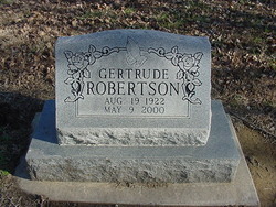
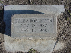
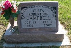
Family Members:
Parent

Spouse

Siblings

Flowers:


Nearby Cemetories:
1. Stony Point Cemetery
Vinland, Douglas County, USA
Coordinate: 38.8249512, -95.2107391
2. Dow Cemetery
Vinland, Douglas County, USA
Coordinate: 38.8186620, -95.2143000
3. Brumbaugh Cemetery
Douglas County, USA
Coordinate: 38.8319200, -95.2330100
4. Breeze Family Cemetery
Pleasant Grove, Douglas County, USA
Coordinate: 38.8472800, -95.2480400
5. Blue Mound Cemetery
Lawrence, Douglas County, USA
Coordinate: 38.9046600, -95.1865400
6. Ulrich Cemetery
Pleasant Grove, Douglas County, USA
Coordinate: 38.8395740, -95.2531810
7. Clearfield Cemetery
Clearfield, Douglas County, USA
Coordinate: 38.8260002, -95.0930023
8. County Poor Farm Cemetery
Douglas County, USA
Coordinate: 38.9119400, -95.2214600
9. Richland Cemetery
Lawrence, Douglas County, USA
Coordinate: 38.8768997, -95.2630997
10. Kennedy Cemetery
Douglas County, USA
Coordinate: 38.9112900, -95.2269200
11. Marshall Cemetery
Douglas County, USA
Coordinate: 38.9040800, -95.2446700
12. Deay Cemetery
Eudora, Douglas County, USA
Coordinate: 38.8546486, -95.0749435
13. Oakwood Cemetery
Baldwin City, Douglas County, USA
Coordinate: 38.7694016, -95.1825027
14. Pleasant Hill Cemetery
Pleasant Grove, Douglas County, USA
Coordinate: 38.8535995, -95.2794037
15. Prairie City Cemetery
Baldwin City, Douglas County, USA
Coordinate: 38.7689018, -95.2050018
16. Mount Calvary Cemetery
Baldwin City, Douglas County, USA
Coordinate: 38.7687988, -95.2049713
17. Miller Family Cemetery
Baldwin City, Douglas County, USA
Coordinate: 38.7688751, -95.2146683
18. Baldwin City Cemetery
Baldwin City, Douglas County, USA
Coordinate: 38.7612953, -95.1862869
19. Cemetery Beni Israel
Eudora, Douglas County, USA
Coordinate: 38.9280128, -95.1122208
20. Dutton Cemetery
Douglas County, USA
Coordinate: 38.8989800, -95.2790600
21. Black Jack Cemetery
Douglas County, USA
Coordinate: 38.7660400, -95.1159400
22. Franklin Cemetery
Douglas County, USA
Coordinate: 38.9437523, -95.1869431
23. Haskell Cemetery
Lawrence, Douglas County, USA
Coordinate: 38.9353790, -95.2284241
24. Saint Johns Catholic Cemetery
Douglas County, USA
Coordinate: 38.9437900, -95.1919600