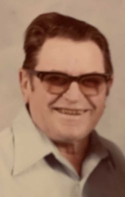
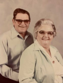
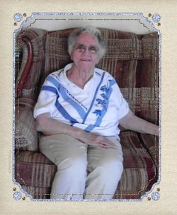
John Earl Cunningham
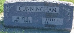
| Birth | : | 5 Nov 1913 Montana, USA |
| Death | : | 23 Jun 1988 Billings, Yellowstone County, Montana, USA |
| Burial | : | Rancher Cemetery, Myers, Treasure County, USA |
| Coordinate | : | 46.2580986, -107.4197006 |
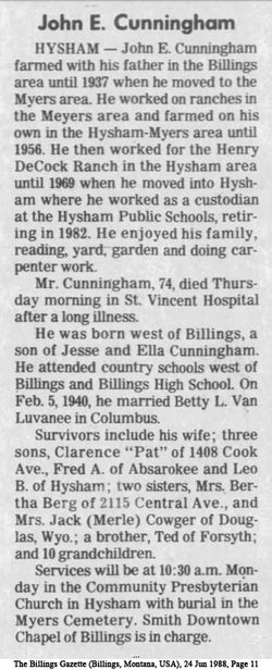
| Description | : | SOURCE: Death Certificate: ''''''''''''''''''''''''''''''''''''''''' The Billings Gazette, (MT.) 6/24/1988 Friday Page 11 John E. Cunningham HYSHAM, MT. ---- John E. Cunningham farmed with his father in the Billings area until 1937 when he moved to the Myers area. He worked on ranches in the Meyers area and farmed on his own in the Hysham - Myers area until 1956. He then worked for the henry DeCock Ranch in the Hysham area until 1969 when he moved into Hysham where he worked as a custodian at the Hysham Public Schools, retiring in 1982. He... Read More |
frequently asked questions (FAQ):
-
Where is John Earl Cunningham's memorial?
John Earl Cunningham's memorial is located at: Rancher Cemetery, Myers, Treasure County, USA.
-
When did John Earl Cunningham death?
John Earl Cunningham death on 23 Jun 1988 in Billings, Yellowstone County, Montana, USA
-
Where are the coordinates of the John Earl Cunningham's memorial?
Latitude: 46.2580986
Longitude: -107.4197006
Family Members:
Parent
Spouse
Siblings
Flowers:
Nearby Cemetories:
1. Rancher Cemetery
Myers, Treasure County, USA
Coordinate: 46.2580986, -107.4197006
2. Memorial Vale Cemetery
Hysham, Treasure County, USA
Coordinate: 46.2552986, -107.2307968
3. Junction City Cemetery
Yellowstone County, USA
Coordinate: 46.1437320, -107.5493300
4. Custer Cemetery
Custer, Yellowstone County, USA
Coordinate: 46.1270690, -107.5700030
5. Howard Cemetery
Rosebud County, USA
Coordinate: 46.2621994, -106.9222031
6. Cabin Creek Cemetery
Musselshell County, USA
Coordinate: 46.4794006, -107.8122025
7. Castle Butte Cemetery
Yellowstone County, USA
Coordinate: 46.1721992, -107.9242020
8. Sumatra Cemetery
Rosebud County, USA
Coordinate: 46.6136017, -107.5674973
9. Mount Vera Cemetery
Foster, Big Horn County, USA
Coordinate: 45.9067982, -107.6333357
10. Melstone Cemetery
Melstone, Musselshell County, USA
Coordinate: 46.6068993, -107.8507996
11. Musselshell Cemetery
Musselshell County, USA
Coordinate: 46.4989014, -108.0888977
12. Forsyth Cemetery
Forsyth, Rosebud County, USA
Coordinate: 46.2689018, -106.6528015
13. Fairview Cemetery
Hardin, Big Horn County, USA
Coordinate: 45.7394981, -107.6415024
14. Pleasantview Cemetery
Ballantine, Yellowstone County, USA
Coordinate: 45.9414000, -108.1557400
15. Vanstel Cemetery
Rosebud County, USA
Coordinate: 46.7872009, -106.8942032
16. Apsaalooke Veterans Cemetery
Crow Agency, Big Horn County, USA
Coordinate: 45.6055500, -107.4776900
17. Crow Agency Cemetery
Crow Agency, Big Horn County, USA
Coordinate: 45.6044006, -107.4730988
18. Colstrip Cemetery
Colstrip, Rosebud County, USA
Coordinate: 45.9096985, -106.6194000
19. Rosebud Cemetery
Rosebud, Rosebud County, USA
Coordinate: 46.2689018, -106.4381027
20. Kilby Butte Hutterite Cemetery
Musselshell County, USA
Coordinate: 46.4746694, -108.3626017
21. Little Bighorn Battlefield National Monument
Little Big Horn Battle Site, Big Horn County, USA
Coordinate: 45.5703000, -107.4273500
22. Custer National Cemetery
Crow Agency, Big Horn County, USA
Coordinate: 45.5699000, -107.4318000
23. Evangelical Cemetery
Shepherd, Yellowstone County, USA
Coordinate: 45.9580490, -108.3162640
24. Huntley Cemetery
Huntley, Yellowstone County, USA
Coordinate: 45.8988991, -108.2780991

