
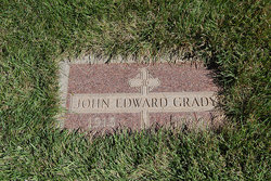
John Edward Grady
| Birth | : | 14 May 1915 Lathrop, Clinton County, Missouri, USA |
| Death | : | 31 Oct 1959 Lewis and Clark County, Montana, USA |
| Burial | : | Sunset Memorial Park, Gallup, McKinley County, USA |
| Coordinate | : | 35.5028770, -108.8443640 |
| Description | : | Great Falls Tribune (MT), 1 Nov 1959 Local Man Found Dead in Ravine Near Rogers Pass A number of Great Falls hunters killed in the young 1959 Montana big game hunting season rose to three Saturday afternoon when John Edward Grady, 44, 606 5th Ave. S., died of a gunshot wound to the head. His body was found in a deep snow covered ravine near Rogers Pass between Lincoln and Great Falls on Route 20. Lewis and Clark Deputy Sheriff Larry Lytle said the wound was not self-inflicted. "The shot did not come from his weapon--a 30-06, Lytle said." The... Read More |
frequently asked questions (FAQ):
-
Where is John Edward Grady's memorial?
John Edward Grady's memorial is located at: Sunset Memorial Park, Gallup, McKinley County, USA.
-
When did John Edward Grady death?
John Edward Grady death on 31 Oct 1959 in Lewis and Clark County, Montana, USA
-
Where are the coordinates of the John Edward Grady's memorial?
Latitude: 35.5028770
Longitude: -108.8443640
Family Members:
Parent

Spouse
Flowers:


Nearby Cemetories:
1. Sunset Memorial Park
Gallup, McKinley County, USA
Coordinate: 35.5028770, -108.8443640
2. Gallup City Cemetery
Gallup, McKinley County, USA
Coordinate: 35.5016320, -108.8400220
3. Hillcrest Cemetery
Gallup, McKinley County, USA
Coordinate: 35.5214005, -108.7525024
4. Cathedral of the Sacred Heart Crypt
Gallup, McKinley County, USA
Coordinate: 35.5258450, -108.7357330
5. Gallup State Veterans Cemetery
Gallup, McKinley County, USA
Coordinate: 35.5358950, -108.7086870
6. Rehoboth Mission Cemetery
Rehoboth, McKinley County, USA
Coordinate: 35.5286640, -108.6540990
7. Pinehaven Cemetery
Pinehaven, McKinley County, USA
Coordinate: 35.3518982, -108.7268982
8. Bowman Memorial Park
Apache County, USA
Coordinate: 35.4192009, -109.1072006
9. Family Cemeteries
Apache County, USA
Coordinate: 35.3595472, -109.0677722
10. Pine Tree Cemetery
Vanderwagen, McKinley County, USA
Coordinate: 35.2658410, -108.7540080
11. Saint Michaels Cemetery
Saint Michaels, Apache County, USA
Coordinate: 35.6431900, -109.0986900
12. Navajo Veterans Cemetery
Fort Defiance, Apache County, USA
Coordinate: 35.7226600, -109.0553390
13. Torreon Cemetery
McKinley County, USA
Coordinate: 35.3722000, -108.5250015
14. McGaffey Cemetery
McGaffey, McKinley County, USA
Coordinate: 35.3703003, -108.5224991
15. Good Shepherd Mission Cemetery
Fort Defiance, Apache County, USA
Coordinate: 35.7429100, -109.0705680
16. Lone Pine Cemetery
Mexican Springs, McKinley County, USA
Coordinate: 35.8258018, -108.8771973
17. Pinedale Cemetery
Pinedale, McKinley County, USA
Coordinate: 35.6113860, -108.4498390
18. New Houck Veteran and Community Cemetery
Houck, Apache County, USA
Coordinate: 35.2791732, -109.1883917
19. Tohatchi Cemetery
Tohatchi, McKinley County, USA
Coordinate: 35.8626080, -108.7582670
20. Houck Community Cemetery
Houck, Apache County, USA
Coordinate: 35.2851790, -109.2333750
21. Old Mission Cemetery
Zuni, McKinley County, USA
Coordinate: 35.0678960, -108.8492640
22. Quincy Pateah Cemetery
Zuni, McKinley County, USA
Coordinate: 35.0527470, -108.8502790
23. Mormon Colony Cemetery
Cibola County, USA
Coordinate: 35.1730995, -108.4661026
24. Sawmill Community Cemetery
Sawmill, Apache County, USA
Coordinate: 35.8991700, -109.1614400