
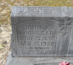
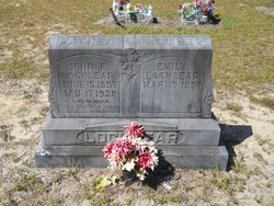
John Franklin Locklear
| Birth | : | 15 Jun 1856 Richmond County, North Carolina, USA |
| Death | : | 17 Jan 1928 Robeson County, North Carolina, USA |
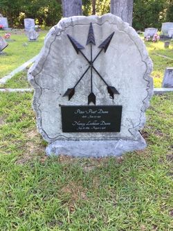
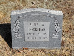
| Burial | : | Oak Grove Cemetery, Scotland County, USA |
| Coordinate | : | 34.6685000, -79.4691200 |
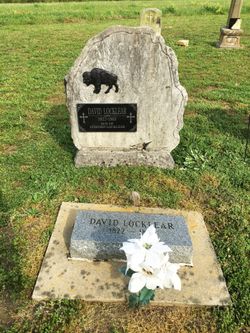
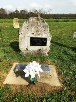
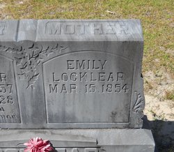
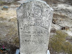
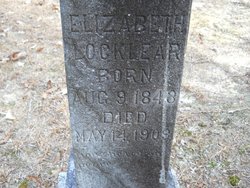
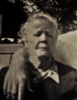
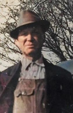
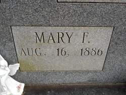
| Description | : | John Franklin Locklear, Native American, was born on June 15th 1856 to David Locklear and Esther Revels in the Johns community of Richmond County. He is the grandson of Stephen Locklear and Mollie Cheirin and Burwell Revels and Winifred Hammonds. John F. Locklear was one of the leaders/trustees in office that erected the first Oak Grove Baptist Church(Indian Church) and Oak Grove Indian School. His siblings were: Winnie Locklear, Andrew Locklear, Elizabeth Betsy Locklear, Mary Ann Locklear, and Flora Ann Locklear. He married Emily T.P. Driggers, daughter of Abner Driggers and Nancy Harrel. John and... Read More |
frequently asked questions (FAQ):
-
Where is John Franklin Locklear's memorial?
John Franklin Locklear's memorial is located at: Oak Grove Cemetery, Scotland County, USA.
-
When did John Franklin Locklear death?
John Franklin Locklear death on 17 Jan 1928 in Robeson County, North Carolina, USA
-
Where are the coordinates of the John Franklin Locklear's memorial?
Latitude: 34.6685000
Longitude: -79.4691200
Family Members:
Parent
Spouse
Siblings
Children


Flowers:


Nearby Cemetories:
1. Oak Grove Cemetery
Scotland County, USA
Coordinate: 34.6685000, -79.4691200
2. Good News Chapel Church Cemetery
Laurinburg, Scotland County, USA
Coordinate: 34.6671200, -79.4822700
3. Locklear Native Cemetery
Johns, Scotland County, USA
Coordinate: 34.6818761, -79.4581009
4. Smyrna Presbyterian Church Cemetery
Johns, Scotland County, USA
Coordinate: 34.6588554, -79.4526520
5. Bowen Family Cemetery
Laurinburg, Scotland County, USA
Coordinate: 34.6527500, -79.4887100
6. Smiling Family Cemetery
Laurinburg, Scotland County, USA
Coordinate: 34.6649550, -79.5036320
7. Priest Cemetery
McColl, Marlboro County, USA
Coordinate: 34.6447100, -79.4885200
8. Reedy Branch Baptist Church
Marlboro County, USA
Coordinate: 34.6254900, -79.4757300
9. Brown Cemetery #2
McColl, Marlboro County, USA
Coordinate: 34.6415140, -79.5130430
10. Bethel Bible Believing Church Cemetery
McColl, Marlboro County, USA
Coordinate: 34.6389610, -79.5123580
11. Greater Fair Plains AME Zion Church Cemetery
McColl, Marlboro County, USA
Coordinate: 34.6650590, -79.5321980
12. Seales Family Cemetery
Laurinburg, Scotland County, USA
Coordinate: 34.7008290, -79.5199050
13. Old Reedy Branch Cemetery
Clio, Marlboro County, USA
Coordinate: 34.6160300, -79.4836400
14. Daniels Chapel Cemetery
Marlboro County, USA
Coordinate: 34.6192000, -79.4993600
15. Mount Misery Cemetery
McColl, Marlboro County, USA
Coordinate: 34.6725520, -79.5395280
16. McLaurin Cemetery
McColl, Marlboro County, USA
Coordinate: 34.6688995, -79.5417023
17. Caledonia United Methodist Church Cemetery
Laurinburg, Scotland County, USA
Coordinate: 34.7290916, -79.4603958
18. Pee Dee Chapel Baptist Church Cemetery
Carolina, Dillon County, USA
Coordinate: 34.6074638, -79.4516678
19. Harris Family Cemetery
Laurinburg, Scotland County, USA
Coordinate: 34.7160960, -79.4189630
20. Britt-Brock Cemetery
Clio, Marlboro County, USA
Coordinate: 34.6121670, -79.5049090
21. Laurinburg Memorial Park
Laurinburg, Scotland County, USA
Coordinate: 34.7114700, -79.5264800
22. Red Bluff Cemetery
Clio, Marlboro County, USA
Coordinate: 34.6117783, -79.5053711
23. Graham Plantation Cemetery
Laurinburg, Scotland County, USA
Coordinate: 34.6997300, -79.5389800
24. Gibson Cemetery
McColl, Marlboro County, USA
Coordinate: 34.6639230, -79.5518280