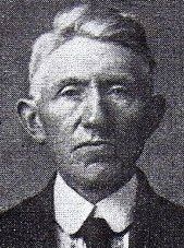
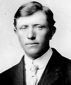
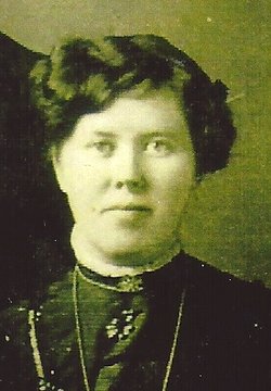
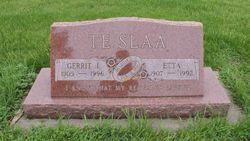
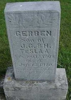
John Gerrit “Hendrik Jan” Te Slaa
| Birth | : | 27 Feb 1879 Aalten, Aalten Municipality, Gelderland, Netherlands |
| Death | : | 25 Jun 1949 Hull, Sioux County, Iowa, USA |
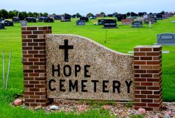
| Burial | : | Smiths Chapel Cemetery, Edwardsburg, Cass County, USA |
| Coordinate | : | 41.7680855, -86.1456833 |
| Inscription | : | FATHER |
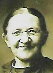
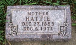
| Description | : | John (Jno) G. Te Slaa was born February 27, 1879, at Aalten, Prov., Gelderland, Netherlands and was from a family of four brothers and seven sisters. At the age of fourteen years he immigrated to this country with his parents, Mr. & Mrs. G. J. Te Slaa, and settled near Sioux Center. First the family lived around Sioux Center and later moved to a farm three and one-half miles south of Hull. He was married on February 23, 1905, to Hattie De Vries. They settled on a farm southwest of Hull where they lived for 26 years. In the... Read More |
frequently asked questions (FAQ):
-
Where is John Gerrit “Hendrik Jan” Te Slaa's memorial?
John Gerrit “Hendrik Jan” Te Slaa's memorial is located at: Smiths Chapel Cemetery, Edwardsburg, Cass County, USA.
-
When did John Gerrit “Hendrik Jan” Te Slaa death?
John Gerrit “Hendrik Jan” Te Slaa death on 25 Jun 1949 in Hull, Sioux County, Iowa, USA
-
Where are the coordinates of the John Gerrit “Hendrik Jan” Te Slaa's memorial?
Latitude: 41.7680855
Longitude: -86.1456833
Family Members:
Parent
Spouse
Siblings
Children
Flowers:
Nearby Cemetories:
1. Smiths Chapel Cemetery
Edwardsburg, Cass County, USA
Coordinate: 41.7680855, -86.1456833
2. Harris Prairie Cemetery
Granger, St. Joseph County, USA
Coordinate: 41.7531013, -86.1500015
3. Truitt Cemetery
Edwardsburg, Cass County, USA
Coordinate: 41.7811110, -86.1666670
4. Rodgers Cemetery
Edwardsburg, Cass County, USA
Coordinate: 41.8055477, -86.1197169
5. Saint Joseph Valley Memorial Park
Mishawaka, St. Joseph County, USA
Coordinate: 41.7217445, -86.1831512
6. Edwardsburg Cemetery
Edwardsburg, Cass County, USA
Coordinate: 41.8030014, -86.0800018
7. Christ the King Lutheran Church Columbarium
South Bend, St. Joseph County, USA
Coordinate: 41.7240810, -86.2017250
8. Truitts Chapel Cemetery
Niles, Berrien County, USA
Coordinate: 41.7752991, -86.2356033
9. Salem Cemetery
Granger, St. Joseph County, USA
Coordinate: 41.7357292, -86.0626373
10. Stuckey Cemetery
Indian Village, St. Joseph County, USA
Coordinate: 41.7230988, -86.2225037
11. Saint Michael and All Angels Church Memorial Garde
South Bend, St. Joseph County, USA
Coordinate: 41.7129530, -86.2158230
12. Higbee Cemetery
Niles Township, Berrien County, USA
Coordinate: 41.7769810, -86.2560010
13. Barron Lake Cemetery
Howard Township, Cass County, USA
Coordinate: 41.8480988, -86.1931000
14. Coulter Cemetery
Howard Township, Cass County, USA
Coordinate: 41.8552780, -86.1277780
15. Ullery Cemetery
Roseland, St. Joseph County, USA
Coordinate: 41.7230800, -86.2485030
16. Silverbrook Cemetery
Niles, Berrien County, USA
Coordinate: 41.8208427, -86.2427444
17. Saint Joseph Mission Cemetery
Bertrand, Berrien County, USA
Coordinate: 41.7783000, -86.2656000
18. Dick Cemetery
Howard Township, Cass County, USA
Coordinate: 41.8511009, -86.2089005
19. Beeson Mausoleum
Niles, Berrien County, USA
Coordinate: 41.8080410, -86.2625560
20. Basilica of The Sacred Heart
Notre Dame, St. Joseph County, USA
Coordinate: 41.7022860, -86.2397000
21. Island Cemetery (Defunct)
South Bend, St. Joseph County, USA
Coordinate: 41.7038540, -86.2425040
22. Father Allouez Grave Site
Niles, Berrien County, USA
Coordinate: 41.8143050, -86.2599910
23. Crawford Cemetery
Edwardsburg, Cass County, USA
Coordinate: 41.8328018, -86.0481033
24. Fairview Cemetery
Mishawaka, St. Joseph County, USA
Coordinate: 41.6747017, -86.1830978


