
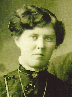
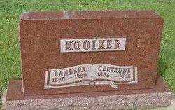

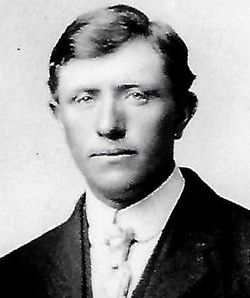
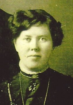
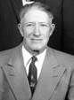
Gertrude “Dot” Te Slaa Kooiker
| Birth | : | 3 Nov 1888 Aalten, Aalten Municipality, Gelderland, Netherlands |
| Death | : | 10 Jan 1966 Hull, Sioux County, Iowa, USA |
| Burial | : | Humboldt Cemetery, Humboldt, Richardson County, USA |
| Coordinate | : | 40.1610985, -95.9578018 |
| Description | : | Rites for Mrs. Kooiker Will Be Held Today Funeral services for Mrs. Lambert Kooiker will be held at the First Reformed Church of Hull today, Thursday, January 13, 1966 beginning at 1:30 o’clock. Prayer services for members of the family will be held in the church parlors at 1:00 o’clock. The Reverend Harold C. Ringenoldus will officiate. Special music will be provided by Mrs. Harold Koele and Mrs. Willis Brouwer, who will sing “Love Lifted Me” and by Mrs. Kenneth De Groot who will sing “How Great Thou Art.” Pallbearers will be grandsons of the deceased, Leroy Kooiker, Roger Kooiker, Dean Kooiker, Earl Kooiker,... Read More |
frequently asked questions (FAQ):
-
Where is Gertrude “Dot” Te Slaa Kooiker's memorial?
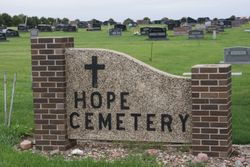
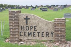
Gertrude “Dot” Te Slaa Kooiker's memorial is located at: Humboldt Cemetery, Humboldt, Richardson County, USA.
-
When did Gertrude “Dot” Te Slaa Kooiker death?
Gertrude “Dot” Te Slaa Kooiker death on 10 Jan 1966 in Hull, Sioux County, Iowa, USA
-
Where are the coordinates of the Gertrude “Dot” Te Slaa Kooiker's memorial?
Latitude: 40.1610985
Longitude: -95.9578018
Family Members:
Parent
Spouse

Siblings


Children


Flowers:


Nearby Cemetories:
1. Humboldt Cemetery
Humboldt, Richardson County, USA
Coordinate: 40.1610985, -95.9578018
2. Longbranch Cemetery
Humboldt, Richardson County, USA
Coordinate: 40.1996000, -95.9740000
3. Lynchburg Cemetery
Humboldt, Richardson County, USA
Coordinate: 40.1306000, -95.9068985
4. Standerford Cemetery
Humboldt, Richardson County, USA
Coordinate: 40.2110000, -95.9656000
5. Dry Branch Pioneer Cemetery
Richardson County, USA
Coordinate: 40.1292000, -96.0100021
6. Bohemian Cemetery
Richardson County, USA
Coordinate: 40.1175003, -95.9955978
7. Bohemian Cemetery
Table Rock, Pawnee County, USA
Coordinate: 40.1786003, -96.0374985
8. Starr Cemetery
Dawson, Richardson County, USA
Coordinate: 40.1464005, -95.8692017
9. Mound Cemetery
Humboldt, Richardson County, USA
Coordinate: 40.1960983, -95.8602982
10. Saint Marys Cemetery
Dawson, Richardson County, USA
Coordinate: 40.1307983, -95.8414001
11. Heim Cemetery
Dawson, Richardson County, USA
Coordinate: 40.1380997, -95.8328018
12. Saint Johns Cemetery
Table Rock, Pawnee County, USA
Coordinate: 40.2148000, -96.0657000
13. East Amish Cemetery
Table Rock, Pawnee County, USA
Coordinate: 40.1310000, -96.0854000
14. Four Mile Cemetery
Humboldt, Richardson County, USA
Coordinate: 40.0589000, -95.9455000
15. Pleasant View Cemetery
Auburn, Nemaha County, USA
Coordinate: 40.2681007, -95.9163971
16. Table Rock Cemetery
Table Rock, Pawnee County, USA
Coordinate: 40.1791400, -96.1037400
17. Iliff Cemetery
Dawson, Richardson County, USA
Coordinate: 40.1241989, -95.8127975
18. Athens Cemetery
Richardson County, USA
Coordinate: 40.0449982, -95.9852982
19. Pleasant Hill Cemetery
Richardson County, USA
Coordinate: 40.0471992, -95.9075012
20. Mount Zion Cemetery
Nemaha County, USA
Coordinate: 40.2761002, -96.0113983
21. Saint James Lutheran Cemetery
Nemaha County, USA
Coordinate: 40.2757500, -96.0161500
22. Liberty Township Cemetery
Verdon, Richardson County, USA
Coordinate: 40.1597200, -95.7664100
23. Trinity Lutheran Cemetery
Nemaha County, USA
Coordinate: 40.3058014, -96.0093994
24. Clear Creek Cemetery
Table Rock, Pawnee County, USA
Coordinate: 40.2193985, -96.1391983