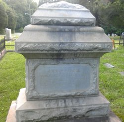
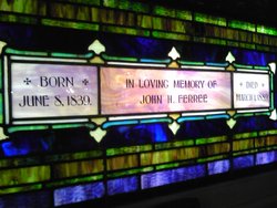
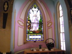
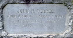
John H Ferree
| Birth | : | 8 Jun 1839 Morganton, Burke County, North Carolina, USA |
| Death | : | 1 Mar 1899 Randleman, Randolph County, North Carolina, USA |
| Burial | : | All Saints Churchyard, Loose, Maidstone Borough, England |
| Coordinate | : | 51.2406640, 0.5159710 |
| Plot | : | Section/Row D2 |
| Description | : | JOHN H. FERREE OF RANDOLPH. He Died Yesterday at 4 O'Clock, P.M. - A Progressive Man Who Had Done Much For His Country. Special To The Charlotte Observer: Randleman, March 1, 1898. Mr. John H. Ferree, the leading manufacturer and foremost citizen of Randolph County, died today at 4 P.M. He was one of the pioneers in the cotton mill business of this county, and during the past 30 years had contributed more to the development and growth of Randolph County than any other ONE citizen. He was a leading spirit in every movement, looking to the weal, of his county and will be... Read More |
frequently asked questions (FAQ):
-
Where is John H Ferree's memorial?
John H Ferree's memorial is located at: All Saints Churchyard, Loose, Maidstone Borough, England.
-
When did John H Ferree death?
John H Ferree death on 1 Mar 1899 in Randleman, Randolph County, North Carolina, USA
-
Where are the coordinates of the John H Ferree's memorial?
Latitude: 51.2406640
Longitude: 0.5159710
Family Members:
Parent
Spouse
Siblings
Children
Flowers:
Nearby Cemetories:
1. All Saints Churchyard
Loose, Maidstone Borough, England
Coordinate: 51.2406640, 0.5159710
2. St Nicholas' Churchyard
Linton, Maidstone Borough, England
Coordinate: 51.2235230, 0.5109550
3. Maidstone Cemetery
Maidstone, Maidstone Borough, England
Coordinate: 51.2554700, 0.5323500
4. Tovil Anabaptist Burial Ground
Tovil, Maidstone Borough, England
Coordinate: 51.2602944, 0.5082881
5. St. Peter's Churchyard
Boughton Monchelsea, Maidstone Borough, England
Coordinate: 51.2207560, 0.5348660
6. East Farleigh Parish Churchyard
East Farleigh, Maidstone Borough, England
Coordinate: 51.2526270, 0.4835740
7. St Stephens Churchyard
Tovil, Maidstone Borough, England
Coordinate: 51.2642700, 0.5110600
8. Maidstone Baptist Church
Maidstone, Maidstone Borough, England
Coordinate: 51.2704370, 0.5230740
9. All Saints Churchyard
Maidstone, Maidstone Borough, England
Coordinate: 51.2706920, 0.5215980
10. Holy Trinity Church
Maidstone, Maidstone Borough, England
Coordinate: 51.2749390, 0.5252620
11. St Faith Churchyard
Maidstone, Maidstone Borough, England
Coordinate: 51.2764210, 0.5211100
12. St. Mary's Churchyard
Hunton, Maidstone Borough, England
Coordinate: 51.2209290, 0.4676140
13. St Margaret of Antioch Churchyard
Barming, Maidstone Borough, England
Coordinate: 51.2612070, 0.4638390
14. All Saints Churchyard
West Farleigh, Maidstone Borough, England
Coordinate: 51.2548540, 0.4570870
15. St Mary's Church
Langley, Maidstone Borough, England
Coordinate: 51.2340870, 0.5847120
16. Vinters Park Crematorium
Maidstone, Maidstone Borough, England
Coordinate: 51.2833100, 0.5506470
17. St Peter and St Paul Churchyard
Teston, Maidstone Borough, England
Coordinate: 51.2551804, 0.4425540
18. St. Michael's Churchyard
Chart Sutton, Maidstone Borough, England
Coordinate: 51.2154120, 0.5821570
19. Teston War Memorial
Teston, Maidstone Borough, England
Coordinate: 51.2550049, 0.4399090
20. St Mary the Virgin Churchyard
Sutton Valence, Maidstone Borough, England
Coordinate: 51.2132540, 0.5897170
21. Sutton Valence War Memorial
Sutton Valence, Maidstone Borough, England
Coordinate: 51.2131810, 0.5911370
22. Marden Cemetery
Marden, Maidstone Borough, England
Coordinate: 51.1882744, 0.4894070
23. St Peter and St Paul Churchyard
Yalding, Maidstone Borough, England
Coordinate: 51.2245390, 0.4309730
24. Royal British Legion Village Memorial
Aylesford, Tonbridge and Malling Borough, England
Coordinate: 51.2964380, 0.4744810

