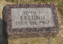
John Harry “Jack” Eklund
| Birth | : | 21 Sep 1884 Clay County, South Dakota, USA |
| Death | : | 1962 Clay County, South Dakota, USA |
| Burial | : | Dalesburg Baptist Cemetery, Dalesburg, Clay County, USA |
| Coordinate | : | 42.9675102, -96.8850403 |
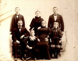
| Description | : | Jack was married to Alma Lydia Swanson of Sioux City, Iowa, on July 27, 1910. They farmed half of his father's original homestead for many year. They quit farming and Jack ran a garage at Dalesburg for some time. They then moved to Sioux City where they operated a sandwich shop known as "Ye Olde Tavern" on west Seventh Street. The couple became estranged and Jack came back to live and work in the Dalesburg area. |
frequently asked questions (FAQ):
-
Where is John Harry “Jack” Eklund's memorial?
John Harry “Jack” Eklund's memorial is located at: Dalesburg Baptist Cemetery, Dalesburg, Clay County, USA.
-
When did John Harry “Jack” Eklund death?
John Harry “Jack” Eklund death on 1962 in Clay County, South Dakota, USA
-
Where are the coordinates of the John Harry “Jack” Eklund's memorial?
Latitude: 42.9675102
Longitude: -96.8850403
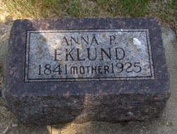
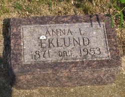
Family Members:
Parent
Siblings
Flowers:
Nearby Cemetories:
1. Dalesburg Baptist Cemetery
Dalesburg, Clay County, USA
Coordinate: 42.9675102, -96.8850403
2. Dalesburg Lutheran Cemetery
Vermillion, Clay County, USA
Coordinate: 42.9389424, -96.9242594
3. Rockfield Cemetery
Clay County, USA
Coordinate: 42.9397011, -96.8302994
4. Danefield Seventh Day Advent Cemetery
Clay County, USA
Coordinate: 43.0108000, -96.8452300
5. Clay Point Cemetery
Prairie Center Township, Clay County, USA
Coordinate: 42.8987700, -96.9065600
6. Komstad Cemetery
Dalesburg, Clay County, USA
Coordinate: 43.0417938, -96.9058914
7. Old Lodi Cemetery
Lodi, Clay County, USA
Coordinate: 42.9757996, -96.9907990
8. CJ Anderson Homestead
Riverside Township, Clay County, USA
Coordinate: 43.0214180, -96.9675540
9. Spirit Mound Cemetery
Clay County, USA
Coordinate: 42.8885994, -96.9424973
10. Roseni Lutheran Church Cemetery
Beresford, Union County, USA
Coordinate: 42.9388000, -96.7639000
11. Riverside-Barton Cemetery
Clay County, USA
Coordinate: 43.0402985, -96.9725037
12. Mortvedt Cemetery
Clay County, USA
Coordinate: 42.9169006, -97.0028000
13. Hovde Cemetery
Clay County, USA
Coordinate: 43.0685997, -96.8835983
14. Saint Joseph Catholic Church Cemetery
Emmet, Union County, USA
Coordinate: 42.9836950, -96.7466350
15. Pleasant Valley Cemetery
Westerville, Clay County, USA
Coordinate: 42.9247017, -97.0124969
16. Saint Johns Cemetery
Clay County, USA
Coordinate: 43.0696983, -96.9056015
17. Saint Peters Cemetery
Clay County, USA
Coordinate: 43.0619011, -96.8244019
18. Olbue Lerseth Cemetery
Beresford, Union County, USA
Coordinate: 42.9281100, -96.7516100
19. Saint Peter Greenfield Cemetery
Vermillion, Clay County, USA
Coordinate: 42.8608017, -96.8644028
20. New Lodi Cemetery
Lodi, Clay County, USA
Coordinate: 42.9530983, -97.0417023
21. Bethel Baptist Cemetery
Wakonda, Clay County, USA
Coordinate: 42.9393570, -97.0433520
22. Saint Patricks Catholic Cemetery
Wakonda, Clay County, USA
Coordinate: 42.9672012, -97.0516968
23. Clay Creek Cemetery
Clay County, USA
Coordinate: 42.8516998, -96.9788971
24. Saint Mary Cemetery
Union County, USA
Coordinate: 42.8520584, -96.7877502


