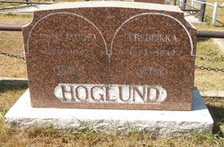
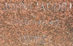
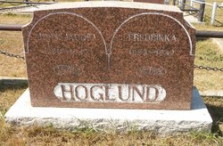
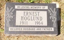
John Jacob Hoglund
| Birth | : | 27 Oct 1866 Norway |
| Death | : | 6 Sep 1943 Claresholm, Claresholm Census Division, Alberta, Canada |
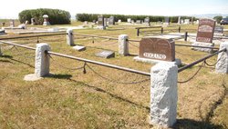
| Burial | : | Granum Cemetery, Granum, Claresholm Census Division, Canada |
| Coordinate | : | 49.8812800, -113.5251600 |
| Plot | : | B95vii |
| Description | : | ALBERTA DEATH REGISTER #405-139 1921 CANADA CENSUS Name John Hoglund Gender Male Marital Status Married Age 53 Birth Year abt 1868 Birth Place Norway Relation to Head of House Head Spouse's Name Rikke Hoglund Father Birth Place Norway Mother Birth Place Norway Year of Immigration 1902 Racial or Tribal Origin Norwegian Province or Territory Alberta District MacLeod District Number 8 Township Number 11 Range Number 25 Meridian Number W4 Occupation Farmer Household Members Name Age John Hoglund 53 Rikke Hoglund 35 Sydney Hoglund 12 Earnest Hoglund 10 Hellen Hoglund 8 |
frequently asked questions (FAQ):
-
Where is John Jacob Hoglund's memorial?
John Jacob Hoglund's memorial is located at: Granum Cemetery, Granum, Claresholm Census Division, Canada.
-
When did John Jacob Hoglund death?
John Jacob Hoglund death on 6 Sep 1943 in Claresholm, Claresholm Census Division, Alberta, Canada
-
Where are the coordinates of the John Jacob Hoglund's memorial?
Latitude: 49.8812800
Longitude: -113.5251600
Family Members:
Spouse
Children
Flowers:
Nearby Cemetories:
1. Granum Cemetery
Granum, Claresholm Census Division, Canada
Coordinate: 49.8812800, -113.5251600
2. Granum Hutterite Cemetery
Granum, Claresholm Census Division, Canada
Coordinate: 49.8513248, -113.6038772
3. Granum Christian Reformed Church Cemetery
Granum, Claresholm Census Division, Canada
Coordinate: 49.8622100, -113.3436600
4. Jumbo Valley Hutterite Cemetery
Granum, Claresholm Census Division, Canada
Coordinate: 49.8452911, -113.3425358
5. Claresholm Cemetery
Claresholm, Claresholm Census Division, Canada
Coordinate: 50.0114784, -113.5946503
6. Five Mile Cemetery
Claresholm, Claresholm Census Division, Canada
Coordinate: 50.0188250, -113.4705730
7. Saint Peter's Lutheran Cemetery
Claresholm, Claresholm Census Division, Canada
Coordinate: 50.0487620, -113.4822460
8. Union Cemetery
Fort Macleod, Claresholm Census Division, Canada
Coordinate: 49.7306500, -113.3882000
9. Holy Cross Cemetery
Fort Macleod, Claresholm Census Division, Canada
Coordinate: 49.7283000, -113.3882400
10. White Lake Cemetery
Nobleford, Lethbridge Census Division, Canada
Coordinate: 49.9018700, -113.2107750
11. White Lake Hutterite Cemetery
Nobleford, Lethbridge Census Division, Canada
Coordinate: 49.9154153, -113.2084160
12. Orton Cemetery
Orton, Claresholm Census Division, Canada
Coordinate: 49.7484600, -113.2540900
13. Elinor Cemetery
Barons, Lethbridge Census Division, Canada
Coordinate: 50.0271520, -113.2340240
14. Bratton Family Cemetery
Spring Point, Claresholm Census Division, Canada
Coordinate: 49.7150200, -113.8017500
15. Spring Point Hutterite Cemetery
Pincher Creek, Claresholm Census Division, Canada
Coordinate: 49.6843639, -113.8070451
16. Nobleford Monarch Cemetery
Nobleford, Lethbridge Census Division, Canada
Coordinate: 49.8456500, -113.0942100
17. Monarch Cemetery
Monarch, Lethbridge Census Division, Canada
Coordinate: 49.8020980, -113.0953220
18. Barons Cemetery
Barons, Lethbridge Census Division, Canada
Coordinate: 49.9756500, -113.0993100
19. Stavely Cemetery
Stavely, Claresholm Census Division, Canada
Coordinate: 50.1646700, -113.6625600
20. Stavely Cemetery Cremation Cairn
Stavely, Claresholm Census Division, Canada
Coordinate: 50.1646700, -113.6625600
21. Saint Vincent Roman Catholic Cemetery
Stavely, Claresholm Census Division, Canada
Coordinate: 50.1717670, -113.6409830
22. Alston Cemetery
Vulcan, Strathmore Census Division, Canada
Coordinate: 50.1652820, -113.2450470
23. Carmangay Cemetery
Carmangay, Strathmore Census Division, Canada
Coordinate: 50.1214300, -113.1434300
24. Keho Lake Hutterite Cemetery
Barons, Lethbridge Census Division, Canada
Coordinate: 49.9891594, -113.0160634

