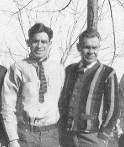
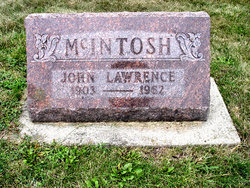
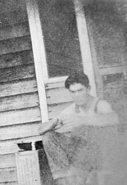
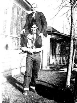
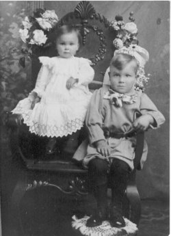
John Lawrence McIntosh
| Birth | : | 22 Jul 1903 Harrison County, Missouri, USA |
| Death | : | 9 Mar 1962 Gentry County, Missouri, USA |
| Burial | : | Temple Mishkan Tefila Memorial Park, West Roxbury, Suffolk County, USA |
| Coordinate | : | 42.2616800, -71.1635100 |
| Plot | : | New Central C (6), Row 13 |
| Description | : | Wife: Edith Graves McIntosh Father: Auris McIntosh Mother: Mary Gertrude Smith Missouri D/C #6131 John Lawrence McIntosh was born in Washington Center, Harrison, Missouri on 22 Jul 1903 to Auris Harvey & Mary G. McIntosh. He spent his early years farming and helping out with a large family of eight other siblings. My Uncle Johnny was a good man and always looked out for his siblings. After he lost his father in 1932, he stayed close to his mother and made sure she was okay with the responsibilities she had to bear. He married Edith Graves on 21 Nov 1936 in Nodaway... Read More |
frequently asked questions (FAQ):
-
Where is John Lawrence McIntosh's memorial?
John Lawrence McIntosh's memorial is located at: Temple Mishkan Tefila Memorial Park, West Roxbury, Suffolk County, USA.
-
When did John Lawrence McIntosh death?
John Lawrence McIntosh death on 9 Mar 1962 in Gentry County, Missouri, USA
-
Where are the coordinates of the John Lawrence McIntosh's memorial?
Latitude: 42.2616800
Longitude: -71.1635100
Family Members:
Parent
Spouse
Siblings
Children
Nearby Cemetories:
1. Temple Mishkan Tefila Memorial Park
West Roxbury, Suffolk County, USA
Coordinate: 42.2616800, -71.1635100
2. Boston United New Hand In Hand Cemetery
West Roxbury, Suffolk County, USA
Coordinate: 42.2614444, -71.1642778
3. Boston United Hand In Hand Cemetery
West Roxbury, Suffolk County, USA
Coordinate: 42.2599300, -71.1635300
4. Congregation Chai Odom Cemetery
West Roxbury, Suffolk County, USA
Coordinate: 42.2601600, -71.1661200
5. Congregation Beth Israel Cemetery
West Roxbury, Suffolk County, USA
Coordinate: 42.2591300, -71.1634800
6. Anshe Dowig Cemetery
West Roxbury, Suffolk County, USA
Coordinate: 42.2591770, -71.1646910
7. Heirs of Morris Greenhood Cemetery
West Roxbury, Suffolk County, USA
Coordinate: 42.2592100, -71.1648400
8. Chevra Thillim Cemetery
West Roxbury, Suffolk County, USA
Coordinate: 42.2593800, -71.1654600
9. Congregation Sharei Sedek Cemetery
West Roxbury, Suffolk County, USA
Coordinate: 42.2591500, -71.1650000
10. King Solomon Memorial Park
West Roxbury, Suffolk County, USA
Coordinate: 42.2598900, -71.1666200
11. Bresna Cemetery
West Roxbury, Suffolk County, USA
Coordinate: 42.2599500, -71.1672300
12. Saint Marys Cemetery
West Roxbury, Suffolk County, USA
Coordinate: 42.2596817, -71.1564331
13. Shari Jerusalem Cemetery
West Roxbury, Suffolk County, USA
Coordinate: 42.2596900, -71.1546800
14. Adath Jeshurun Cemetery
West Roxbury, Suffolk County, USA
Coordinate: 42.2587000, -71.1548500
15. Adath Israel Cemetery
West Roxbury, Suffolk County, USA
Coordinate: 42.2594300, -71.1543200
16. Ohavi Sedeck Cemetery
West Roxbury, Suffolk County, USA
Coordinate: 42.2589400, -71.1544400
17. Jewish Benevolent Cemetery
West Roxbury, Suffolk County, USA
Coordinate: 42.2592100, -71.1540800
18. Young Israel Cemetery
West Roxbury, Suffolk County, USA
Coordinate: 42.2600900, -71.1534700
19. Beth Abraham Cemetery
West Roxbury, Suffolk County, USA
Coordinate: 42.2588500, -71.1536700
20. Jewish Civil Service Cemetery
West Roxbury, Suffolk County, USA
Coordinate: 42.2598300, -71.1532300
21. Hebrew Progressive Cemetery
West Roxbury, Suffolk County, USA
Coordinate: 42.2586800, -71.1533900
22. Pride of Jacob Cemetery
West Roxbury, Suffolk County, USA
Coordinate: 42.2585487, -71.1534500
23. Sons of Benjamin Cemetery
West Roxbury, Suffolk County, USA
Coordinate: 42.2592000, -71.1530700
24. Tifereth Israel Cemetery
West Roxbury, Suffolk County, USA
Coordinate: 42.2585400, -71.1532300

