John Lawrence Ponder
| Birth | : | 9 Aug 1894 Missouri, USA |
| Death | : | Sep 1978 |
| Burial | : | Dogwood Cemetery, Dogwood, Mississippi County, USA |
| Coordinate | : | 36.8231316, -89.4546738 |
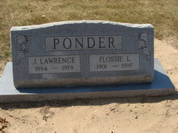
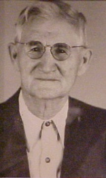
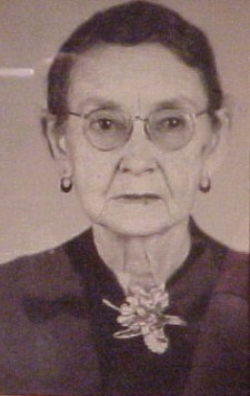
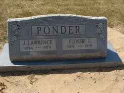
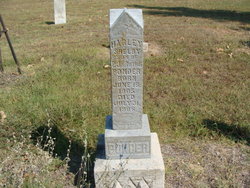
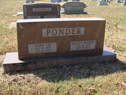
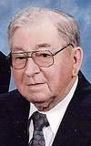
| Description | : | John Lawrence Ponder was born to Phillip and Ruth Ponder on 9 Aug 1894 in MO. He married Flossie Lee (Baker) on 4 June 1922 in Charleston, Miss., MO, with whom he shares a double stone. Together they had two daughters. He was a farmer. |
frequently asked questions (FAQ):
-
Where is John Lawrence Ponder's memorial?
John Lawrence Ponder's memorial is located at: Dogwood Cemetery, Dogwood, Mississippi County, USA.
-
When did John Lawrence Ponder death?
John Lawrence Ponder death on Sep 1978 in
-
Where are the coordinates of the John Lawrence Ponder's memorial?
Latitude: 36.8231316
Longitude: -89.4546738
Family Members:
Parent
Spouse
Siblings
Flowers:
Nearby Cemetories:
1. Dogwood Cemetery
Dogwood, Mississippi County, USA
Coordinate: 36.8231316, -89.4546738
2. Armer Cemetery
East Prairie, Mississippi County, USA
Coordinate: 36.8703003, -89.4608002
3. Big Opening Cemetery
New Madrid County, USA
Coordinate: 36.8089500, -89.5247100
4. Memorial Park Cemetery
East Prairie, Mississippi County, USA
Coordinate: 36.7837868, -89.3962479
5. Zilafro Cemetery
East Prairie, Mississippi County, USA
Coordinate: 36.7544960, -89.4100550
6. Greer Family Cemetery
Mississippi County, USA
Coordinate: 36.8017967, -89.3569275
7. Harper Cemetery
Mississippi County, USA
Coordinate: 36.7429200, -89.4150000
8. Pryor Cemetery
Mississippi County, USA
Coordinate: 36.7429680, -89.4147530
9. Bright Prospect Cemetery
Miner, Scott County, USA
Coordinate: 36.8844948, -89.5352707
10. Sikes Family Cemetery
Sikeston, New Madrid County, USA
Coordinate: 36.8410380, -89.5697350
11. Anniston Cemetery
Anniston, Mississippi County, USA
Coordinate: 36.8235100, -89.3336500
12. Bloomfield Cemetery
New Madrid County, USA
Coordinate: 36.7453003, -89.5382996
13. Calvary Cemetery
Charleston, Mississippi County, USA
Coordinate: 36.9212200, -89.3864000
14. Sikeston Memorial Park
Sikeston, New Madrid County, USA
Coordinate: 36.8630981, -89.5867004
15. Oak Grove Cemetery
Charleston, Mississippi County, USA
Coordinate: 36.9227982, -89.3858032
16. Sikeston City Cemetery
Sikeston, Scott County, USA
Coordinate: 36.8696442, -89.5867538
17. Dalton Cemetery
Charleston, Mississippi County, USA
Coordinate: 36.8698880, -89.3194700
18. Hart Cemetery
Miner, Scott County, USA
Coordinate: 36.8986015, -89.5721970
19. Calhoun Cemetery
Mississippi County, USA
Coordinate: 36.7672005, -89.3191986
20. Pulltight Cemetery
Pulltight, Mississippi County, USA
Coordinate: 36.7796300, -89.3108600
21. Matthews Cemetery
Matthews, New Madrid County, USA
Coordinate: 36.7496986, -89.5817032
22. Garden Of Memories Cemetery
Sikeston, Scott County, USA
Coordinate: 36.8650017, -89.6035995
23. Pleasant Valley Cemetery
Sikeston, Scott County, USA
Coordinate: 36.9418983, -89.5132980
24. Hunter Memorial Cemetery
Sikeston, Scott County, USA
Coordinate: 36.8844200, -89.5952800

